MyTopo
Oswego South Carolina US Topo Map
Couldn't load pickup availability
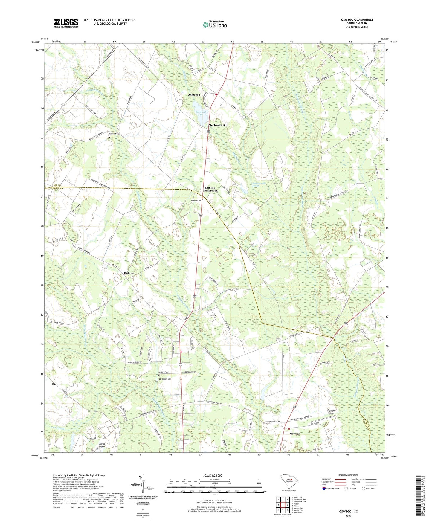
2024 topographic map quadrangle Oswego in the state of South Carolina. Scale: 1:24000. Based on the newly updated USGS 7.5' US Topo map series, this map is in the following counties: Lee, Sumter. The map contains contour data, water features, and other items you are used to seeing on USGS maps, but also has updated roads and other features. This is the next generation of topographic maps. Printed on high-quality waterproof paper with UV fade-resistant inks.
Quads adjacent to this one:
West: Dalzell
Northwest: Spring Hill
North: Bishopville West
Northeast: Bishopville East
East: Elliott
Southeast: Mayesville
South: Sumter East
Southwest: Sumter West
This map covers the same area as the classic USGS quad with code o34080a3.
Contains the following named places: Aman, Antioch Cemetery, Antioch Church, Ashwood, Ashwood Census Designated Place, Ashwood Church, Ashwood Lake, Ashwood School, Bethel Church, Brent, Capers Cemetery, Dicks Church, Dicks School, DuBose, DuBose Crossroads, Dubose School, Flying O Airport, Georgetown School, Good Hope Church, Good Hope School, Hebron Cemetery, Hebron Church, Hill Pond, Hill Pond Dam D-1980, Lee County Rural Fire Department Station 3 Ashwood, Lee Swamp, Manning School, Marbing School, Martin Town School, McCabe, McGirts Creek, Mechanicsville, Mechanicsville Church, Mechanicsville Swamp, Meredith, Oswego, Oswego Census Designated Place, Oswego School, Rembert Cemetery, Rembert Church, Saint James School Number 2, South Carolina Noname 31012 D-2414 Dam, Sumter County Rural Fire Department DuBose, Sumter Fire Department Oswego Station 14, Woodrow School