MyTopo
Fingerville East South Carolina US Topo Map
Couldn't load pickup availability
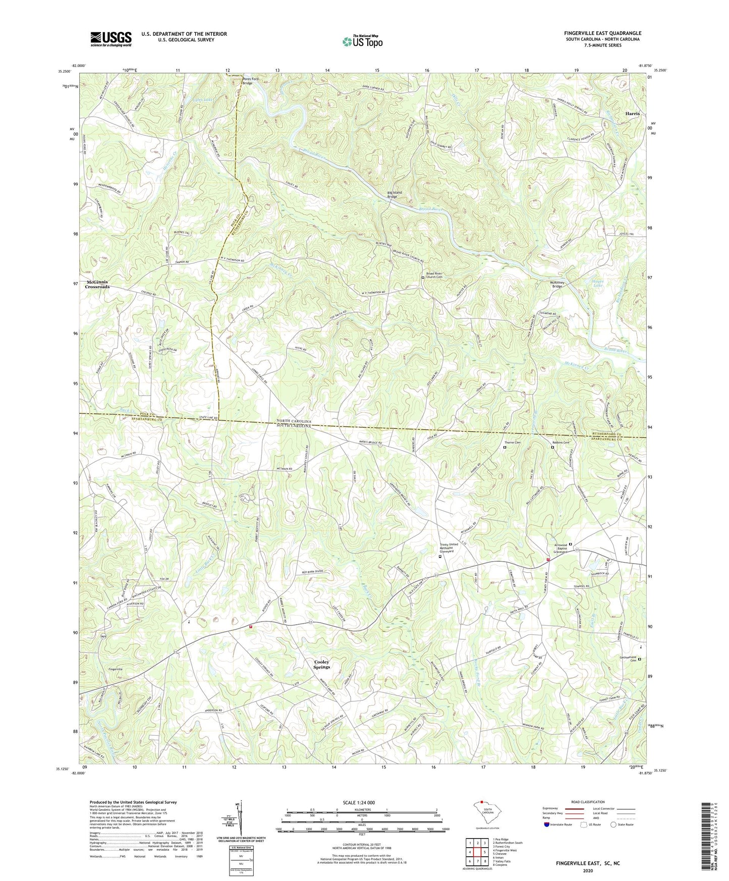
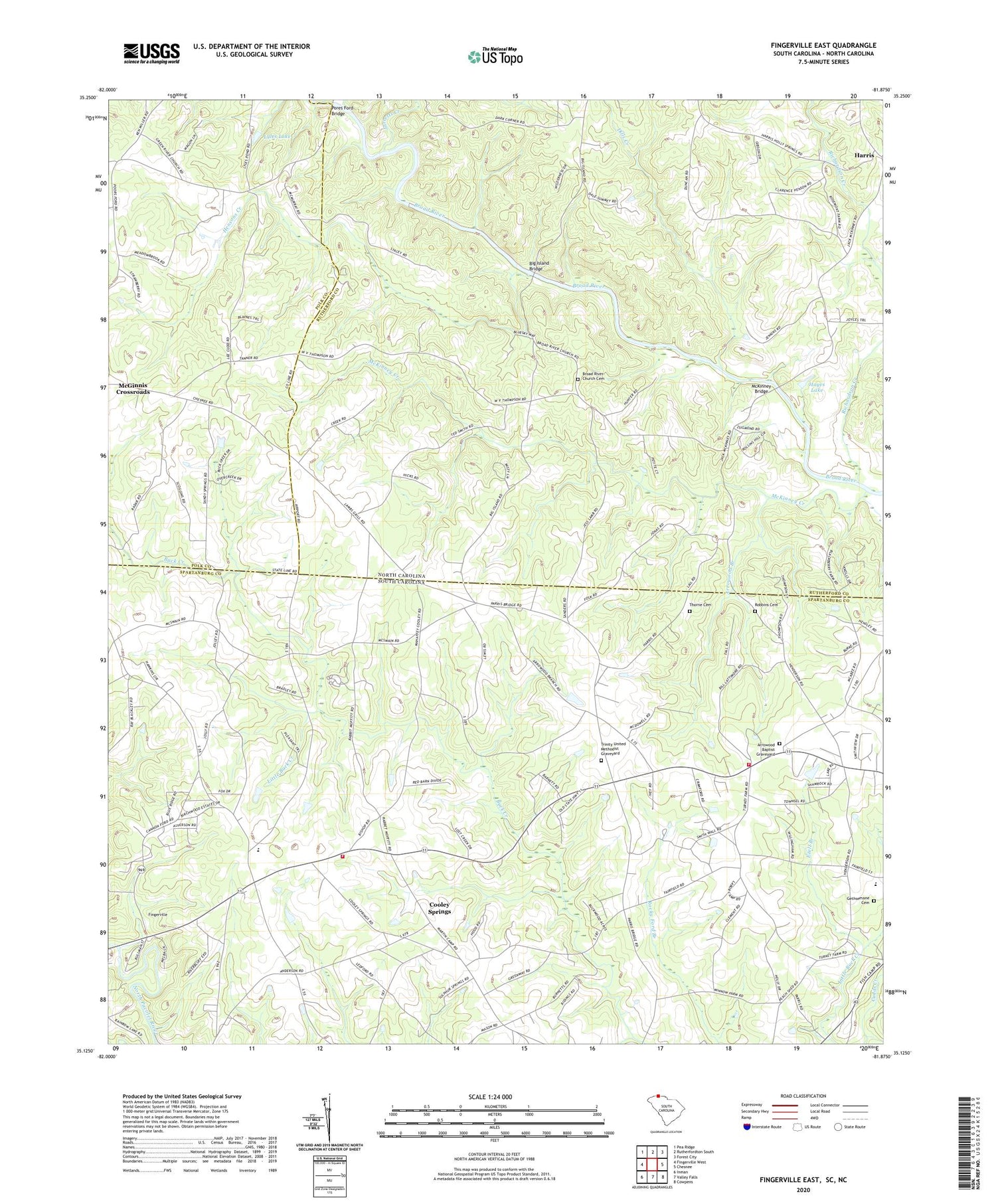
2020 topographic map quadrangle Fingerville East in the states of North Carolina, South Carolina. Scale: 1:24000. Based on the newly updated USGS 7.5' US Topo map series, this map is in the following counties: Spartanburg, Rutherford, Polk. The map contains contour data, water features, and other items you are used to seeing on USGS maps, but also has updated roads and other features. This is the next generation of topographic maps. Printed on high-quality waterproof paper with UV fade-resistant inks.
Quads adjacent to this one:
West: Fingerville West
Northwest: Pea Ridge
North: Rutherfordton South
Northeast: Forest City
Southeast: Cowpens
South: Valley Falls
Southwest: Inman
Contains the following named places: Alverson Grove Baptist Church Cemetery, Alverson Grove Church, Arrow Wood School, Arrowood Baptist Church, Arrowood Baptist Graveyard, Arrowood Branch, Arrowwood, Big Island Bridge, Broad River Church, Broad River Church Cemetery, Brookland School, Brooklyn, Brooklyn Baptist Church Graveyard, Brooklyn Christian Methodist Episcopal Church Graveyard, Brooklyn Church, Cedar Grove Church, Chesnee Community Fire Department Station 2, Chesnee Division, Christian Fellowship Church Graveyard, Cooley Pond Dam D-2718, Cooley Springs, Cooley Springs - Fingerville Fire Department, Cooley Springs Baptist Church, Cooley Springs Baptist Church Cemetery, Cooley Springs School, Cooley Springs-Fingerville Elementary School, Dills Creek, Eden Church, Ezell Branch, Fingerville Baptist Church Cemetery, Friendly Hills Cemetery, Gaffney Chapel, Gethsemane Cemetery, Glenwood School, Green River Church, Hayes Lake, Hensons Creek, Jarretts Creek, L B Davidson Pond Dam D-3321, L Keeney Pond Dam D-2722, Little Buck Creek, Lyles Lake, McKinney Bridge, McKinney Creek, New Bethel Church, New Hope Church, Piney Grove School, Pores Ford Bridge, Providence Church, Providence Wesleyan Church Graveyard, Richardson Creek, Robbins Cemetery, Sandy Springs, Sandy Springs Church, Shields Memorial and Cemetery, Strickland School, Thorne Cemetery, Township of Sulphur Springs, Trinity United Methodist Church, Trinity United Methodist Graveyard, Unknown, Vance Memorial Church, ZIP Code: 29323