MyTopo
Fingerville West South Carolina US Topo Map
Couldn't load pickup availability
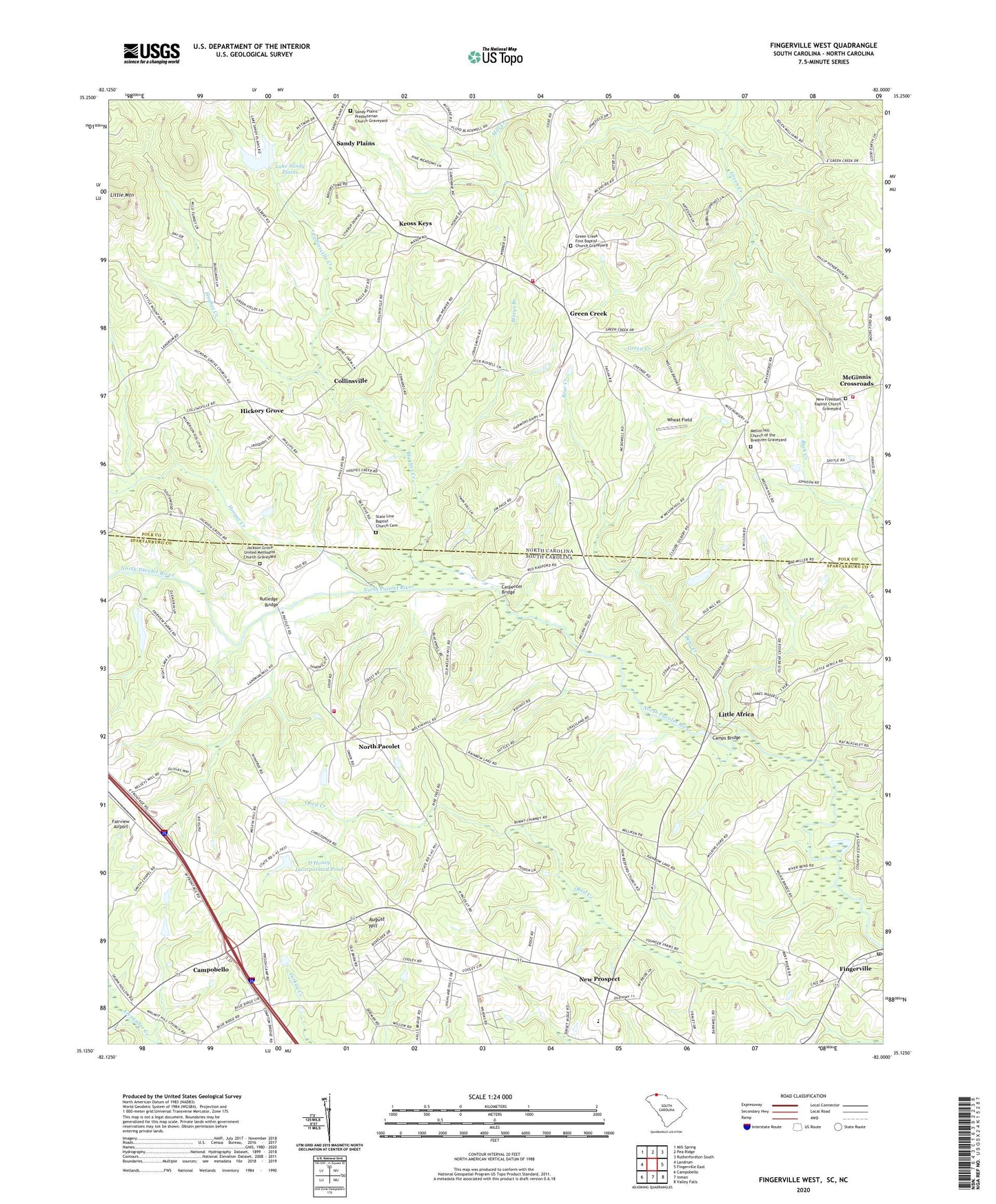
2024 topographic map quadrangle Fingerville West in the states of South Carolina, North Carolina. Scale: 1:24000. Based on the newly updated USGS 7.5' US Topo map series, this map is in the following counties: Spartanburg, Polk. The map contains contour data, water features, and other items you are used to seeing on USGS maps, but also has updated roads and other features. This is the next generation of topographic maps. Printed on high-quality waterproof paper with UV fade-resistant inks.
Quads adjacent to this one:
West: Landrum
Northwest: Mill Spring
North: Pea Ridge
Northeast: Rutherfordton South
Southeast: Valley Falls
South: Inman
Southwest: Campobello
This map covers the same area as the classic USGS quad with code o35082b1.
Contains the following named places: Africa School, August Hill, Bear Creek, Bryants Store, Burns Mill, C Barre Pond, C Barre Pond Dam D-3301, Camps Bridge, Carpenter Bridge, Collinsville, Collinsville Creek, Crossroads Baptist Church Graveyard, D Honey Incorporated Pond, D Honey Number One Pond, D Honey Number One Pond Dam D-3302, D Honey Pond Dam Number Three D-3303, Fairview Airport, Fairview Christian Methodist Episcopal Church Graveyard, Fairview Church, Fairview Farms Pond, Fingerville, Fingerville Census Designated Place, Fingerville Division, Fingerville United Methodist Church Cemetery, Green Creek, Green Creek First Baptist Church Graveyard, Green Creek Volunteer Fire Department Station 1, Green Creek Volunteer Fire Department Station 2, Greens Creek School, Hickory Grove, Hooper Creek, Hughes Creek, Jackson Grove United Methodist Church, Jackson Grove United Methodist Church Graveyard, Jackson Memorial Church, Kross Keys, Lake Sandy Plains, Little Africa, Little Mountain, Marys Branch, McGinnis Crossroads, Melvin Hill Church, Melvin Hill Church of the Brethren Graveyard, Mill Creek Church, Mount Lebanon Cemetery, New Bedford Baptist Church Cemetery, New Bedford School, New Freedom Baptist Church Graveyard, New Pilgrim School, New Prospect, New Prospect Baptist Church, New Prospect Baptist Church Cemetery, New Prospect Elementary School, New Prospect Fire Department, North Pacolet, North Pacolet Church, North Pacolet School, Obed, Riverside Church, Riverside Free Will Baptist Church Graveyard, Rutledge Bridge, Sandy Plains, Sandy Plains Dam, Sandy Plains Presbyterian Church Graveyard, Smith Chapel, Smiths Chapel School, South Carolina Noname 42020 D-1682 Dam, State Line Baptist Church Cemetery, Stateline Church, Steppes Pond, T Steppe Pond Dam D-3299, Township of Greens Creek, Wakeforest School, Wheat Field, ZIP Codes: 28722, 29338