MyTopo
Kershaw South Carolina US Topo Map
Couldn't load pickup availability
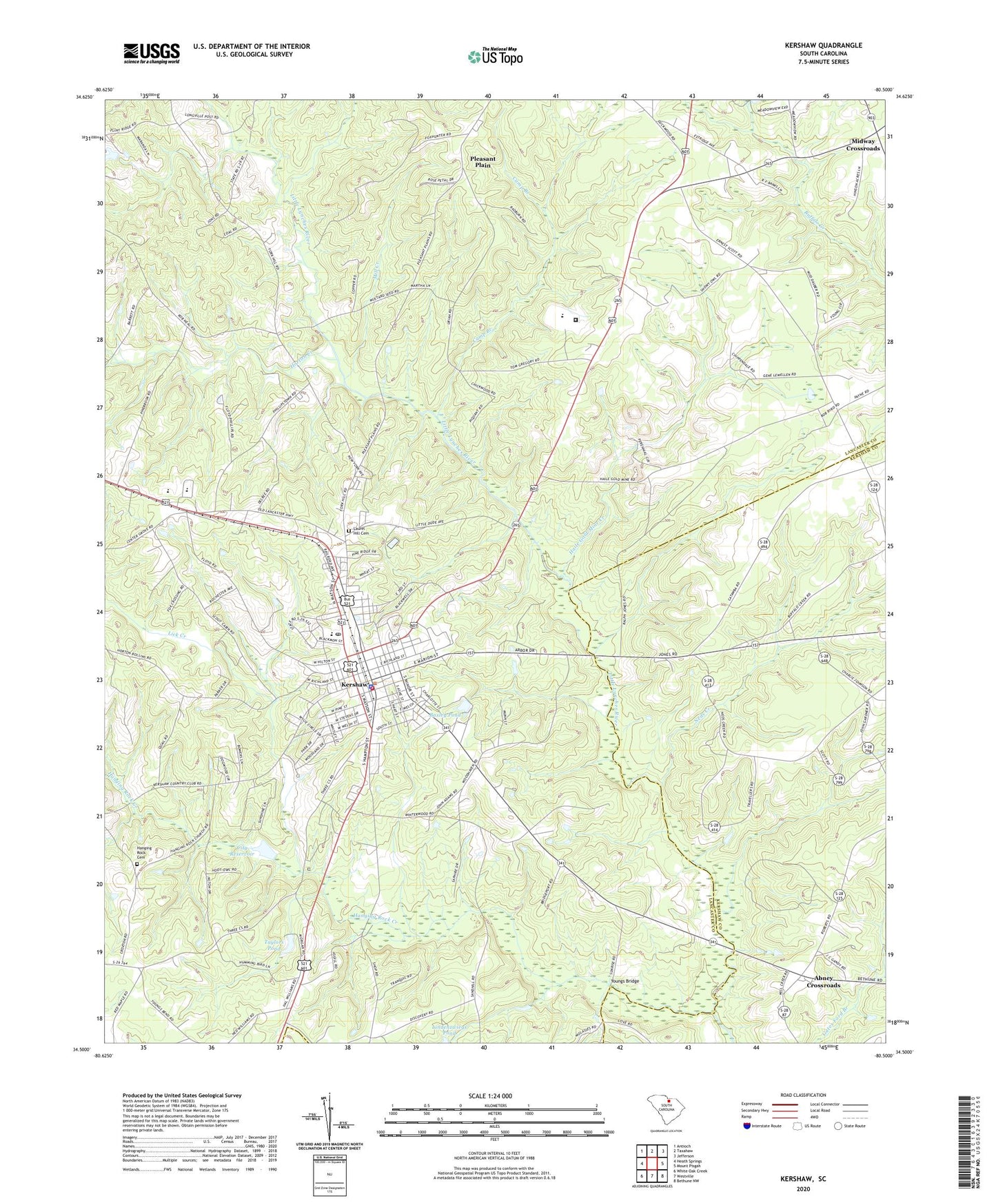
2020 topographic map quadrangle Kershaw in the state of South Carolina. Scale: 1:24000. Based on the newly updated USGS 7.5' US Topo map series, this map is in the following counties: Lancaster, Kershaw. The map contains contour data, water features, and other items you are used to seeing on USGS maps, but also has updated roads and other features. This is the next generation of topographic maps. Printed on high-quality waterproof paper with UV fade-resistant inks.
Quads adjacent to this one:
West: Heath Springs
Northwest: Antioch
North: Taxahaw
Northeast: Jefferson
East: Mount Pisgah
Southeast: Bethune NW
South: Westville
Southwest: White Oak Creek
Contains the following named places: Abney Church, Abney Crossroads, Abney Crossroads Census Designated Place, Andrew Jackson High School, Andrew Jackson Middle School, Arthur Jones Pond D-1775 Dam, Baskins Creek, Baxley Pond, Baxley Pond Dam D-1782, Blackman Branch, Camp Branch, Center Grove Church, City Reservoir, Clinton Church, East Richland Street - East Church Street Historic District, First Baptist Church, First Baptist Church of North Hampton Street, First United Methodist Church of Kershaw, Gethsemane Church, Haile Gold Mine, Haile Gold Mine Church, Haile Gold Mine Creek, Haile Gold Mine School, Hails Mill, Hails Plantation, Hanging Rock Cemetery, Hanging Rock Church, Hanging Rock Creek, Hanging Rock School, Horton Creek, Kershaw, Kershaw City Hall, Kershaw City Reservoir Dam D-1781, Kershaw Correctional Institution, Kershaw Division, Kershaw Fire Department Station 11, Kershaw Grammar School, Kershaw High School, Kershaw Police Department, Kershaw Post Office, Kershaw Presbyterian Church, Kershaw Primary School, Kirkleys Mill Pond, Laurel Hill Baptist Church, Laurel Hill Cemetery, Lick Creek, Lindenzwieg Pond Dam D-1783, Matson Street Historic District, Midway, Midway Church, Midway Crossroads, Midway School, Mill Creek, Mount Zion Church, Neds Creek, Neds Creek School, Northside School, Oakhurst School, Pleasant Plain, Pleasant Plain Baptist Church, Pleasant Plains School, Pleasant Valley Church, Saint John Church, Sand Hill Church, Sand Hill School, Sandy Hill Church, Second Church, Stevens Acres, Stevens Park, Taylors Pond, Taylors Pond Dam D-1780, Three Corners School, Town of Kershaw, Unity Baptist Church, Westside High School, WKSC-AM (Kershaw), Youngs Bridge, ZIP Code: 29067