
MyTopo
Lebanon South Carolina US Topo Map
Couldn't load pickup availability
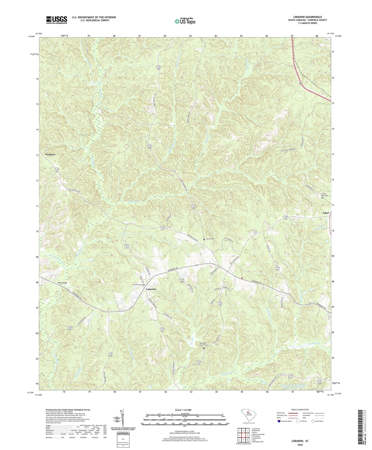
2020 topographic map quadrangle Lebanon in the state of South Carolina. Scale: 1:24000. Based on the newly updated USGS 7.5' US Topo map series, this map is in the following counties: Fairfield. The map contains contour data, water features, and other items you are used to seeing on USGS maps, but also has updated roads and other features. This is the next generation of topographic maps. Printed on high-quality waterproof paper with UV fade-resistant inks.
Quads adjacent to this one:
West: Salem Crossroads
Northwest: Carlisle SE
North: Blackstock
Northeast: Stover
East: Winnsboro
Southeast: Winnsboro Mills
South: Rion
Southwest: Jenkinsville
Contains the following named places: Adger, Bells Bridge, Brushy Fork Creek, Camp Branch, Douglass, Dumpers Creek, Fairfield County Fire Department Lebanon Station, Jordan Branch, Kennedy Creek, Lebanon, Lebanon Cemetery, Lebanon Presbyterian Church, Lick Branch, Mobley Creek, Nazareth Church, Old Stone Church Cemetery, Opossum Branch, Saint Johns Cemetery, Sand Creek, Shady Grove Church, Shady Grove School, South Carolina Noname 20019 D-0520 Dam, Stitt Branch, Sweet Prospect Church, Sweet Prospect School, Turner Cemetery, West Fork Little River, White Oak Lookout Tower


