MyTopo
Winnsboro Mills South Carolina US Topo Map
Couldn't load pickup availability
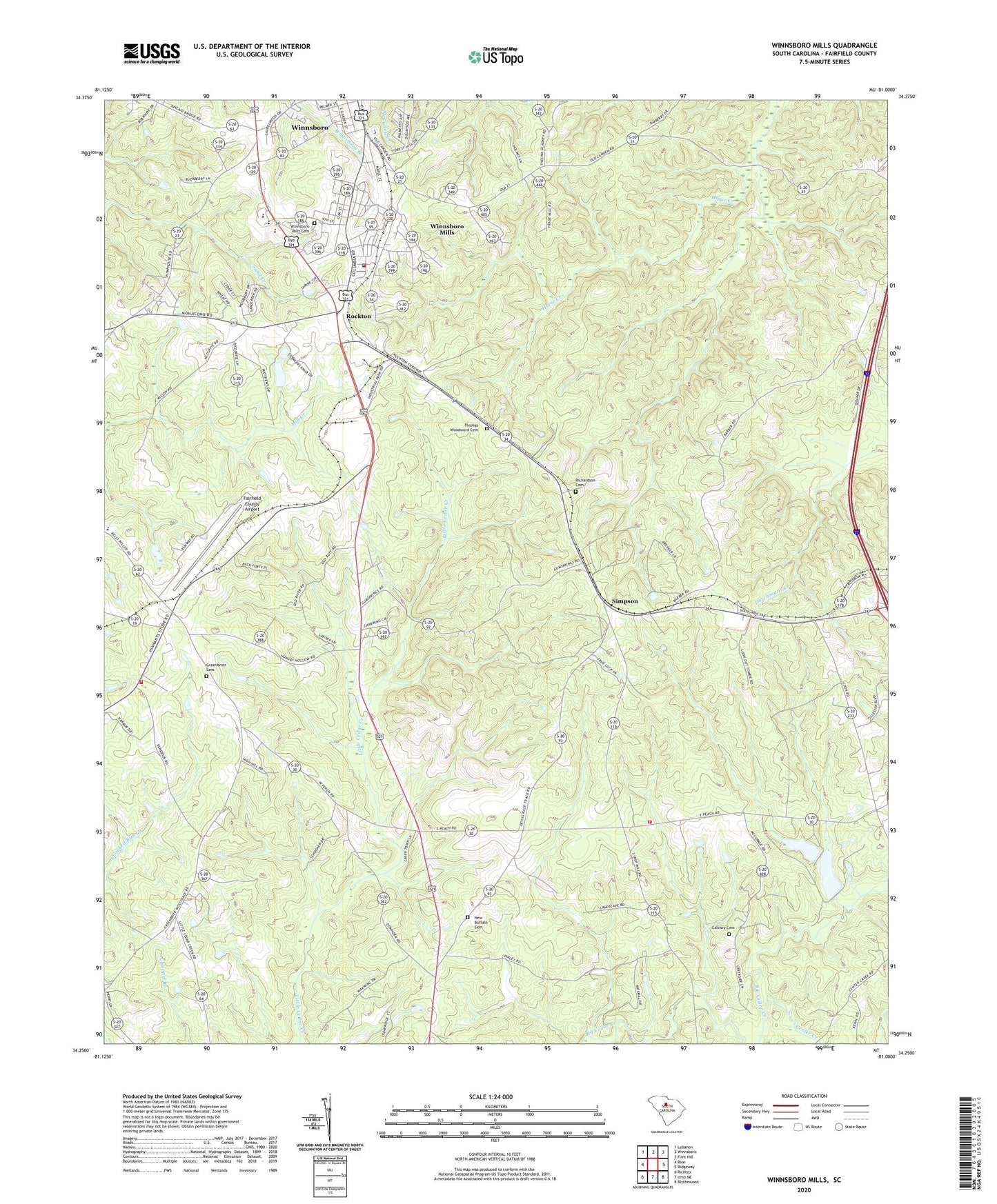
2024 topographic map quadrangle Winnsboro Mills in the state of South Carolina. Scale: 1:24000. Based on the newly updated USGS 7.5' US Topo map series, this map is in the following counties: Fairfield. The map contains contour data, water features, and other items you are used to seeing on USGS maps, but also has updated roads and other features. This is the next generation of topographic maps. Printed on high-quality waterproof paper with UV fade-resistant inks.
Quads adjacent to this one:
West: Rion
Northwest: Lebanon
North: Winnsboro
Northeast: Flint Hill
East: Ridgeway
Southeast: Blythewood
South: Irmo NE
Southwest: Richtex
This map covers the same area as the classic USGS quad with code o34081c1.
Contains the following named places: Calvary Cemetery, Calvary Church, Calvary School, Center Creek, Church of God, Church of the Nazarene, Ebenezer Church, Everett School, Fairfield County Airport, Fairfield County Community Fire Department, Fairfield County Fire Department Greenbrier Bethel, Fairfield County Fire Department Greenbrier Substation, Fairfield Memorial Hospital, Greenbrier Cemetery, Greenbrier Church, Greenbrier School, New Buffalo Cemetery, New Haven Church, Richardson Cemetery, Rockton, Rockton Church, Saint Johns Church, Saint Lukes Church, Saint Mark School, Saint Marks Church, Saint Theresa Church, Simpson, Simpson Lookout Tower, South Carolina Noname 20002 D-0530 Dam, South Carolina Noname 20010 D-0527 Dam, South Carolina Noname 20022 D-0528 Dam, Stephen Green Memorial Baptist Church, Thomas Woodward Cemetery, Town of Winnsboro, Waymaon Methodist Church, Winnsboro High School, Winnsboro Mills, Winnsboro Mills Cemetery, Winnsboro Mills Census Designated Place, Winnsboro Mills Methodist Church, ZIP Code: 29180