MyTopo
Olanta South Carolina US Topo Map
Couldn't load pickup availability
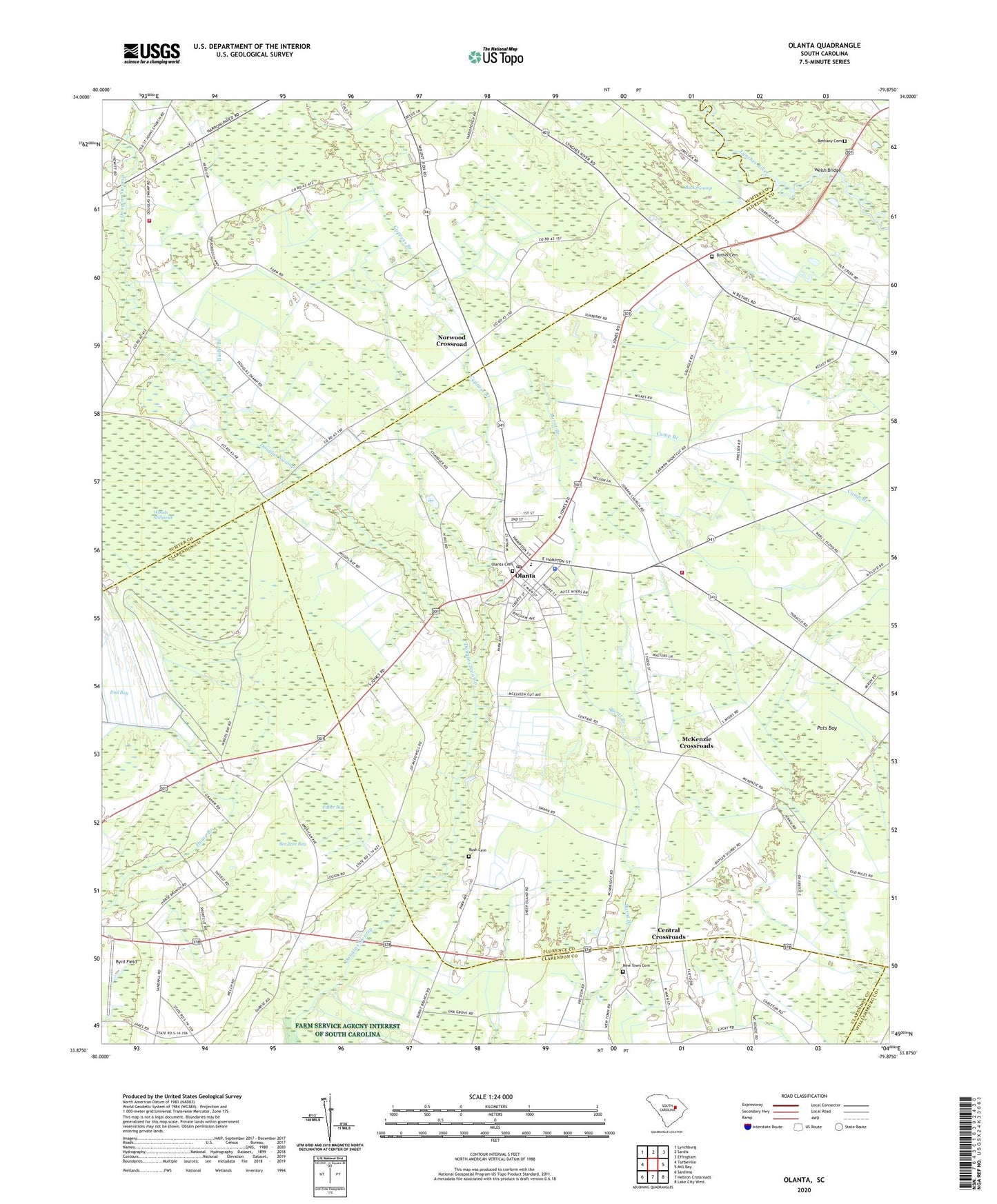
2020 topographic map quadrangle Olanta in the state of South Carolina. Scale: 1:24000. Based on the newly updated USGS 7.5' US Topo map series, this map is in the following counties: Florence, Sumter, Clarendon, Williamsburg. The map contains contour data, water features, and other items you are used to seeing on USGS maps, but also has updated roads and other features. This is the next generation of topographic maps. Printed on high-quality waterproof paper with UV fade-resistant inks.
Quads adjacent to this one:
West: Turbeville
Northwest: Lynchburg
North: Sardis
Northeast: Effingham
East: Mill Bay
Southeast: Lake City West
South: Hebron Crossroads
Southwest: Sardinia
Contains the following named places: Back Swamp, Bee Tree Bay, Bethany Cemetery, Bethel Cemetery, Bethel Church, Bethel School, Beulah Mission Church, Bushy Branch, Byrd Field, Central Crossroads, Central School, Cypress Branch, Fuller Bay, Jerusalem Church, Jordan Chapel Baptist Church, McKenzie Crossroads, Mimms Crossroads, Motts Crossroads, New Jerusalem School, New Town Cemetery, New Town Church, Norwood Crossroad, Oak Grove Church, Oak Grove School, Olanta, Olanta Cemetery, Olanta Division, Olanta Elementary School, Olanta First Pentecostal Holiness Church, Olanta Police Department, Olanta Post Office, Olanta Presbyterian Church, Olanta Public Library, Olanta Rural Fire Department, Pats Bay, Pine Dale School, Rush Cemetery, Saint John School, Saint Johns Church, Saint Johns School, Saint Mark Church, Saint Mark School, Sumter Fire Department Byrds Station 18, Town of Olanta, Union Hill Church, Union Hill School, Welsh Bridge, Woods Bay State Park, Woods Millpond, Zion Church, ZIP Code: 29114