MyTopo
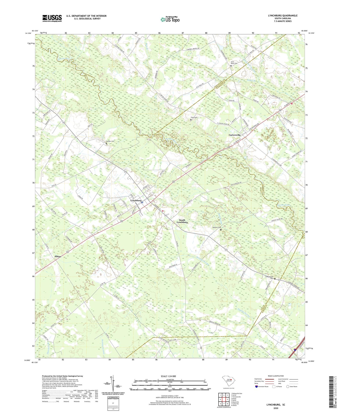
Lynchburg South Carolina US Topo Map
Couldn't load pickup availability
2024 topographic map quadrangle Lynchburg in the state of South Carolina. Scale: 1:24000. Based on the newly updated USGS 7.5' US Topo map series, this map is in the following counties: Lee, Florence, Darlington, Sumter. The map contains contour data, water features, and other items you are used to seeing on USGS maps, but also has updated roads and other features. This is the next generation of topographic maps. Printed on high-quality waterproof paper with UV fade-resistant inks.
Quads adjacent to this one:
West: Elliott
Northwest: Bishopville East
North: Lamar
Northeast: Timmonsville
East: Sardis
Southeast: Olanta
South: Turbeville
Southwest: Mayesville
This map covers the same area as the classic USGS quad with code o34080a1.
Contains the following named places: Atkins, Back Swamp, Bethesda Church, Byrds Ferry, Camel Branch, Campground Cemetery, Cartersville, Cartersville Baptist Church, Cartersville School, Durants Ferry, Evening Light Church, Fair Hope Church, Field Cemetery, Fleming School, Green Bay Church, Hawkins Cemetery, Holiness Church, King Emmanuel Church, Lee County Fire Department Station 2 - Lynchburg, Lynchburg, Lynchburg Division, Lynchburg Presbyterian Church, Macedonia Church, Mathis School, Mount Tabor Church, New Haven Church, Rose Branch, Saint Johns Church, Saint Matthews Church, Saint Paul Church, Saint Pauls Cemetery, Sanders Bridge, Sanders Cemetery, Sardis - Timmonsville Fire Department Station 2, South Lynchburg, Tolson Farms, Town of Lynchburg, ZIP Code: 29080