
MyTopo
Sardis South Carolina US Topo Map
Couldn't load pickup availability
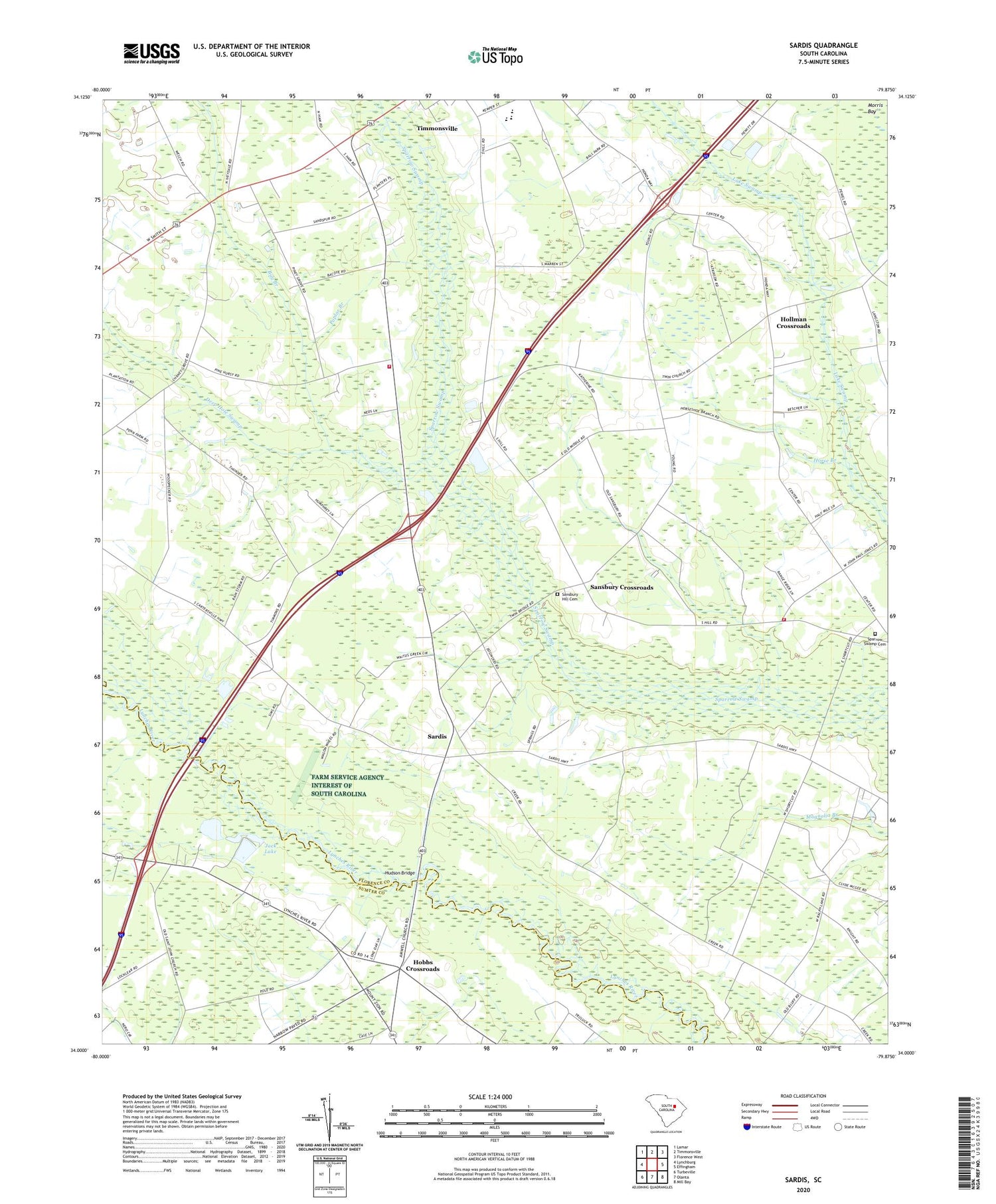
2020 topographic map quadrangle Sardis in the state of South Carolina. Scale: 1:24000. Based on the newly updated USGS 7.5' US Topo map series, this map is in the following counties: Florence, Sumter. The map contains contour data, water features, and other items you are used to seeing on USGS maps, but also has updated roads and other features. This is the next generation of topographic maps. Printed on high-quality waterproof paper with UV fade-resistant inks.
Quads adjacent to this one:
West: Lynchburg
Northwest: Lamar
North: Timmonsville
Northeast: Florence West
East: Effingham
Southeast: Mill Bay
South: Olanta
Southwest: Turbeville
Contains the following named places: Aimwell Church, Antioch Church, Bay Branch, Bay Branch Church, Bethany Church, Brownwood School, Center School, Chaney Grove Church, China Grove Church, China Grove School, Deep Hole Swamp, Deliverance Tabernacle, Fellowship Church of God Holiness, Hobbs Crossroads, Hollman Crossroads, Horse Branch, Howard Chapel, Hudson Bridge, Humphrey Chapel, Humphrey Lake, Jack Lake, Kelly Lake, Mc Kay Airport, Morrell School, New Home School, New Zion Church, Peniel Church, Pleasant View, Poplar Branch, Roy Hudgens Academy, Saint Johns Church, Sansbury Crossroads, Sansbury Hill Cemetery, Sardis, Sardis - Timmonsville Fire Department, Sardis - Timmonsville Fire Department Station 3, Sardis Baptist Church, Sardis Division, Scotts Mill, Sparrow Swamp Cemetery, Sparrow Swamp Church, Sparrows Crossroads, Timmonsville Division, ZIP Code: 29161


