MyTopo
Six Mile South Carolina US Topo Map
Couldn't load pickup availability
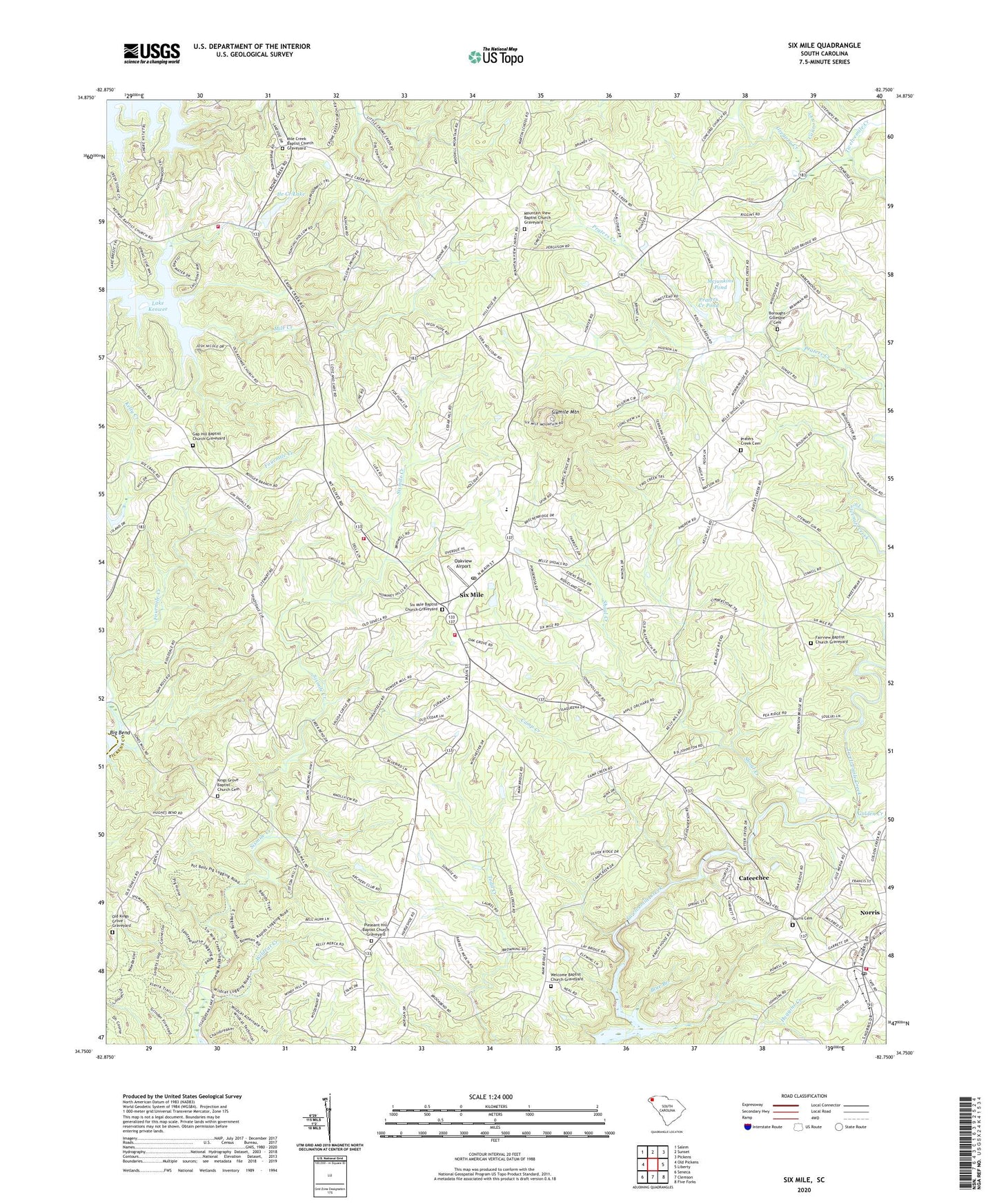
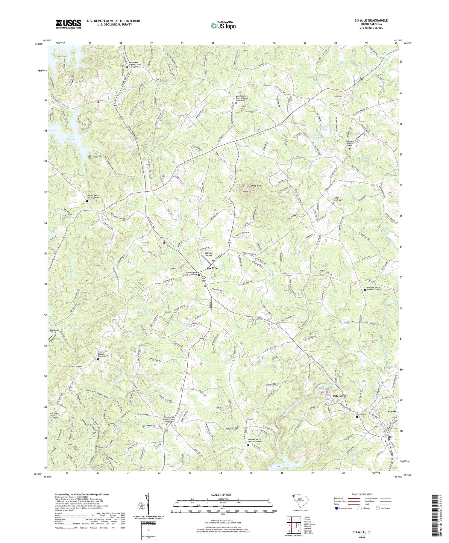
2020 topographic map quadrangle Six Mile in the state of South Carolina. Scale: 1:24000. Based on the newly updated USGS 7.5' US Topo map series, this map is in the following counties: Pickens, Oconee. The map contains contour data, water features, and other items you are used to seeing on USGS maps, but also has updated roads and other features. This is the next generation of topographic maps. Printed on high-quality waterproof paper with UV fade-resistant inks.
Quads adjacent to this one:
West: Old Pickens
Northwest: Salem
North: Sunset
Northeast: Pickens
East: Liberty
Southeast: Five Forks
South: Clemson
Southwest: Seneca
Contains the following named places: Blue Branch, Boroughs Gillespie Cemetery, Camp Creek, Camp Creek Church, Cannon Creek, Cateechee, Cateechee Census Designated Place, Cedar Hill Church, Cross Roads Church, Cross Roads School, Crow Creek Church, Fairview Baptist Church, Fairview Baptist Church Graveyard, Faith Baptist Church, Fourmile Creek, Gap Hill Baptist Church, Gap Hill Baptist Church Graveyard, Gap Hill Church, Gap Hill Church of God, Gates School, Golden Creek, Gregory Creek, Huggins Creek, Ile Creek Lake, Kings Grove Baptist Church Cemetery, Kings Grove Church, Kings Grove School, Lay Bridge, Mcjunkins Pond, Mcjunkins Pond Dam D-1963, Mile Creek Baptist Church, Mile Creek Baptist Church Graveyard, Mile Creek School, Mount Olivet Church, Mountain View Baptist Church, Mountain View Baptist Church Graveyard, Mountain View School, New Beginnings Independent Baptist Church, Norris, Norris Cemetery, Norris Fire Department, Norris First Baptist Church, Oakview Airport, Old Kings Grove Graveyard, Palestine School, Pearidge, Pickens County Emergency Medical Services, Pleasant Hill Baptist Church, Pleasant Hill Baptist Church Graveyard, Pleasant Hill School, Prater School, Praters Creek Baptist Church, Praters Creek Cemetery, Praters Creek Dam, Praters Creek Pond, Shoal Creek, Six Mile, Six Mile Baptist Church, Six Mile Baptist Church Graveyard, Six Mile Division, Six Mile Elementary School, Six Mile Fire Department, Six Mile School, Sixmile Mountain, South Carolina Noname 39019 D-1971 Dam, Terrapin Crossroads, Town of Norris, Town of Six Mile, Welcome Baptist Church, Welcome Baptist Church Graveyard, Wildcat Creek, ZIP Codes: 29667, 29682