
MyTopo
Spring Hill South Carolina US Topo Map
Couldn't load pickup availability
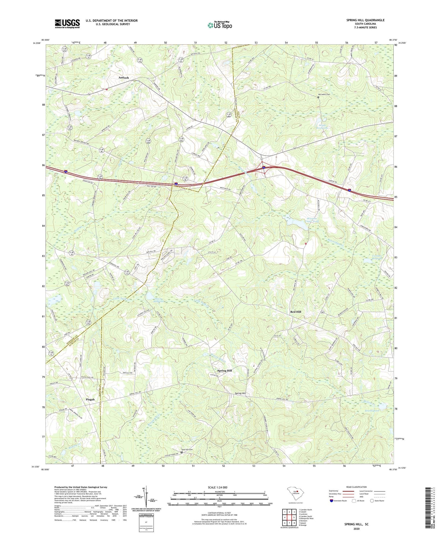
2020 topographic map quadrangle Spring Hill in the state of South Carolina. Scale: 1:24000. Based on the newly updated USGS 7.5' US Topo map series, this map is in the following counties: Lee, Kershaw, Sumter. The map contains contour data, water features, and other items you are used to seeing on USGS maps, but also has updated roads and other features. This is the next generation of topographic maps. Printed on high-quality waterproof paper with UV fade-resistant inks.
Quads adjacent to this one:
West: Camden South
Northwest: Camden North
North: Cassatt
Northeast: Lucknow
East: Bishopville West
Southeast: Oswego
South: Dalzell
Southwest: Rembert
Contains the following named places: Antioch, Antioch Baptist Church, Antioch Elementary School, Ashwood Division, Central High School, Community Bible Church, Corbitts Millpond, Corbitts Millpond Dam D-1721, Elizabeth Church, Gospel Hill Church, Ionia School, Kershaw County Fire Station Antioch, Lee County Rural Fire Department Red Hill, McCaskill Cemetery, McLeod School, McLeods Lower Pond, McLeods Pond, McLeods Upper Pond, McLeods Upper Pond Dam D-2409, Mizpah Church, Mount Calvary Church, Newell Pond, Oak Grove School, Pine Grove Church, Pisgah, Pisgah Church, Red Hill, Red Hill Baptist Church, Reedy Branch School, Rock Hill Church, Rock Hill School, Saint Andrews Church, Saint James Church, Saint Johns Church, Saint Lukes Church, Saint Phillips Church, Saint Phillips School, Saints Church, Salem Church, Sand Hill Cemetery, Sandy Hill Plantation, Shiver Millpond, South Carolina Noname 28038 D-2536 Dam, South Carolina Noname 31016 D-2406 Dam, South Carolina Noname 31018 D-2408 Dam, Spring Hill, Spring Hill School, West Lee School, Windi Knoll Lake, Windi Knoll Lake D-1723 Dam, WQHB-TV (Sumter), Zion Hill Church


