MyTopo
Sunset South Carolina US Topo Map
Couldn't load pickup availability
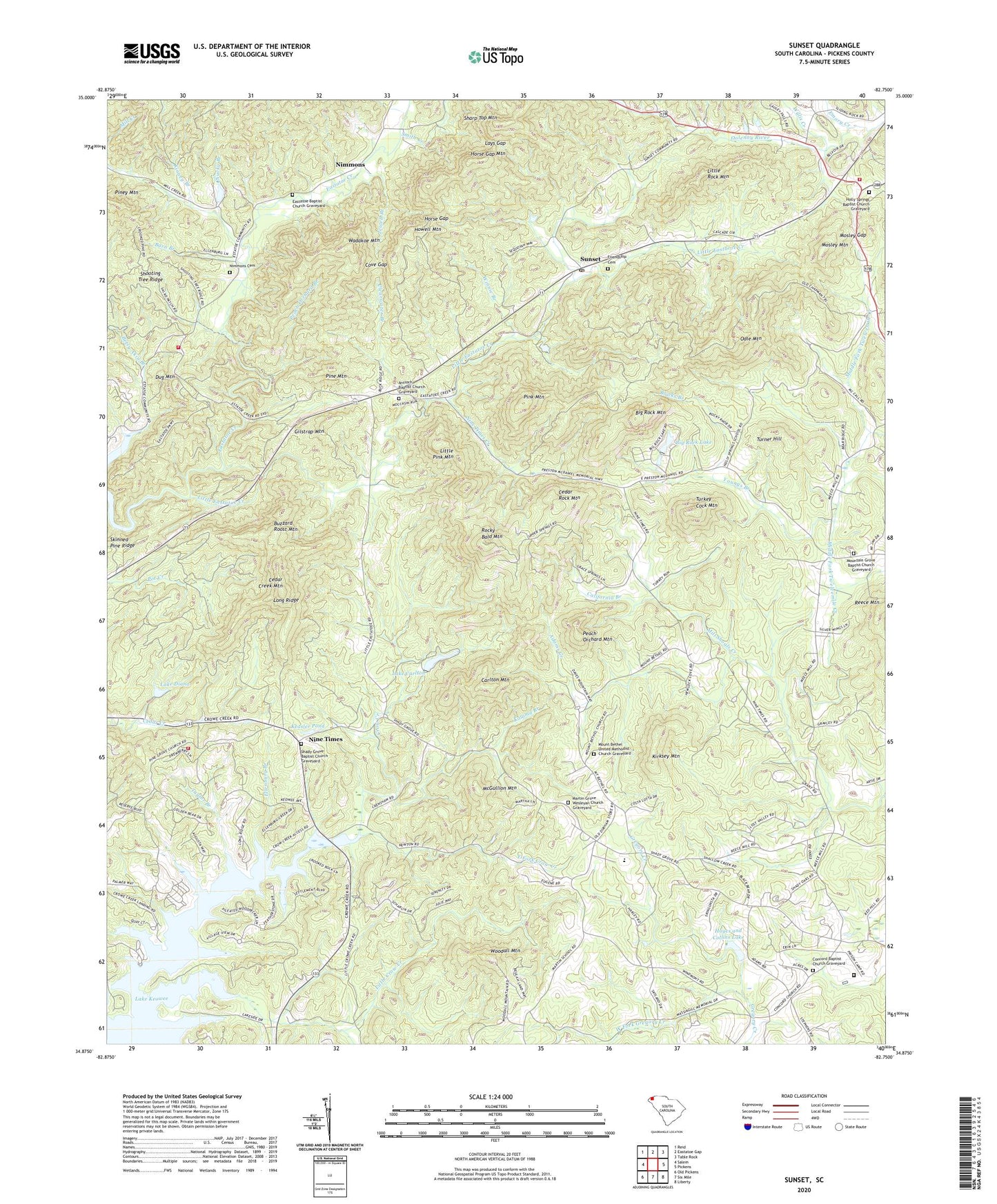
2020 topographic map quadrangle Sunset in the state of South Carolina. Scale: 1:24000. Based on the newly updated USGS 7.5' US Topo map series, this map is in the following counties: Pickens. The map contains contour data, water features, and other items you are used to seeing on USGS maps, but also has updated roads and other features. This is the next generation of topographic maps. Printed on high-quality waterproof paper with UV fade-resistant inks.
Quads adjacent to this one:
West: Salem
Northwest: Reid
Northeast: Table Rock
East: Pickens
Southeast: Liberty
South: Six Mile
Southwest: Old Pickens
Contains the following named places: Adams Creek, Antioch Baptist Church, Antioch Baptist Church Graveyard, Antioch School, Barn Branch, Big Rock Lake, Big Rock Lake Dam D-1960, Big Rock Mountain, Blacks Branch, Buzzard Roost Mountain, California Branch, Carlton Mountain, Cedar Creek Mountain, Cedar Rock Mountain, Chucky Branch, Clearwater Branch, Concord Baptist Church Graveyard, Concord Church, Country Club Lake, Cove Creek, Cove Gap, Crow Creek, Dug Mountain, East Fork Crow Creek, Eastatoe Baptist Church, Eastatoe Baptist Church Graveyard, Eastatoe School, Ellenburg Branch, Emory Creek, Friendship Cemetery, Gilstrap Mountain, Gospel Church, Hampton School, Harris Pond, Hayes and Collins Lake, Holly Springs Baptist Church, Holly Springs Baptist Church Graveyard, Holly Springs Fire Department, Holly Springs School, Horse Gap, Horse Gap Mountain, Howell Mountain, Jewell Branch, Katoma Branch, Keasler Pond, Keasler Pond Dam D-1979, Kinney Branch, Kirksey Mountain, Lake Carlton, Lake Diana, Lays Gap, Lewis School, Little Crow Creek, Little Eastatoe Creek, Little Pink Mountain, Little Rock Mountain, Long Ridge, Martin Grove Church, Martin Grove Wesleyan Church Graveyard, Martin School, McGullion Mountain, Mill Creek, Mill Shoals Creek, Mosley Gap, Mosley Mountain, Mount Bethel Church, Mount Bethel United Methodist Church Graveyard, Mount Grove Church, Mountain Grove Baptist Church Graveyard, Nimmons, Nimmons Cemetery, Nine Times, Nine Times Creek, Odle Mountain, Peach Orchard Branch, Peach Orchard Mountain, Pickens County Prison, Pine Mountain, Pink Mountain, Prices Store, Reece Mountain, Rocky Bald Mountain, Salem Church, Shady Grove Baptist Church, Shady Grove Baptist Church Graveyard, Shady Grove Fire Department, Shady Grove School, Sharp Top Mountain, Shooting Tree Ridge, Skinned Pine Ridge, Smith Creek, South Carolina Noname 39008 D-1965 Dam, South Carolina Noname 39009 D-1954 Dam, South Carolina Noname 39013 D-1968 Dam, South Carolina Noname 39021 D-1969 Dam, South Carolina Noname 39025 D-1961 Dam, Summey Pond, Summey Pond Dam D-1959, Sunset, Taylor Branch, Turkey Cock Mountain, Turner Hill, Twelve Mile School, Vineyards Fire Department, Wadakoe Mountain, West Fork Gregory Creek, Willis Creek, Winnie Branch, Woodall Lookout Tower, Woodall Mountain, Youngs Branch, ZIP Code: 29685