MyTopo
Akaska SW South Dakota US Topo Map
Couldn't load pickup availability
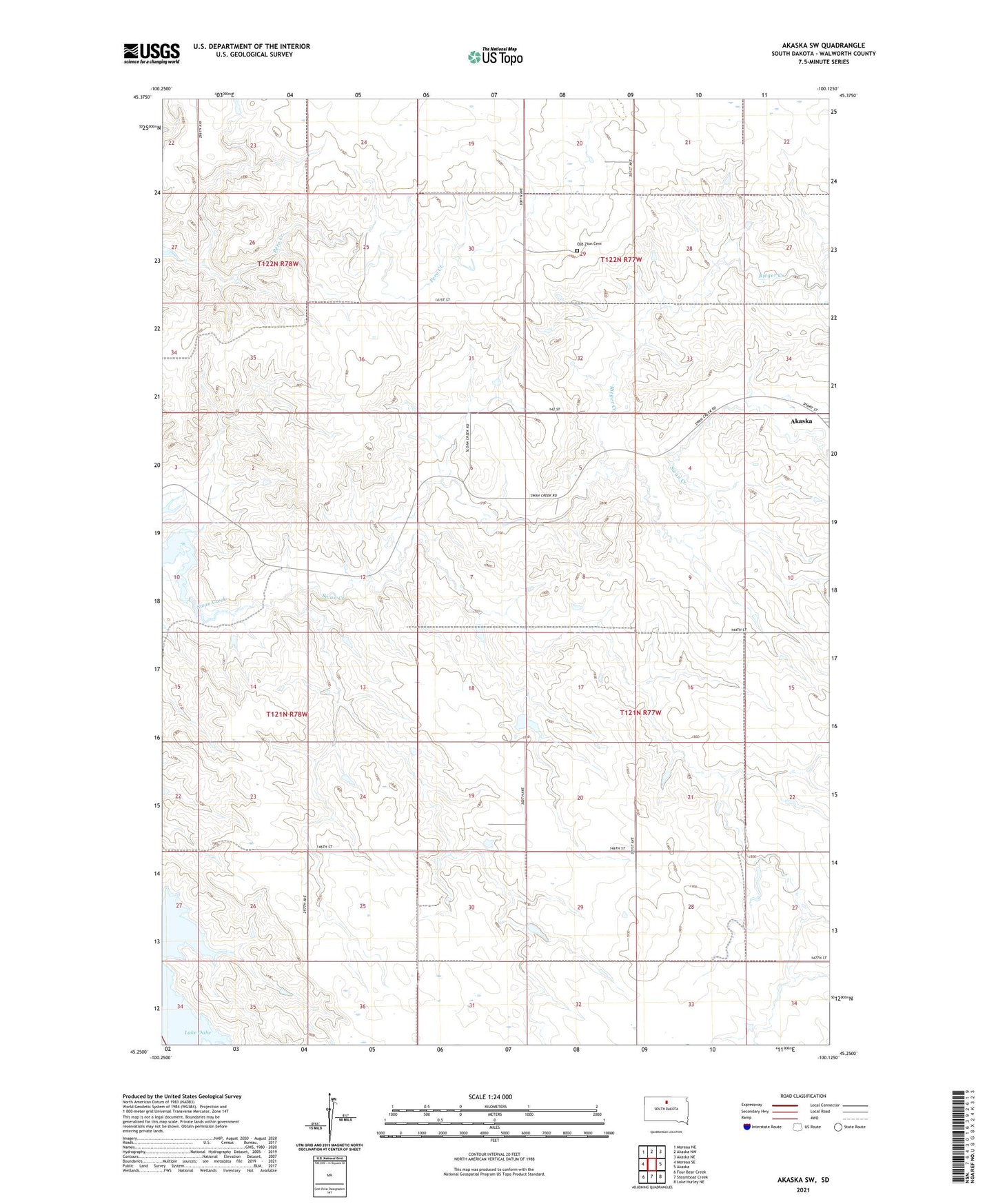
2021 topographic map quadrangle Akaska SW in the state of South Dakota. Scale: 1:24000. Based on the newly updated USGS 7.5' US Topo map series, this map is in the following counties: Walworth. The map contains contour data, water features, and other items you are used to seeing on USGS maps, but also has updated roads and other features. This is the next generation of topographic maps. Printed on high-quality waterproof paper with UV fade-resistant inks.
Quads adjacent to this one:
West: Moreau SE
Northwest: Moreau NE
North: Akaska NW
Northeast: Akaska NE
East: Akaska
Southeast: Lake Hurley NE
South: Steamboat Creek
Southwest: Four Bear Creek
Contains the following named places: Albert Kulm Dam, Calvin Ballensky Dam, Old Zion Cemetery, Rieger Creek, Tom Hauk Number 1 Dam, Township of Brown, Township of Liberty, Township of River, Township of Scranton, ZIP Code: 57420