MyTopo
Four Bear Creek South Dakota US Topo Map
Couldn't load pickup availability
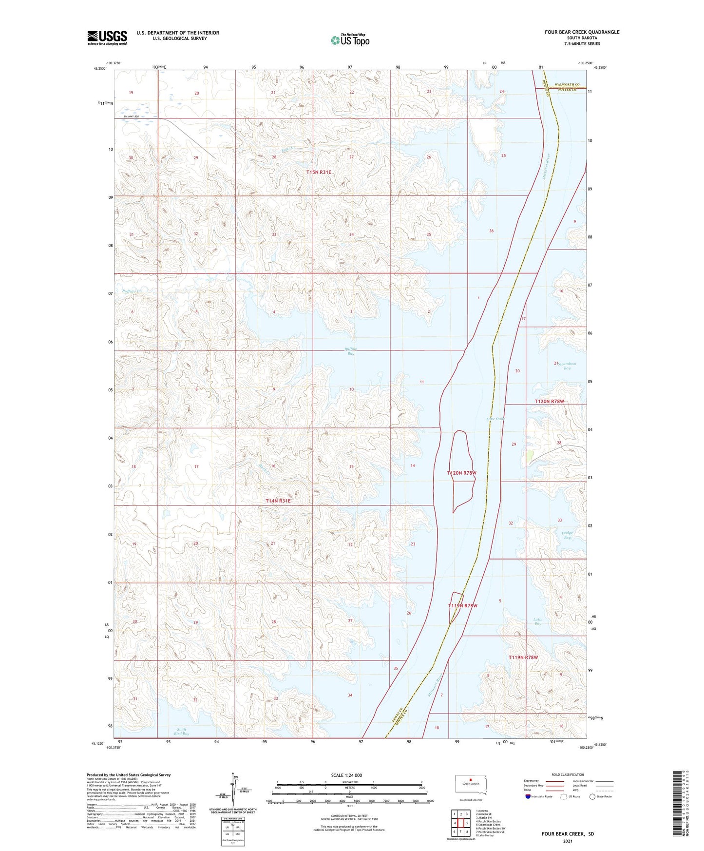
2021 topographic map quadrangle Four Bear Creek in the state of South Dakota. Scale: 1:24000. Based on the newly updated USGS 7.5' US Topo map series, this map is in the following counties: Dewey, Potter, Walworth. The map contains contour data, water features, and other items you are used to seeing on USGS maps, but also has updated roads and other features. This is the next generation of topographic maps. Printed on high-quality waterproof paper with UV fade-resistant inks.
Quads adjacent to this one:
West: Patch Skin Buttes
Northwest: Moreau
North: Moreau SE
Northeast: Akaska SW
East: Steamboat Creek
Southeast: Lake Hurley
South: Patch Skin Buttes SE
Southwest: Patch Skin Buttes SW
This map covers the same area as the classic USGS quad with code o45100b3.
Contains the following named places: Buck Creek, Buffalo Bay, Buffalo Creek, Dodge Bay, Dodge Draw Recreation Area, Four Bear Creek, Four Bear School, Houck Ranch, Latin Bay, Le Beau Cemetery, Le Beau Church, Saint Stephens Church, Swift Bird Creek