MyTopo
Big Bend Dam NE South Dakota US Topo Map
Couldn't load pickup availability
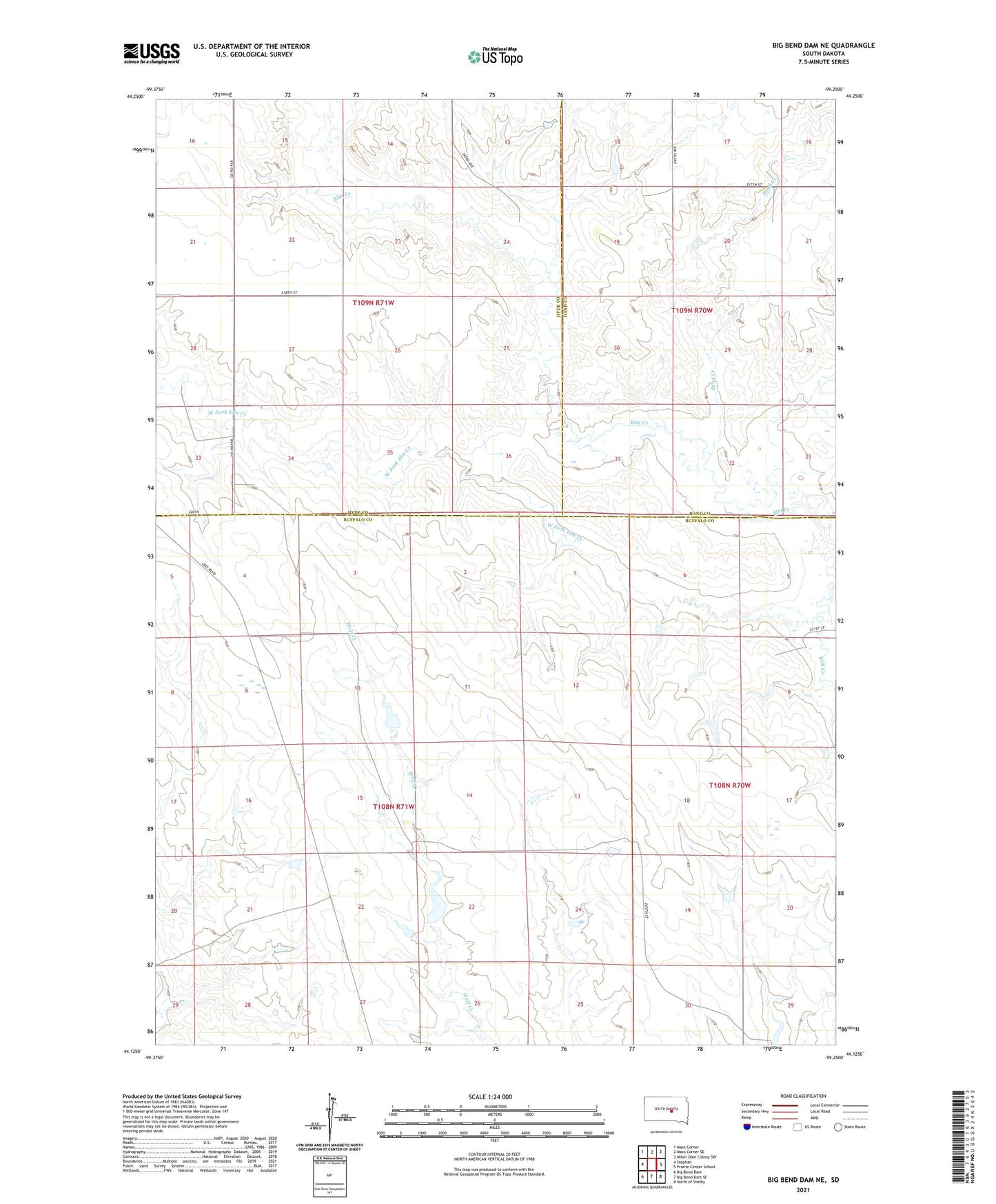
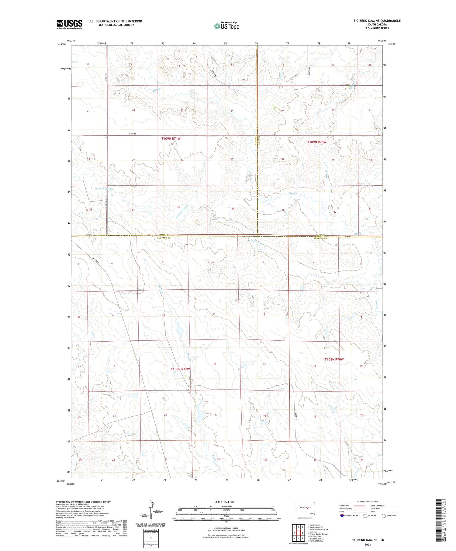
2021 topographic map quadrangle Big Bend Dam NE in the state of South Dakota. Scale: 1:24000. Based on the newly updated USGS 7.5' US Topo map series, this map is in the following counties: Buffalo, Hyde, Hand. The map contains contour data, water features, and other items you are used to seeing on USGS maps, but also has updated roads and other features. This is the next generation of topographic maps. Printed on high-quality waterproof paper with UV fade-resistant inks.
Quads adjacent to this one:
West: Stephan
Northwest: Macs Corner
North: Macs Corner SE
Northeast: Miller Dale Colony SW
East: Prairie Center School
Southeast: North of Shelby
South: Big Bend Dam SE
Southwest: Big Bend Dam
Contains the following named places: Curtis School, Knippling Ranch, M Smith Dam, Sand Creek, Township of Convent, West Fork Elm Creek