MyTopo
Big Bend Dam South Dakota US Topo Map
Couldn't load pickup availability
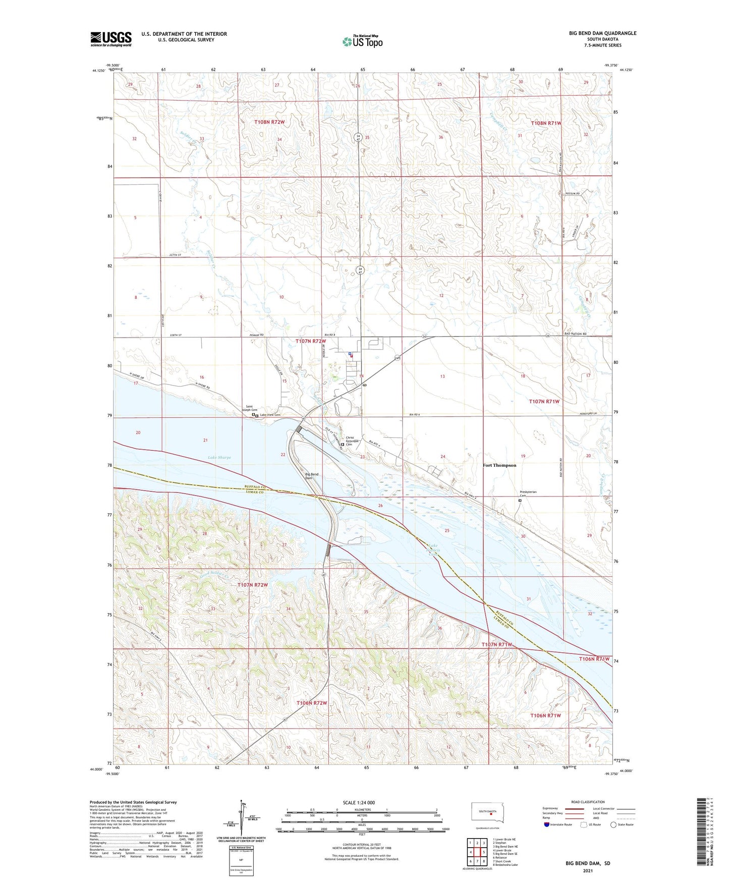
2021 topographic map quadrangle Big Bend Dam in the state of South Dakota. Scale: 1:24000. Based on the newly updated USGS 7.5' US Topo map series, this map is in the following counties: Buffalo, Lyman. The map contains contour data, water features, and other items you are used to seeing on USGS maps, but also has updated roads and other features. This is the next generation of topographic maps. Printed on high-quality waterproof paper with UV fade-resistant inks.
Quads adjacent to this one:
West: Lower Brule
Northwest: Lower Brule NE
North: Stephan
Northeast: Big Bend Dam NE
East: Big Bend Dam SE
Southeast: Bedashosha Lake
South: Short Creek
Southwest: Reliance
This map covers the same area as the classic USGS quad with code o44099a4.
Contains the following named places: Big Bend Dam, Big Bend Landing Strip, Christ Episcopal Cemetery, Crow Creek Fire Department, Crow Creek Police Department, Crow Creek Sioux Ambulance Service, Fort Thompson, Fort Thompson Census Designated Place, Fort Thompson Post Office, Fort Thompson Recreation Area, Good Soldier Creek, Good Soldier Creek Recreation Area, Lake View Cemetery, North Shore Recreation Area, Presbyterian Cemetery, Saint Joseph Cemetery, Soldier Creek, Tailwaters Recreation Area, Trailwaters Recreation Area, ZIP Code: 57339