MyTopo
Bowdle South Dakota US Topo Map
Couldn't load pickup availability
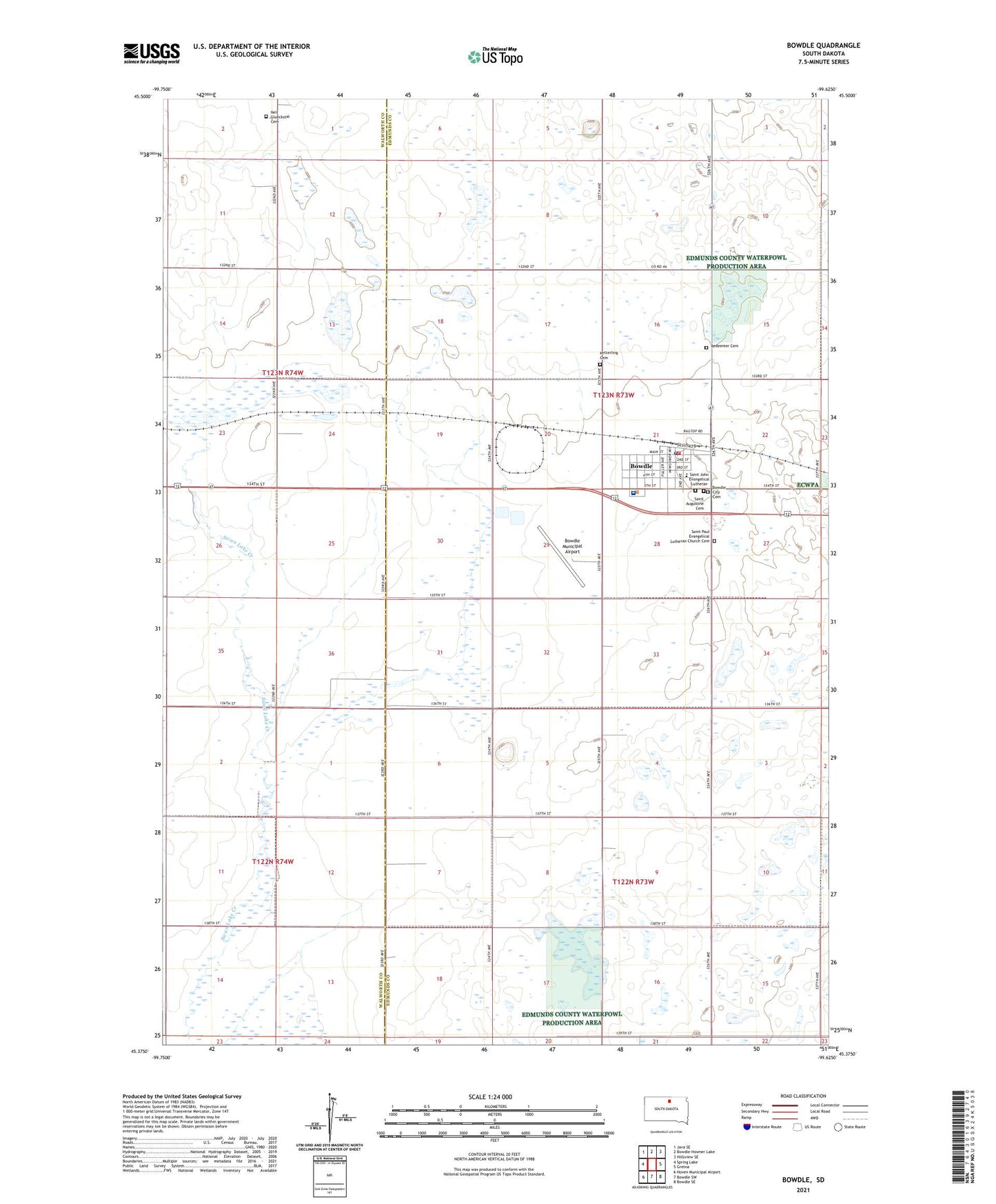
2021 topographic map quadrangle Bowdle in the state of South Dakota. Scale: 1:24000. Based on the newly updated USGS 7.5' US Topo map series, this map is in the following counties: Edmunds, Walworth. The map contains contour data, water features, and other items you are used to seeing on USGS maps, but also has updated roads and other features. This is the next generation of topographic maps. Printed on high-quality waterproof paper with UV fade-resistant inks.
Quads adjacent to this one:
West: Spring Lake
Northwest: Java SE
North: Bowdle-Hosmer Lake
Northeast: Hillsview SE
East: Gretna
Southeast: Bowdle SE
South: Bowdle SW
Southwest: Hoven Municipal Airport
Contains the following named places: Bowdle, Bowdle City Cemetery, Bowdle City Hall, Bowdle Elementary School, Bowdle Healthcare Center, Bowdle High School, Bowdle Junior High School, Bowdle Municipal Airport, Bowdle Post Office, Bowdle Volunteer Fire Department, City of Bowdle, Ketterling Cemetery, Nell Glueckstal Cemetery, Redeemer Cemetery, Reverend Martin Bieber Public Library, Saint Augustine Cemetery, Saint John Evangelical Lutheran, Saint Paul Evangelical Lutheran Church Cemetery, Township of Bowdle, Township of Odessa, ZIP Code: 57428