MyTopo
Bryant South Dakota US Topo Map
Couldn't load pickup availability
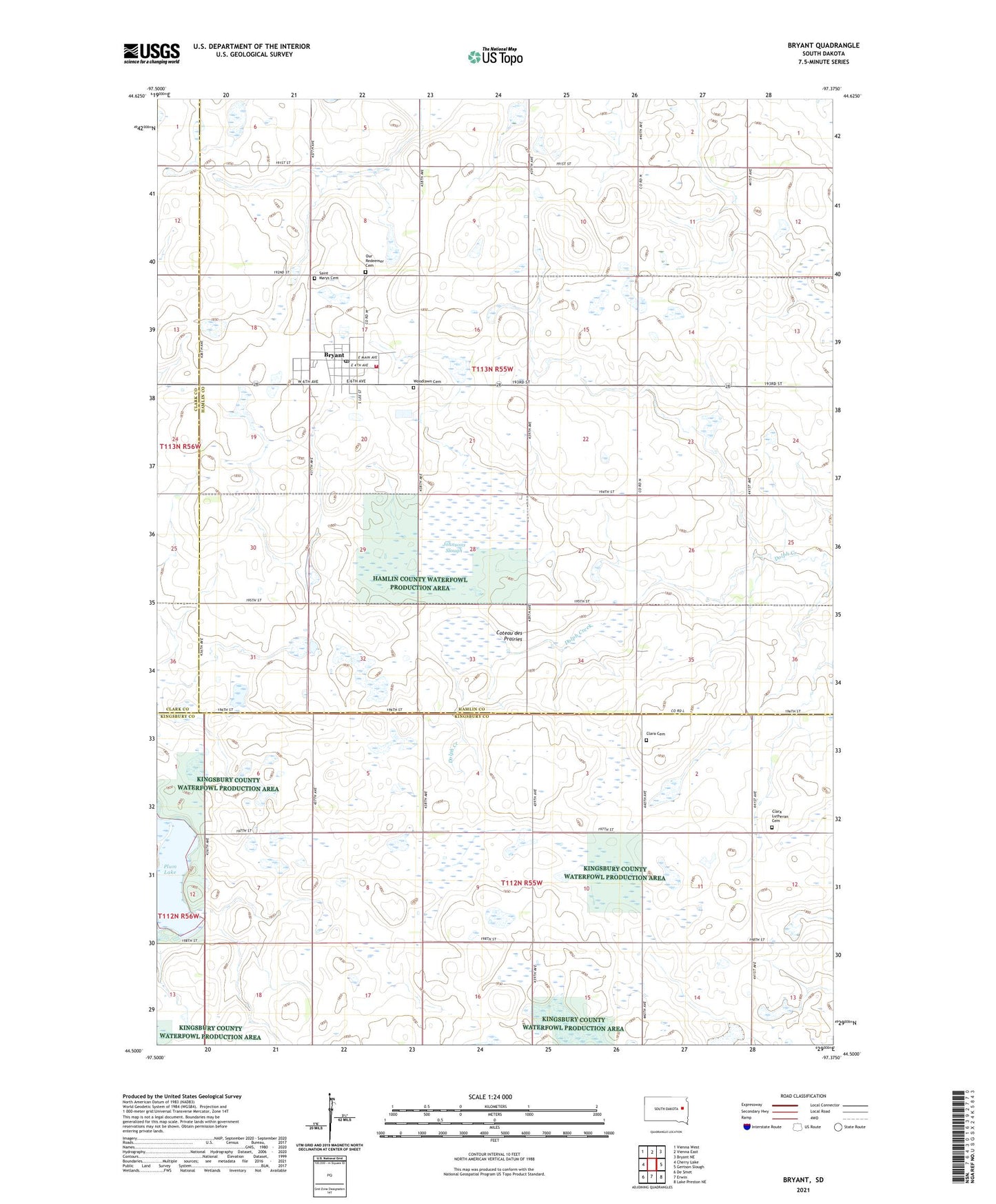
2021 topographic map quadrangle Bryant in the state of South Dakota. Scale: 1:24000. Based on the newly updated USGS 7.5' US Topo map series, this map is in the following counties: Hamlin, Kingsbury, Clark. The map contains contour data, water features, and other items you are used to seeing on USGS maps, but also has updated roads and other features. This is the next generation of topographic maps. Printed on high-quality waterproof paper with UV fade-resistant inks.
Quads adjacent to this one:
West: Cherry Lake
Northwest: Vienna West
North: Vienna East
Northeast: Bryant NE
East: Gertson Slough
Southeast: Lake Preston NE
South: Erwin
Southwest: De Smet
Contains the following named places: Bryant, Bryant Fire Department, Bryant Police Department, Bryant Post Office, City of Bryant, Clara Cemetery, Clara Church, Clara Lutheran Cemetery, Elkhorn, Hamlin County Waterfowl Production Area, Johnsons Slough, Johnsons Slough State Public Shooting Area, McShane State Public Shooting Area, Our Redeemer Cemetery, Plum Lake, Saint Marys Cemetery, School Number 34, School Number 50, Township of Garfield, Woodlawn Cemetery, ZIP Codes: 57221, 57233