MyTopo
Vienna West South Dakota US Topo Map
Couldn't load pickup availability
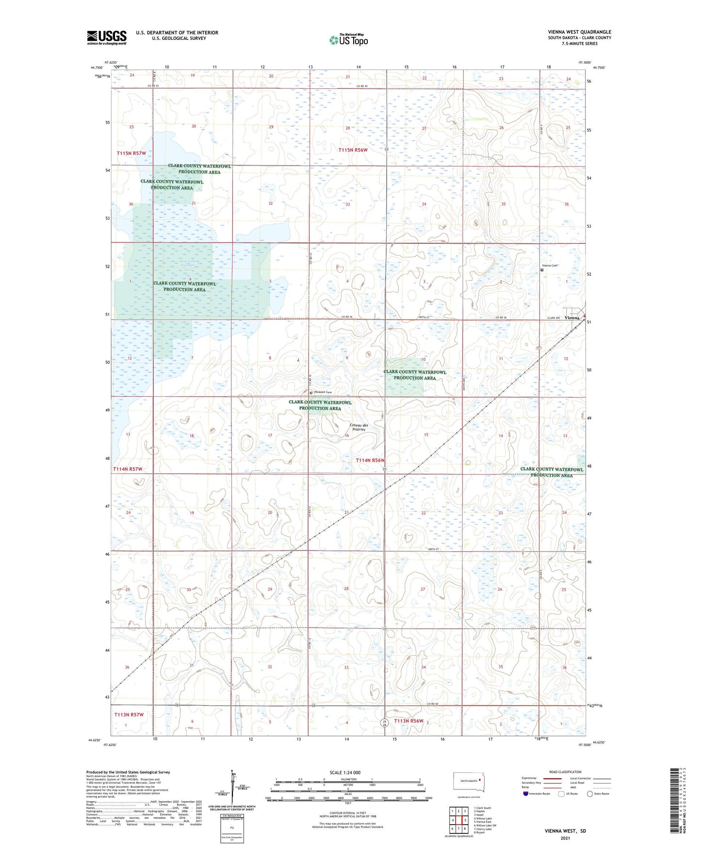
2021 topographic map quadrangle Vienna West in the state of South Dakota. Scale: 1:24000. Based on the newly updated USGS 7.5' US Topo map series, this map is in the following counties: Clark. The map contains contour data, water features, and other items you are used to seeing on USGS maps, but also has updated roads and other features. This is the next generation of topographic maps. Printed on high-quality waterproof paper with UV fade-resistant inks.
Quads adjacent to this one:
West: Willow Lake
Northwest: Clark South
North: Naples
Northeast: Hazel
East: Vienna East
Southeast: Bryant
South: Cherry Lake
Southwest: Willow Lake SW
This map covers the same area as the classic USGS quad with code o44097f5.
Contains the following named places: Clark County Waterfowl Production Area, Dry Lake Number Two, Dudley State Public Shooting Area, Hamre State Public Shooting Area, Mayfield Colony, Mayfield Colony Census Designated Place, Mayfield Colony Elementary School, Pleasant Cemetery, Town of Vienna, Township of Pleasant, Valberg-Lamb State Public Shooting Area, Vienna, Vienna Cemetery, Vienna Fire Department, Vienna Post Office, ZIP Code: 57271