MyTopo
Campbell Creek South Dakota US Topo Map
Couldn't load pickup availability
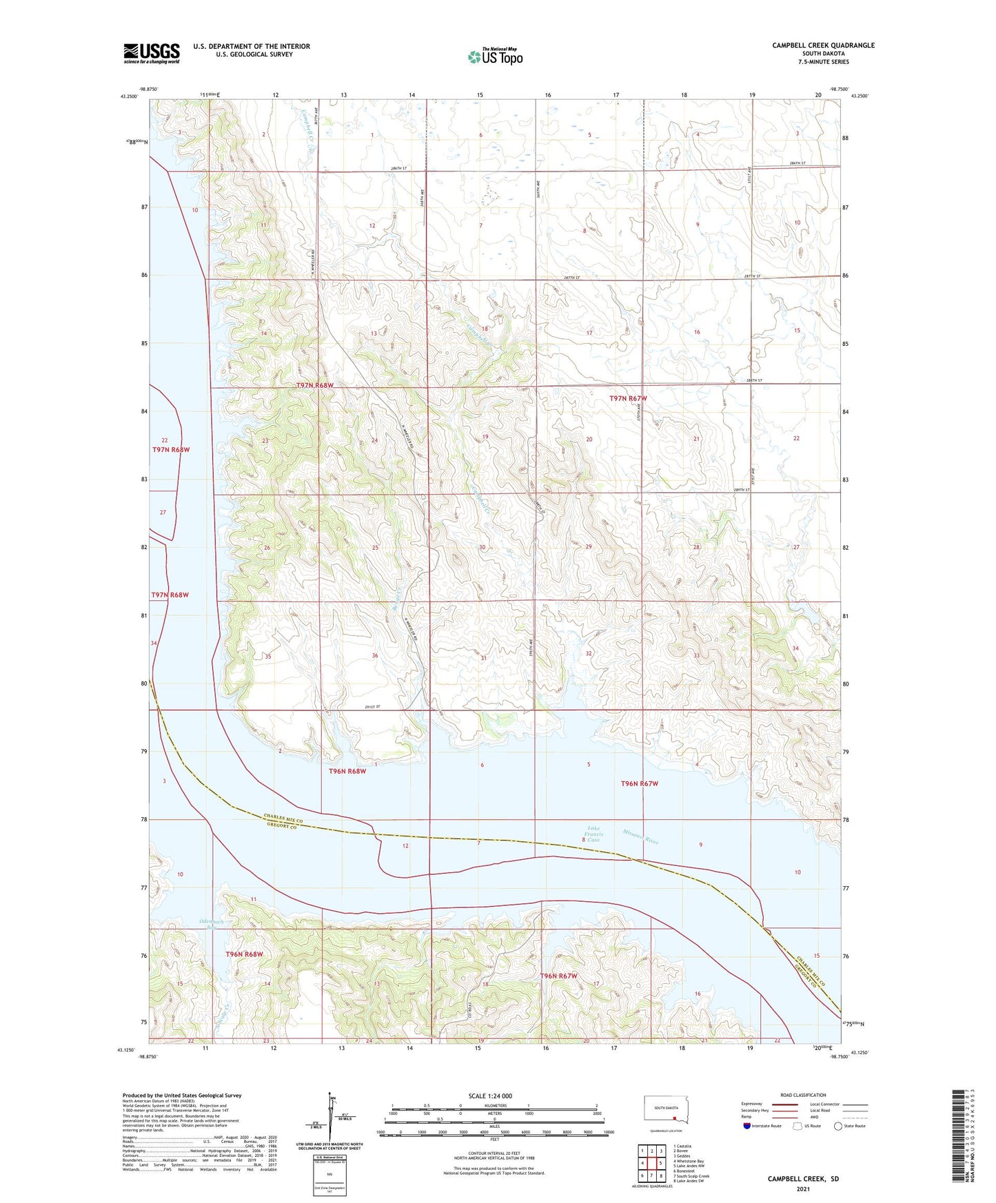
2021 topographic map quadrangle Campbell Creek in the state of South Dakota. Scale: 1:24000. Based on the newly updated USGS 7.5' US Topo map series, this map is in the following counties: Charles Mix, Gregory. The map contains contour data, water features, and other items you are used to seeing on USGS maps, but also has updated roads and other features. This is the next generation of topographic maps. Printed on high-quality waterproof paper with UV fade-resistant inks.
Quads adjacent to this one:
West: Whetstone Bay
Northwest: Castalia
North: Bovee
Northeast: Geddes
East: Lake Andes NW
Southeast: Lake Andes SW
South: South Scalp Creek
Southwest: Bonesteel
Contains the following named places: Benge Creek, Burning Bluff, Campbell Creek, Dowd Dam, Ducharme Cemetery, Harney City, Jackson Number 1 School, Jacobson Ferry, Le Compte Island, Limekiln Creek, Molayses Spring, North Scalp Creek, North Wheeler Recreation Area, Oak Point, Odenbach Bay, Pease Island, Porter Landing, Raymond Landing, South Wheeler Recreation Area, Starcher, Steamboat Landing, Stony Point, Strine School, Wheeler, Wheeler Bottoms, Wheeler Bridge, Whetstone Agency