MyTopo
Castalia South Dakota US Topo Map
Couldn't load pickup availability
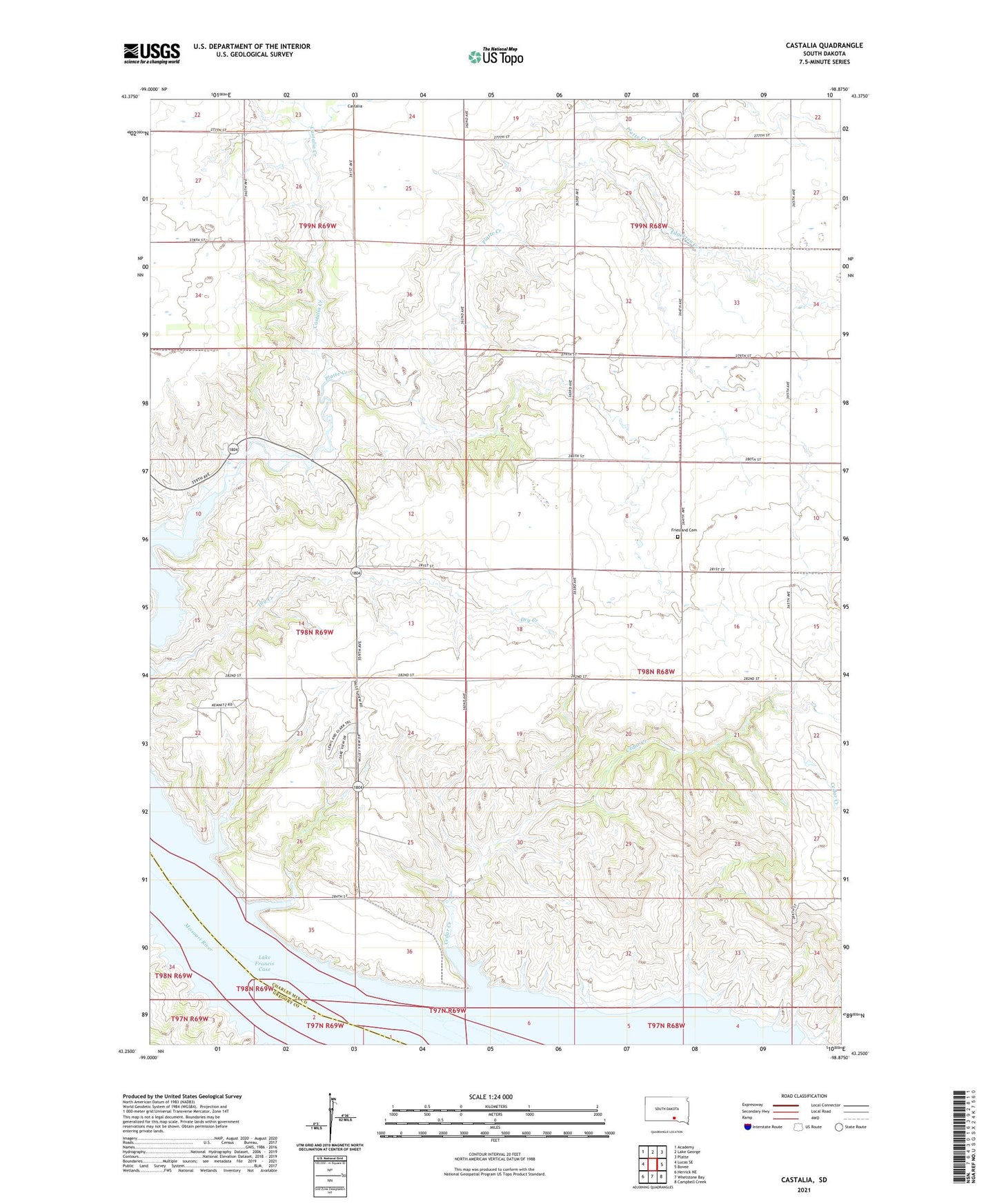
2021 topographic map quadrangle Castalia in the state of South Dakota. Scale: 1:24000. Based on the newly updated USGS 7.5' US Topo map series, this map is in the following counties: Charles Mix, Gregory. The map contains contour data, water features, and other items you are used to seeing on USGS maps, but also has updated roads and other features. This is the next generation of topographic maps. Printed on high-quality waterproof paper with UV fade-resistant inks.
Quads adjacent to this one:
West: Lucas SE
Northwest: Academy
North: Lake George
Northeast: Platte
East: Bovee
Southeast: Campbell Creek
South: Whetstone Bay
Southwest: Herrick NE
This map covers the same area as the classic USGS quad with code o43098c8.
Contains the following named places: Castalia, Castalia Cemetery, Castalia Creek, Cedar Creek, Cottonwood Island, Dry Creek, Edgerton Creek, Friesland, Friesland Cemetery, Gray State Public Shooting Area, Little Cedar Creek, Little Cedar Island, Township of Hamilton