MyTopo
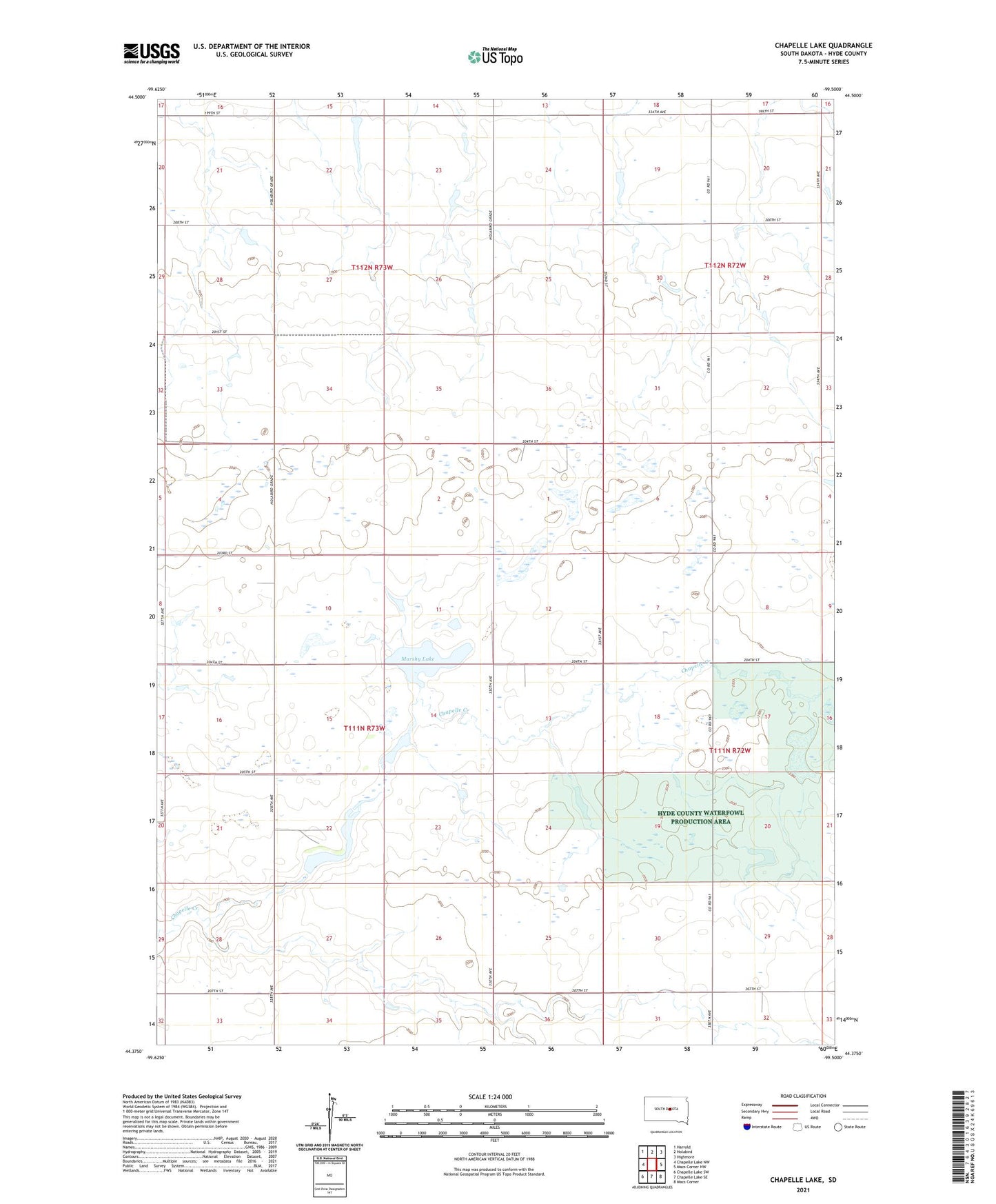
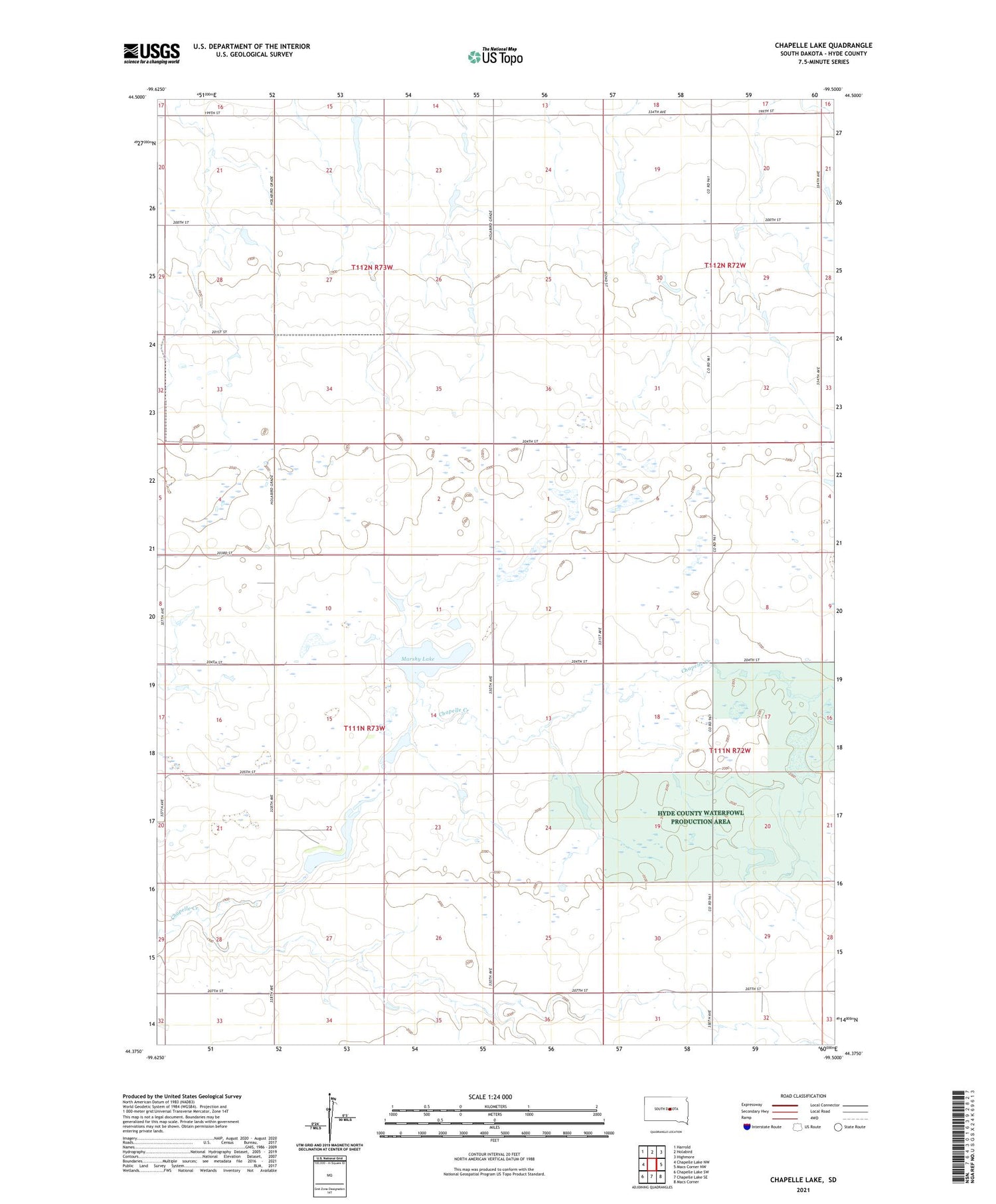
Chapelle Lake South Dakota US Topo Map
Couldn't load pickup availability
2021 topographic map quadrangle Chapelle Lake in the state of South Dakota. Scale: 1:24000. Based on the newly updated USGS 7.5' US Topo map series, this map is in the following counties: Hyde. The map contains contour data, water features, and other items you are used to seeing on USGS maps, but also has updated roads and other features. This is the next generation of topographic maps. Printed on high-quality waterproof paper with UV fade-resistant inks.
Quads adjacent to this one:
West: Chapelle Lake NW
Northwest: Harrold
North: Holabird
Northeast: Highmore
East: Macs Corner NW
Southeast: Macs Corner
South: Chapelle Lake SE
Southwest: Chapelle Lake SW
Contains the following named places: Chapelle, Chapelle Dam, Chapelle Lake, Chapelle School, Hyde County Waterfowl Production Area, J Harter Dam, L M Hanson Dam, Marshy Lake, Township of Chapelle, Township of Holabird, W J Asmussen Dam