MyTopo
Crocker South Dakota US Topo Map
Couldn't load pickup availability
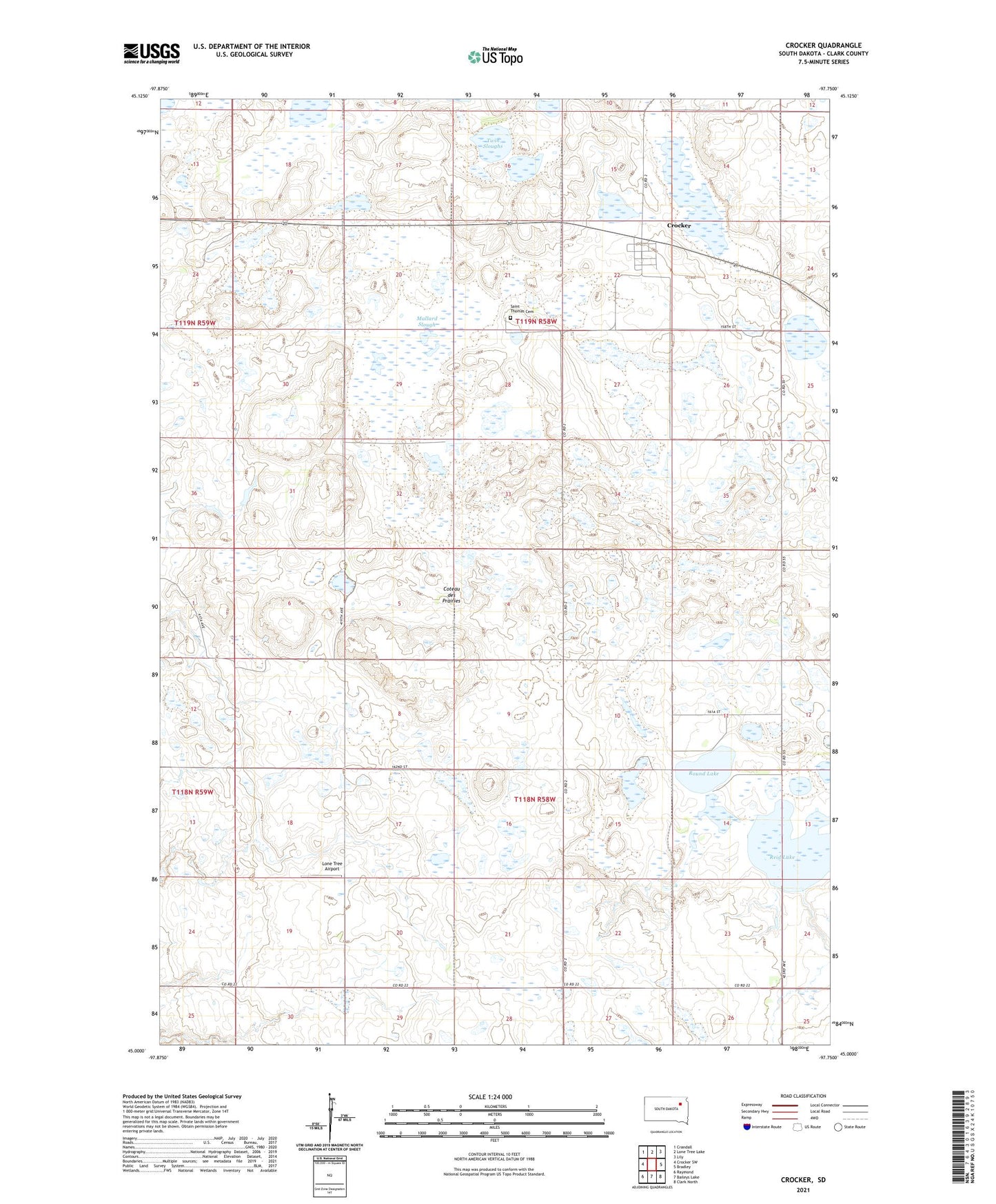
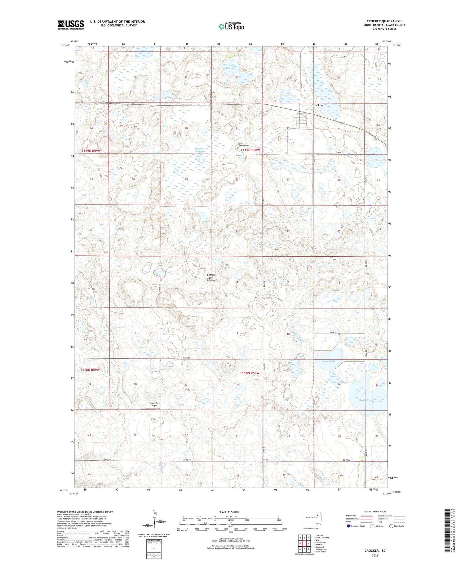
2021 topographic map quadrangle Crocker in the state of South Dakota. Scale: 1:24000. Based on the newly updated USGS 7.5' US Topo map series, this map is in the following counties: Clark. The map contains contour data, water features, and other items you are used to seeing on USGS maps, but also has updated roads and other features. This is the next generation of topographic maps. Printed on high-quality waterproof paper with UV fade-resistant inks.
Quads adjacent to this one:
West: Crocker SW
Northwest: Crandall
North: Lone Tree Lake
Northeast: Lily
East: Bradley
Southeast: Clark North
South: Baileys Lake
Southwest: Raymond
Contains the following named places: Crocker, Crocker Census Designated Place, Crocker State Public Shooting Area, Lone Tree Airport, Mallard Slough, Round Lake, Saint Thomas Cemetery, Sherwood State Public Shooting Area, Spring Valley State Public Shooting Area, Township of Spring Valley, Township of Woodland, Twin Sloughs, Wagner State Public Shooting Area