MyTopo
Clark North South Dakota US Topo Map
Couldn't load pickup availability
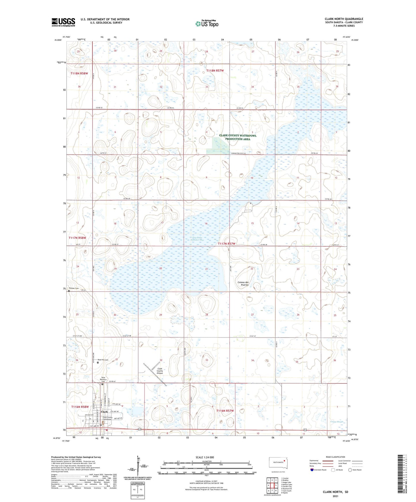
2021 topographic map quadrangle Clark North in the state of South Dakota. Scale: 1:24000. Based on the newly updated USGS 7.5' US Topo map series, this map is in the following counties: Clark. The map contains contour data, water features, and other items you are used to seeing on USGS maps, but also has updated roads and other features. This is the next generation of topographic maps. Printed on high-quality waterproof paper with UV fade-resistant inks.
Quads adjacent to this one:
West: Baileys Lake
Northwest: Crocker
North: Bradley
Northeast: Heggs Lake
East: Garden City
Southeast: Naples
South: Clark South
Southwest: Raymond SE
This map covers the same area as the classic USGS quad with code o44097h6.
Contains the following named places: City of Clark, Clark, Clark City Hall, Clark City Police, Clark County Airport, Clark County Ambulance Service, Clark County Courthouse, Clark County Sheriff's Office, Clark Elementary School, Clark Fire Department, Clark High School, Clark Middle School, Clark Post Office, Dry Lake Number 1 State Public Shooting Area, Dry Lake Number One, Emil M Larson Library, Hillcrest Colony, Hillcrest Colony Census Designated Place, Hillcrest Colony Elementary School, North Dry Lake State Public Shooting Area, Pioneer Cemetery, Rose Hill Cemetery, Saint Boniface Cemetery, Township of Mount Pleasant, ZIP Code: 57225