MyTopo
Dallas SW South Dakota US Topo Map
Couldn't load pickup availability
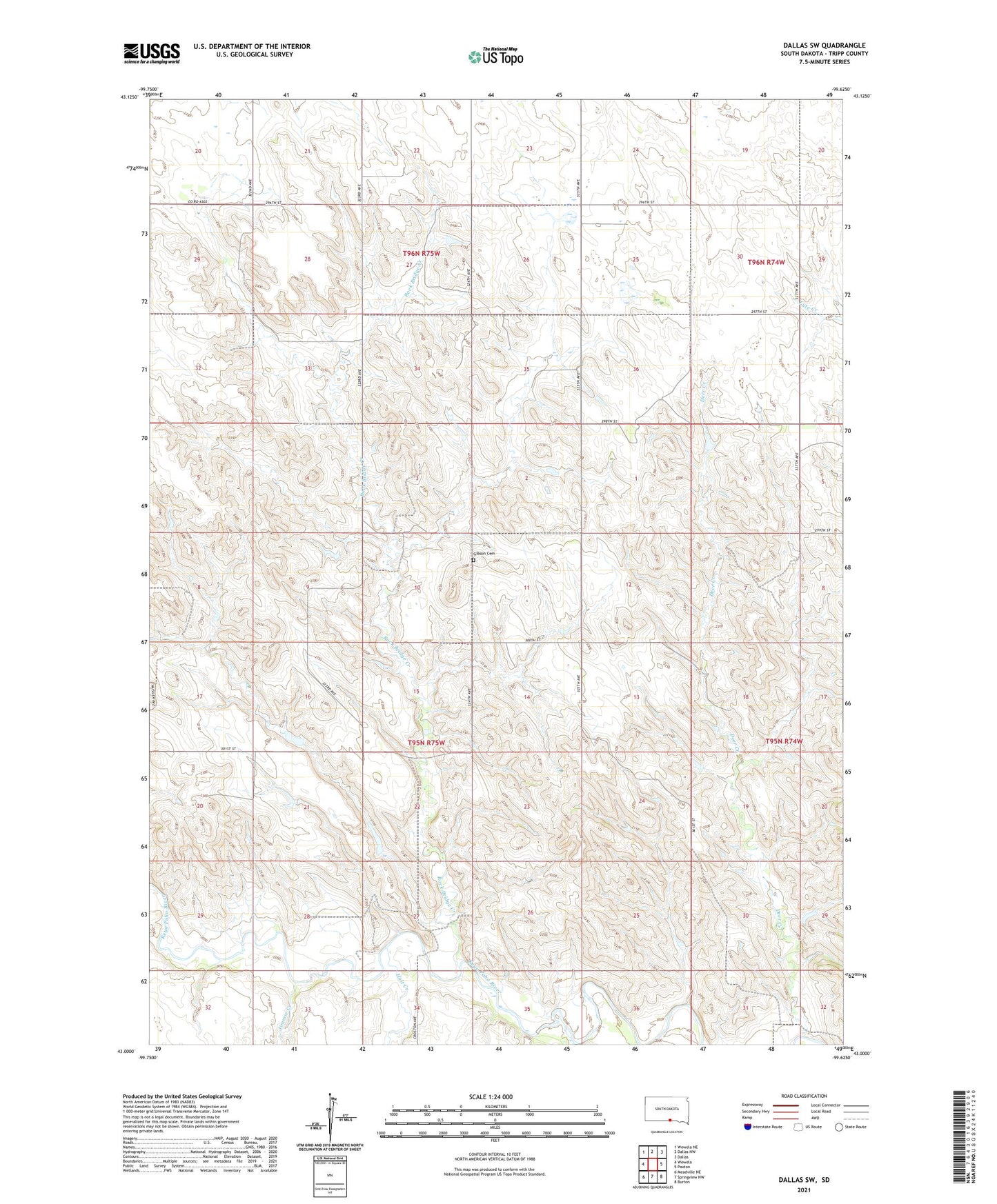
2021 topographic map quadrangle Dallas SW in the state of South Dakota. Scale: 1:24000. Based on the newly updated USGS 7.5' US Topo map series, this map is in the following counties: Tripp. The map contains contour data, water features, and other items you are used to seeing on USGS maps, but also has updated roads and other features. This is the next generation of topographic maps. Printed on high-quality waterproof paper with UV fade-resistant inks.
Quads adjacent to this one:
West: Wewela
Northwest: Wewela NE
North: Dallas NW
Northeast: Dallas
East: Paxton
Southeast: Burton
South: Springview NW
Southwest: Meadville NE
Contains the following named places: Deer Creek, Free Methodist Church, Gibson Cemetery, Highland School, Hillcrest School, Holt Creek, Jimmie Creek, New Nixon School, Rock Bridge Creek, Township of Keyapaha, Woolhizer Dam