MyTopo
Daviston South Dakota US Topo Map
Couldn't load pickup availability
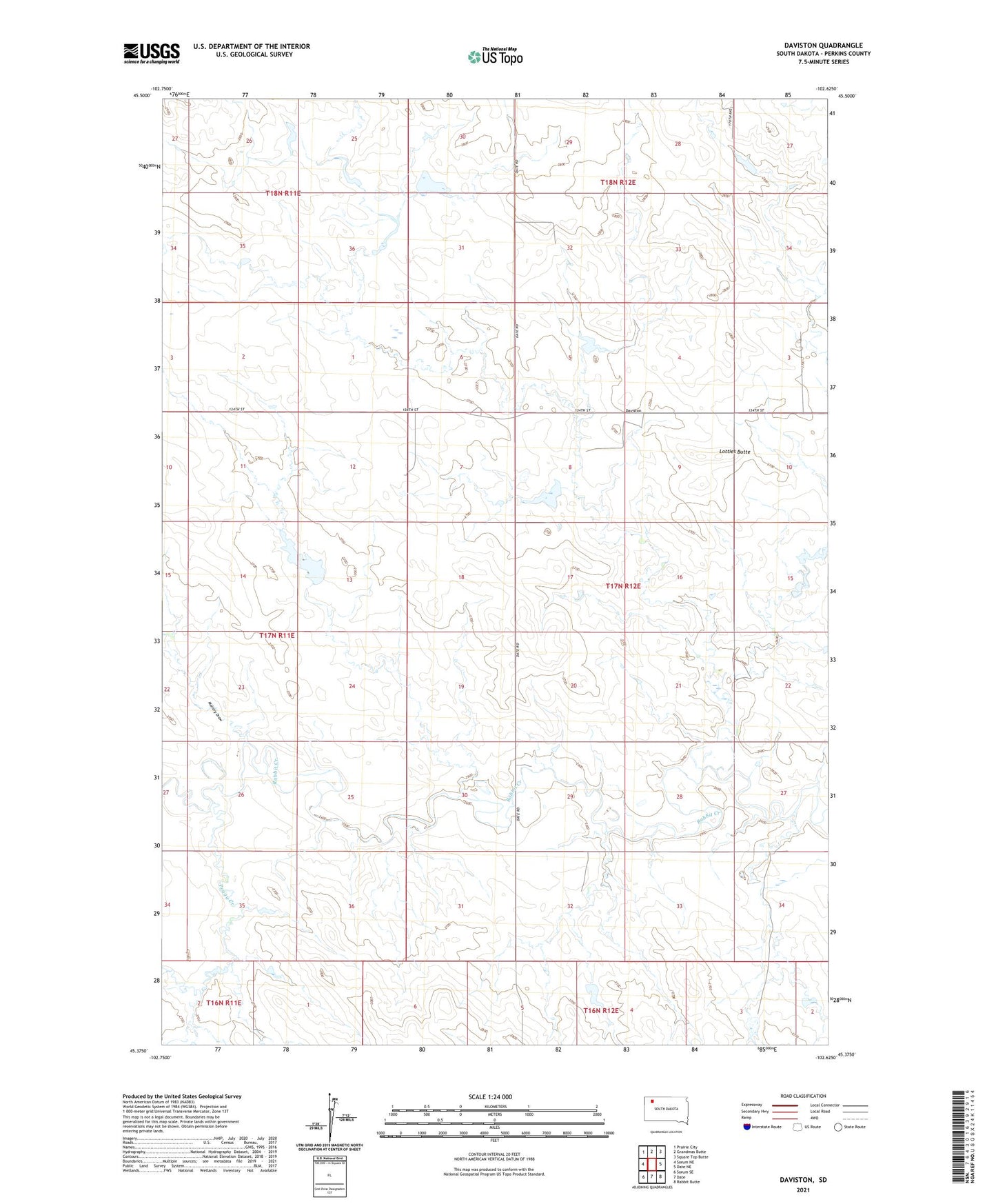
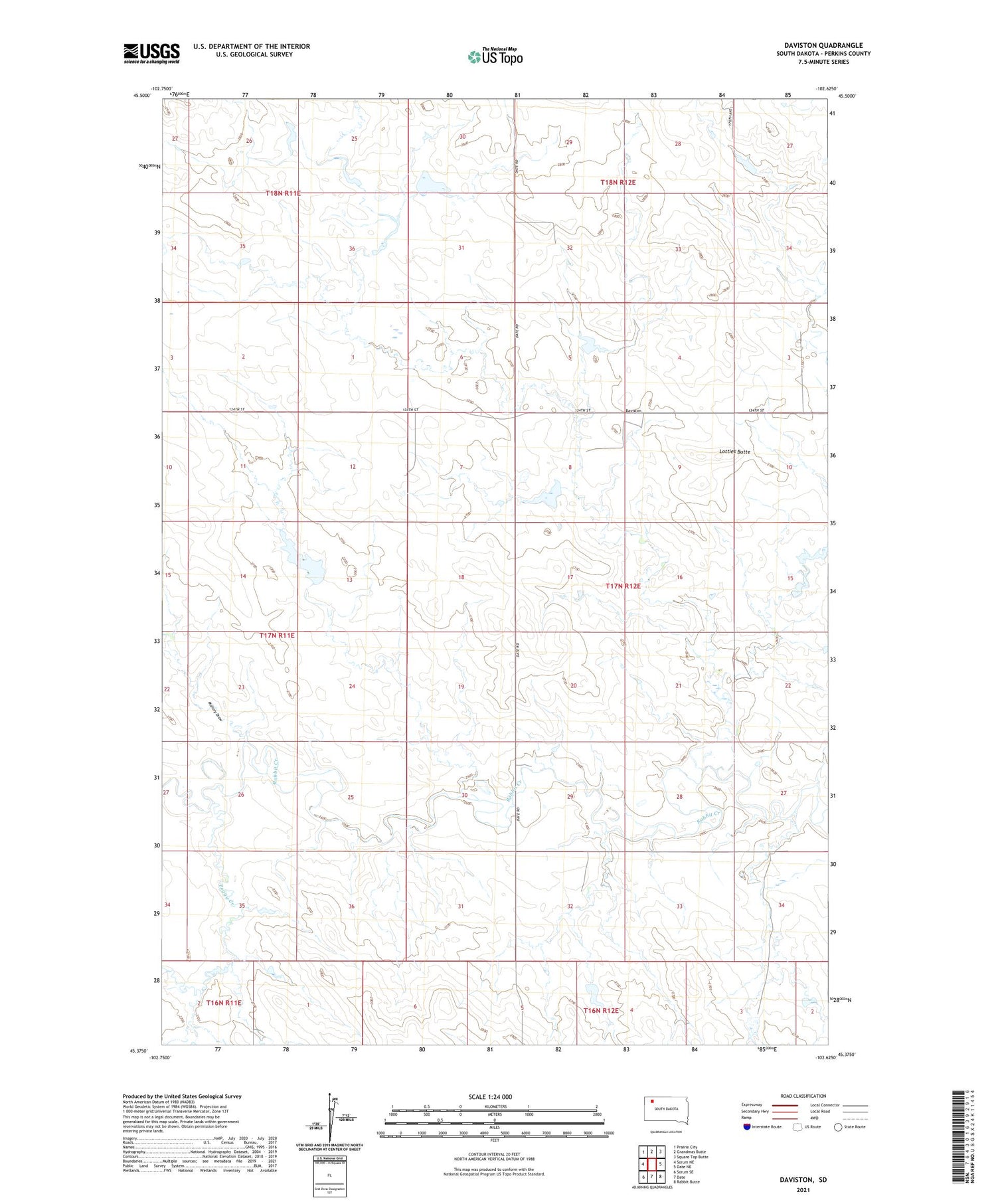
2021 topographic map quadrangle Daviston in the state of South Dakota. Scale: 1:24000. Based on the newly updated USGS 7.5' US Topo map series, this map is in the following counties: Perkins. The map contains contour data, water features, and other items you are used to seeing on USGS maps, but also has updated roads and other features. This is the next generation of topographic maps. Printed on high-quality waterproof paper with UV fade-resistant inks.
Quads adjacent to this one:
West: Sorum NE
Northwest: Prairie City
North: Grandmas Butte
Northeast: Square Top Butte
East: Date NE
Southeast: Rabbit Butte
South: Date
Southwest: Sorum SE
Contains the following named places: Date School, Daviston, Ernest Kolb Dam, G M Strand Dam, Glenn Wishard Dam, John Tescher Dam, Lotties Butte, Mallory Draw, Peggy Creek, Township of Richland, Unorganized Territory of West Central Perkins