MyTopo
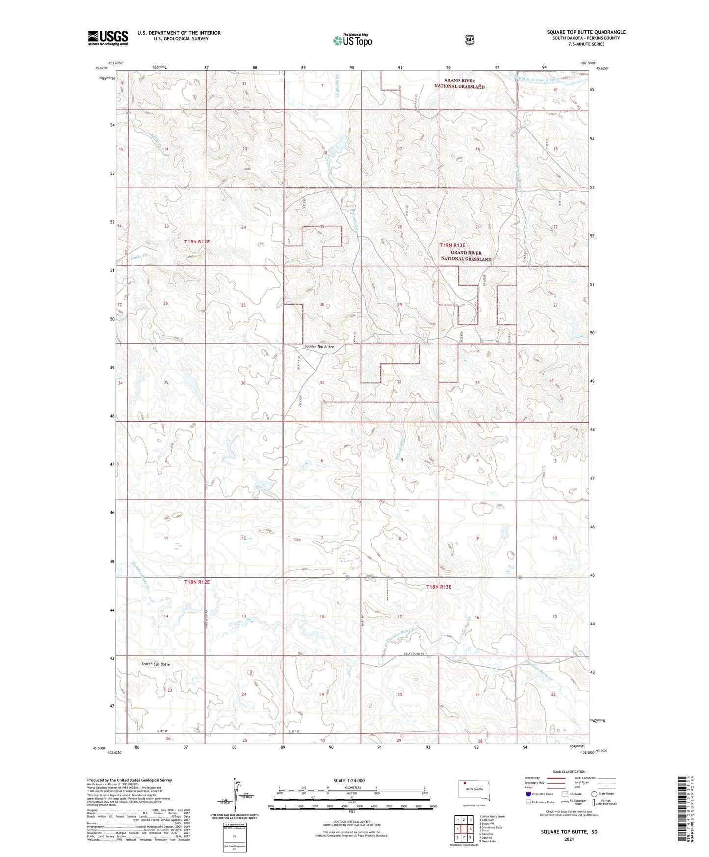
Square Top Butte South Dakota US Topo Map
Couldn't load pickup availability
Also explore the Square Top Butte Forest Service Topo of this same quad for updated USFS data
2021 topographic map quadrangle Square Top Butte in the state of South Dakota. Scale: 1:24000. Based on the newly updated USGS 7.5' US Topo map series, this map is in the following counties: Perkins. The map contains contour data, water features, and other items you are used to seeing on USGS maps, but also has updated roads and other features. This is the next generation of topographic maps. Printed on high-quality waterproof paper with UV fade-resistant inks.
Quads adjacent to this one:
West: Grandmas Butte
Northwest: Little Nasty Creek
North: Cole Dam
Northeast: Bison NW
East: Bison
Southeast: Owen Lake
South: Date NE
Southwest: Daviston
This map covers the same area as the classic USGS quad with code o45102e5.
Contains the following named places: Alex Krischen Dam, Bison Country Club, Marlo Johnson Dam, Scotch Cap Butte, Square Top Butte, Timber Draw Creek, Township of Bison