
MyTopo
De Smet South Dakota US Topo Map
Couldn't load pickup availability
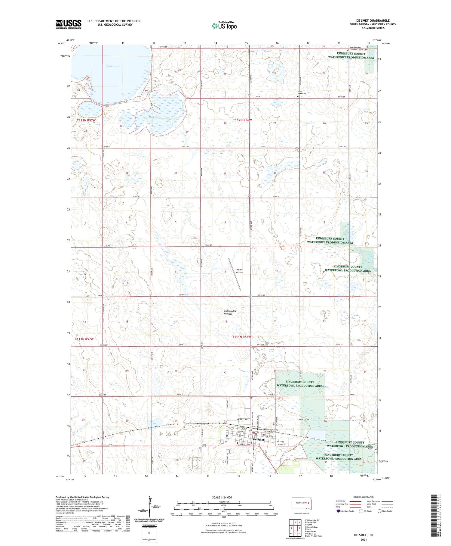
2021 topographic map quadrangle De Smet in the state of South Dakota. Scale: 1:24000. Based on the newly updated USGS 7.5' US Topo map series, this map is in the following counties: Kingsbury. The map contains contour data, water features, and other items you are used to seeing on USGS maps, but also has updated roads and other features. This is the next generation of topographic maps. Printed on high-quality waterproof paper with UV fade-resistant inks.
Quads adjacent to this one:
West: Bancroft East
Northwest: Willow Lake SW
North: Cherry Lake
Northeast: Bryant
East: Erwin
Southeast: Lake Preston West
South: De Smet SE
Southwest: Manchester
Contains the following named places: Avera De Smet Memorial Hospital, Brookings County Farm, City of De Smet, De Smet, De Smet City Hall, De Smet Emergency Rescue Unit, De Smet High School, De Smet Middle School, De Smet Post Office, De Smet Volunteer Fire Department, Hazel L Meyer Memorial Library, Kingsbury County Courthouse, Kingsbury County Sheriff, Laura Ingalls Wilder Elementary School, Mud Lake, School Number 10, School Number 11, School Number 12, School Number 2, School Number 3, School Number 5, Spirit Lake, Spirt Lake Cemetery, Township of De Smet, Township of Spirit Lake, West Bethany Church, West Bethany Lutheran Church Cemetery, Wilder Airport


