MyTopo
Lake Preston West South Dakota US Topo Map
Couldn't load pickup availability
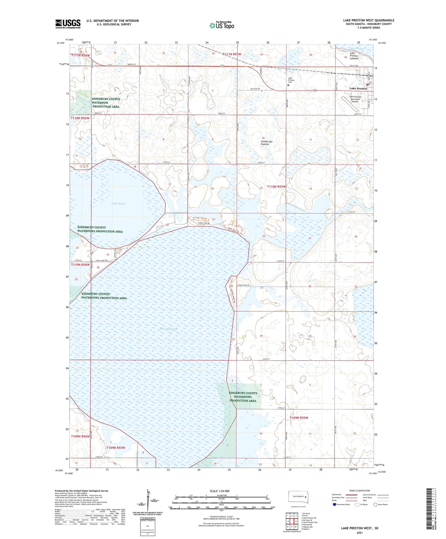
2021 topographic map quadrangle Lake Preston West in the state of South Dakota. Scale: 1:24000. Based on the newly updated USGS 7.5' US Topo map series, this map is in the following counties: Kingsbury. The map contains contour data, water features, and other items you are used to seeing on USGS maps, but also has updated roads and other features. This is the next generation of topographic maps. Printed on high-quality waterproof paper with UV fade-resistant inks.
Quads adjacent to this one:
West: De Smet SE
Northwest: De Smet
North: Erwin
Northeast: Lake Preston NE
East: Lake Preston East
Southeast: Oldham
South: Oldham NW
Southwest: Howard NE
This map covers the same area as the classic USGS quad with code o44097c4.
Contains the following named places: City of Lake Preston, Congregational Church, Dorothee Pike Memorial Library, Kingsbury County, Lake Henry, Lake Preston, Lake Preston Ambulance Service, Lake Preston Cemetery, Lake Preston City Hall, Lake Preston Municipal Airport, Lake Preston Police Department, Lake Preston Post Office, Lake Preston Volunteer Fire Department, Lake Thompson, School Number 1, School Number 4, School Number 5, School Number 7, School Number 8, School Number 9, Township of Baker