MyTopo
Dead Horse Draw South Dakota US Topo Map
Couldn't load pickup availability
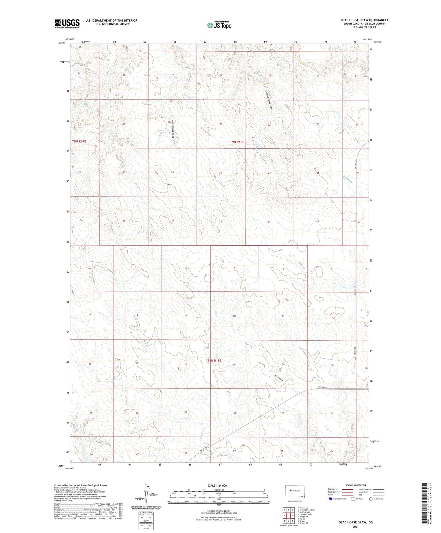
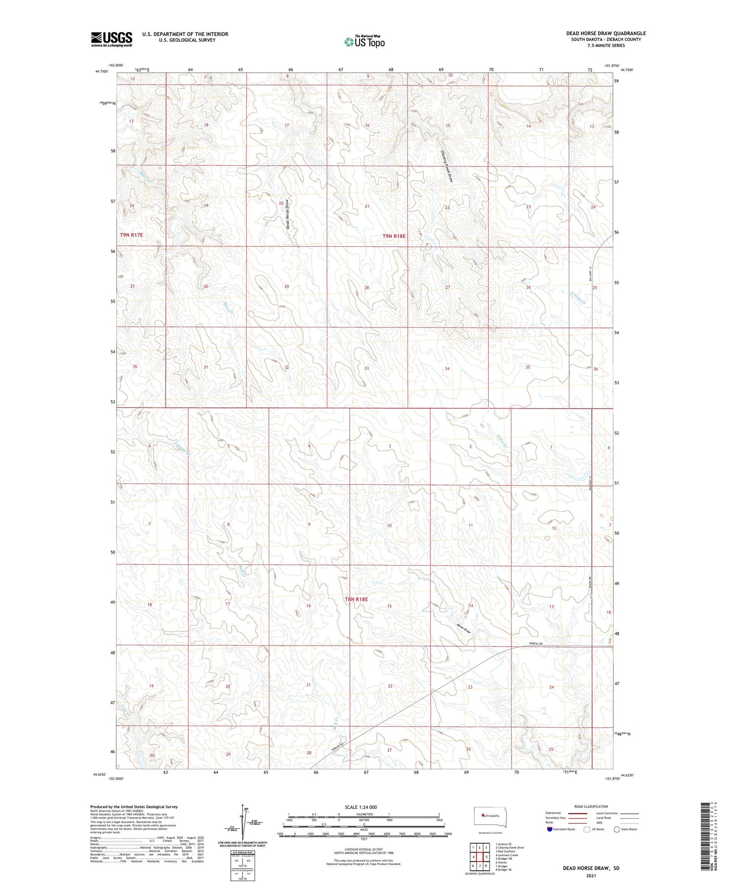
2021 topographic map quadrangle Dead Horse Draw in the state of South Dakota. Scale: 1:24000. Based on the newly updated USGS 7.5' US Topo map series, this map is in the following counties: Ziebach. The map contains contour data, water features, and other items you are used to seeing on USGS maps, but also has updated roads and other features. This is the next generation of topographic maps. Printed on high-quality waterproof paper with UV fade-resistant inks.
Quads adjacent to this one:
West: Lemmon Creek
Northwest: Avance SE
North: Chasing Hawk Draw
Northeast: Red Scaffold
East: Bridger NE
Southeast: Bridger SE
South: Bridger
Southwest: Howes
Contains the following named places: Deer Creek, Road Dam Number 1, Tribe Number 6 Dam, Tribe Number 7 Dam