MyTopo
Bridger South Dakota US Topo Map
Couldn't load pickup availability
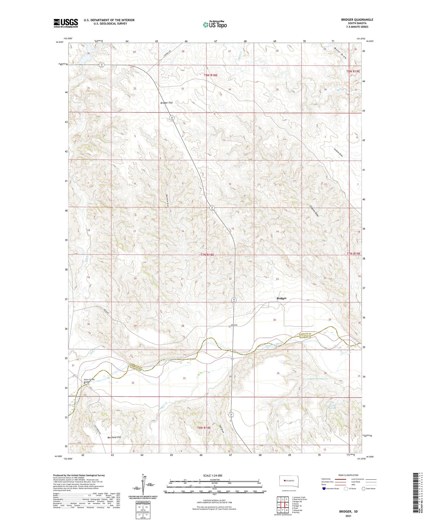
2021 topographic map quadrangle Bridger in the state of South Dakota. Scale: 1:24000. Based on the newly updated USGS 7.5' US Topo map series, this map is in the following counties: Ziebach, Haakon. The map contains contour data, water features, and other items you are used to seeing on USGS maps, but also has updated roads and other features. This is the next generation of topographic maps. Printed on high-quality waterproof paper with UV fade-resistant inks.
Quads adjacent to this one:
West: Howes
Northwest: Lemmon Creek
North: Dead Horse Draw
Northeast: Bridger NE
East: Bridger SE
Southeast: Hartley
South: Hilland NW
Southwest: Pedro
This map covers the same area as the classic USGS quad with code o44101e8.
Contains the following named places: Bridger, Bridger Census Designated Place, Bridger Creek, Bridger Flat, Four Corner Bridge, Hall Draw, Hatchet Spring, Indian Springs Creek, Lake Buffalo, Luis Creek, Red Horse Draw, V J Ranch