MyTopo
Dead Horse Flats South Dakota US Topo Map
Couldn't load pickup availability
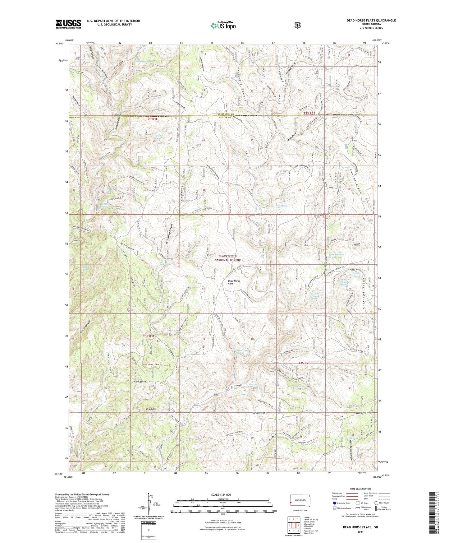
2021 topographic map quadrangle Dead Horse Flats in the state of South Dakota. Scale: 1:24000. Based on the newly updated USGS 7.5' US Topo map series, this map is in the following counties: Custer, Pennington. The map contains contour data, water features, and other items you are used to seeing on USGS maps, but also has updated roads and other features. This is the next generation of topographic maps. Printed on high-quality waterproof paper with UV fade-resistant inks.
Quads adjacent to this one:
West: Fanny Peak
Northwest: Moon
North: Preacher Spring
Northeast: Ditch Creek
East: Signal Hill
Southeast: Jewel Cave
South: Jewel Cave NW
Southwest: Clifton
Contains the following named places: Barrel Spring, Blowout Spring, Buck Spring, Compton Ranch, Compton Spring, Cooper Ridge, Dead Horse Flats, Dead Horse Spring, Ellis Spring, Gooseberry Spring, Hop Draw, Hop Spring, Middle Antelope Spring, North Antelope Spring, Pitts Ranch, Poplar Spring, Red Bank Spring, Red Butte, Sled Canyon, South Antelope Spring, Surveyors Hill, Tepee Spring, The Seeps, Townley Spring, Wells Spring, Wildcat Draw, Wilson Ranch, Wolf Draw, Yellow Butte