MyTopo
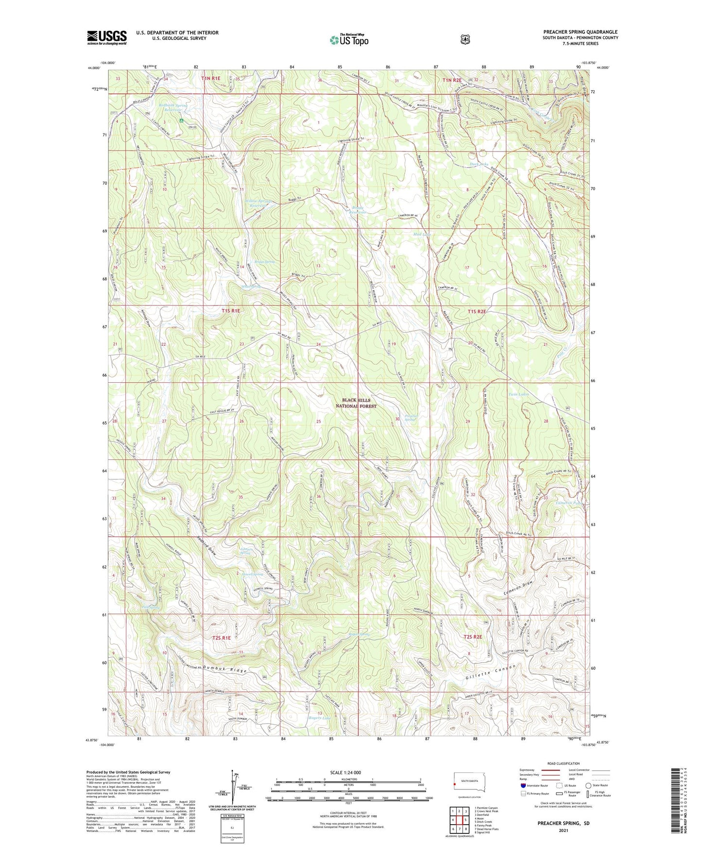
Preacher Spring South Dakota US Topo Map
Couldn't load pickup availability
Also explore the Preacher Spring Forest Service Topo of this same quad for updated USFS data
2021 topographic map quadrangle Preacher Spring in the state of South Dakota. Scale: 1:24000. Based on the newly updated USGS 7.5' US Topo map series, this map is in the following counties: Pennington. The map contains contour data, water features, and other items you are used to seeing on USGS maps, but also has updated roads and other features. This is the next generation of topographic maps. Printed on high-quality waterproof paper with UV fade-resistant inks.
Quads adjacent to this one:
West: Moon
Northwest: Parmlee Canyon
North: Crows Nest Peak
Northeast: Deerfield
East: Ditch Creek
Southeast: Signal Hill
South: Dead Horse Flats
Southwest: Fanny Peak
This map covers the same area as the classic USGS quad with code o43103h8.
Contains the following named places: Antelope Draw, Boggy Reservoir, Briggs Spring, Cameron Draw, Cameron Pond, Comptons Ranch, Coulsen Hughes Draw, Duck Lake, Dumbuk Ridge, Hawks Ranch, Howell Ranch, Howell Spring, Johnson Spring, Moon, Mud Lake, Park Spring, Pole Creek Pond Lake, Preacher Spring, Redbank Spring Campground, Redbank Spring Reservoir, Redbird Draw, Rogers Lake, Rogers Spring, Trail Draw, Twin Lakes, White Spring, Willow Springs Reservoir