
MyTopo
Hamill NW South Dakota US Topo Map
Couldn't load pickup availability
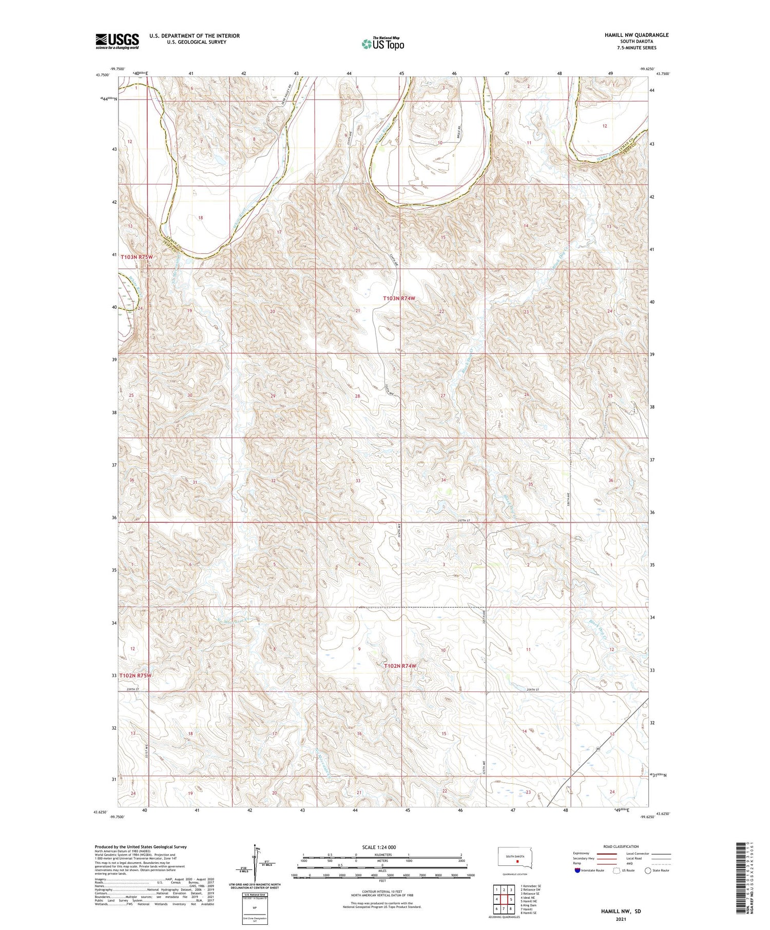
2021 topographic map quadrangle Hamill NW in the state of South Dakota. Scale: 1:24000. Based on the newly updated USGS 7.5' US Topo map series, this map is in the following counties: Tripp, Lyman. The map contains contour data, water features, and other items you are used to seeing on USGS maps, but also has updated roads and other features. This is the next generation of topographic maps. Printed on high-quality waterproof paper with UV fade-resistant inks.
Quads adjacent to this one:
West: Ideal NE
Northwest: Kennebec SE
North: Reliance SW
Northeast: Reliance SE
East: Hamill NE
Southeast: Hamill SE
South: Hamill
Southwest: King Dam
Contains the following named places: Black Dog Creek, Fenenga Ranch, Gassman School, Jim Schuyler Number 2 Dam, Jim Schuyler Number 3 Dam, Nelson Ranch, No Moccasin Creek, Schooler Ranch, Township of Gassman, Township of Roseland, Unorganized Territory of Gassman, Unorganized Territory of North Tripp


