MyTopo
Hamill South Dakota US Topo Map
Couldn't load pickup availability
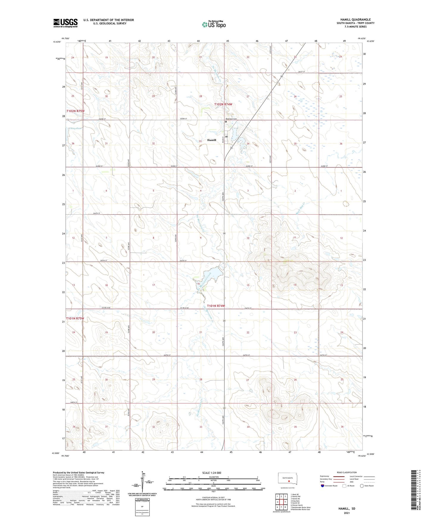
2021 topographic map quadrangle Hamill in the state of South Dakota. Scale: 1:24000. Based on the newly updated USGS 7.5' US Topo map series, this map is in the following counties: Tripp. The map contains contour data, water features, and other items you are used to seeing on USGS maps, but also has updated roads and other features. This is the next generation of topographic maps. Printed on high-quality waterproof paper with UV fade-resistant inks.
Quads adjacent to this one:
West: King Dam
Northwest: Ideal NE
North: Hamill NW
Northeast: Hamill NE
East: Hamill SE
Southeast: Rattlesnake Butte East
South: Rattlesnake Butte West
Southwest: Winner North
Contains the following named places: Center Moss School, Department of Game Fish Parks Dam, Hamill, Hamill Census Designated Place, Hamill Dam Reservoir, Hamill Post Office, Linker Dam, Linker Dam Reservoir, Roseland Cemetery, Snow Dam, Township of Condon, ZIP Code: 57534