MyTopo
Hoven Municipal Airport South Dakota US Topo Map
Couldn't load pickup availability
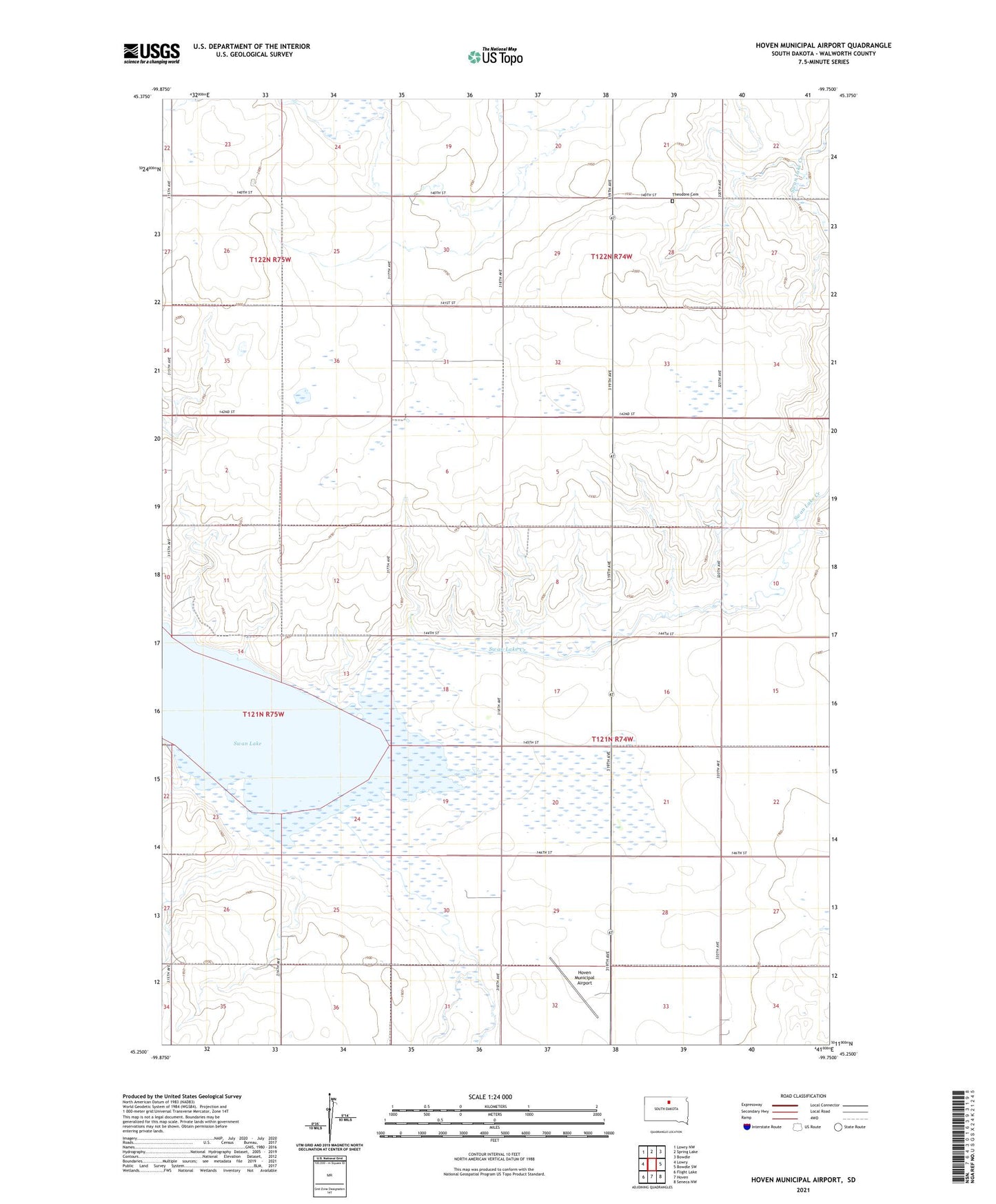
2021 topographic map quadrangle Hoven Municipal Airport in the state of South Dakota. Scale: 1:24000. Based on the newly updated USGS 7.5' US Topo map series, this map is in the following counties: Walworth. The map contains contour data, water features, and other items you are used to seeing on USGS maps, but also has updated roads and other features. This is the next generation of topographic maps. Printed on high-quality waterproof paper with UV fade-resistant inks.
Quads adjacent to this one:
West: Lowry
Northwest: Lowry NW
North: Spring Lake
Northeast: Bowdle
East: Bowdle SW
Southeast: Seneca NW
South: Hoven
Southwest: Flight Lake
Contains the following named places: Baer German Lutheran Church, Harer Farm Strip, Hoven Country Club, Hoven Municipal Airport, Swan Lake, Swan Lake Creek, Swan Lake State Public Shooting Area, Theodore, Theodore Cemetery, Township of Glenn, Township of Hoven, Township of Swan Creek