MyTopo
Huron South Dakota US Topo Map
Couldn't load pickup availability
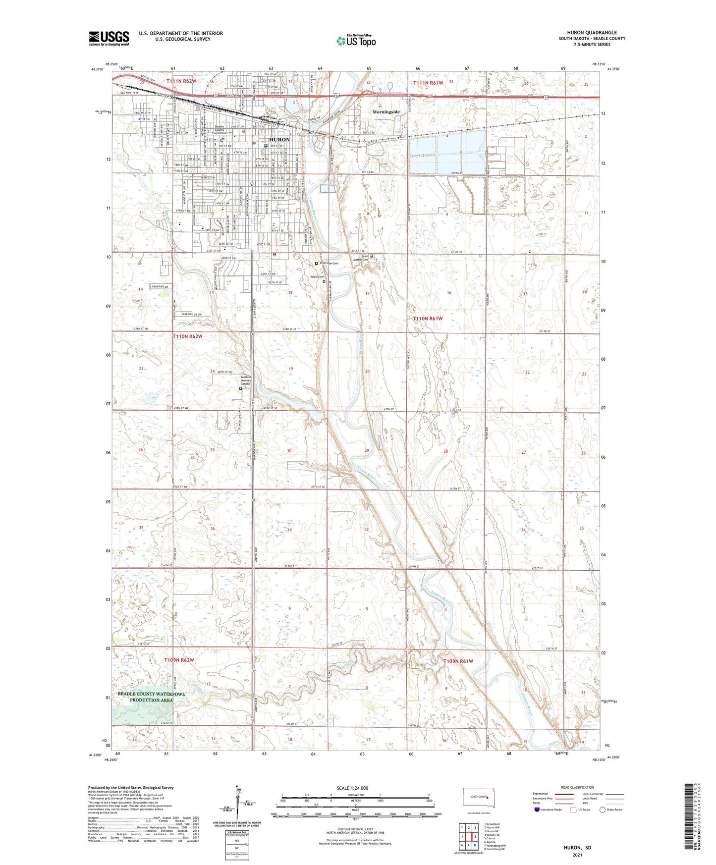
2021 topographic map quadrangle Huron in the state of South Dakota. Scale: 1:24000. Based on the newly updated USGS 7.5' US Topo map series, this map is in the following counties: Beadle. The map contains contour data, water features, and other items you are used to seeing on USGS maps, but also has updated roads and other features. This is the next generation of topographic maps. Printed on high-quality waterproof paper with UV fade-resistant inks.
Quads adjacent to this one:
West: Wolsey SE
Northwest: Broadland
North: Huron NW
Northeast: Huron NE
East: Cavour
Southeast: Forestburg NE
South: Forestburg NW
Southwest: Alpena
Contains the following named places: Beadle County Courthouse, Beadle County Regional Correction, Beadle County Sheriff's Office, Bible Church, Buchanan Elementary School, Cain Creek, City of Huron, Clifton School, Custer School, Grant School, Holy Trinity Catholic Elementary School, Huron, Huron Ambulance Association., Huron Fire Department Station South, Huron High School, Huron Mall, Huron Middle School, Huron Municipal Building, Huron Police Department, Huron Post Office, Huron Public Library, Huron Regional Medical Center, Huron University, Ideal Cemetery, Jefferson Elementary School, Jehovah Kingdom Hall, KIJV-AM (Huron), KOKK-AM (Huron), KURO-FM (Huron), Lincoln School, Madison Elementary School, McKinley School, Medas, Morningside, Morningside Census Designated Place, Pearl Creek, Prospect Park, Ravine Park Dam, Restlawn Memory Garden, Riverside Cemetery, Riverside Park, Saint Johns Hospital, Saint Martin Cemetery, Saint Theresa School, Southgate Shopping Center, Stoney Run Dam, Stony Run, Stony Run Lake, Tiger Stadium, Township of Custer, Washington Elementary School, West 22d Street School, Wilson School