MyTopo
Huron NW South Dakota US Topo Map
Couldn't load pickup availability
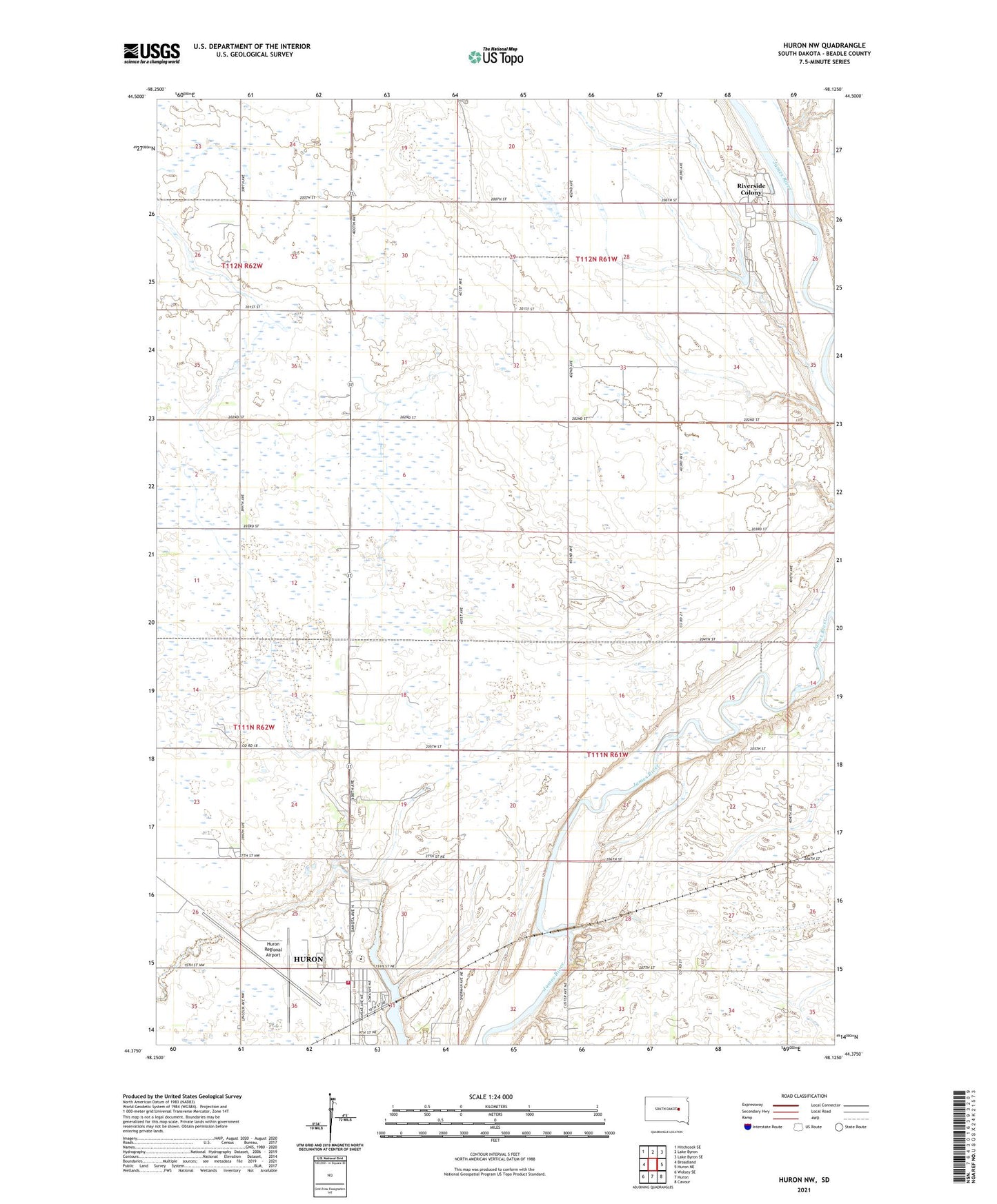
2021 topographic map quadrangle Huron NW in the state of South Dakota. Scale: 1:24000. Based on the newly updated USGS 7.5' US Topo map series, this map is in the following counties: Beadle. The map contains contour data, water features, and other items you are used to seeing on USGS maps, but also has updated roads and other features. This is the next generation of topographic maps. Printed on high-quality waterproof paper with UV fade-resistant inks.
Quads adjacent to this one:
West: Broadland
Northwest: Hitchcock SE
North: Lake Byron
Northeast: Lake Byron SE
East: Huron NE
Southeast: Cavour
South: Huron
Southwest: Wolsey SE
This map covers the same area as the classic USGS quad with code o44098d2.
Contains the following named places: Edison School, Huron Ambulance Association, Huron Fire Department North Station, Huron Regional Airport, Huron Rural Fire Department, James Valley Christian Elementary School, James Valley Christian High School, James Valley Christian Junior High School, Lindbergh School, Morrill School, Ravine Park Lake, Riverside Colony, Riverside Colony Census Designated Place, Riverside Colony Elementary School, School Number 1, School Number 3, South Dakota Highway Patrol, Township of Valley, Whittier School, ZIP Code: 57350