
MyTopo
Joe Creek South Dakota US Topo Map
Couldn't load pickup availability
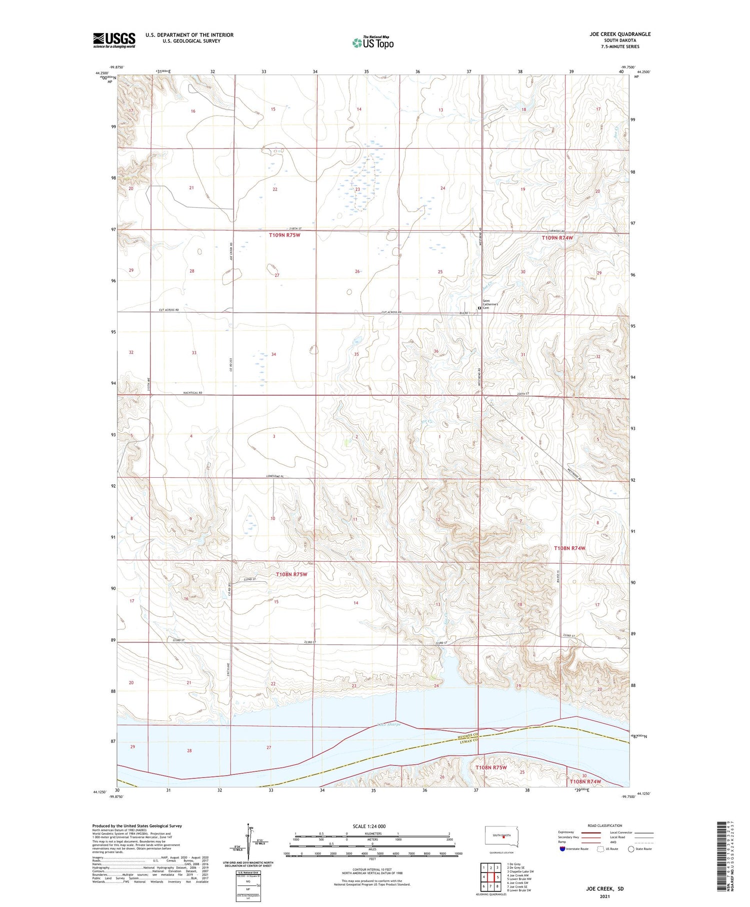
2021 topographic map quadrangle Joe Creek in the state of South Dakota. Scale: 1:24000. Based on the newly updated USGS 7.5' US Topo map series, this map is in the following counties: Hughes, Lyman. The map contains contour data, water features, and other items you are used to seeing on USGS maps, but also has updated roads and other features. This is the next generation of topographic maps. Printed on high-quality waterproof paper with UV fade-resistant inks.
Quads adjacent to this one:
West: Joe Creek NW
Northwest: De Grey
North: De Grey SE
Northeast: Chapelle Lake SW
East: Lower Brule NW
Southeast: Lower Brule SW
South: Joe Creek SE
Southwest: Joe Creek SW
Contains the following named places: Big Bend District, Busy Bee School, Joe Creek, Joe Creek Recreation Area, Reynolds Ranch, Riverdale School, Saint Catherine's Cemetery, Unorganized Territory of Crow Creek


