MyTopo
De Grey SE South Dakota US Topo Map
Couldn't load pickup availability
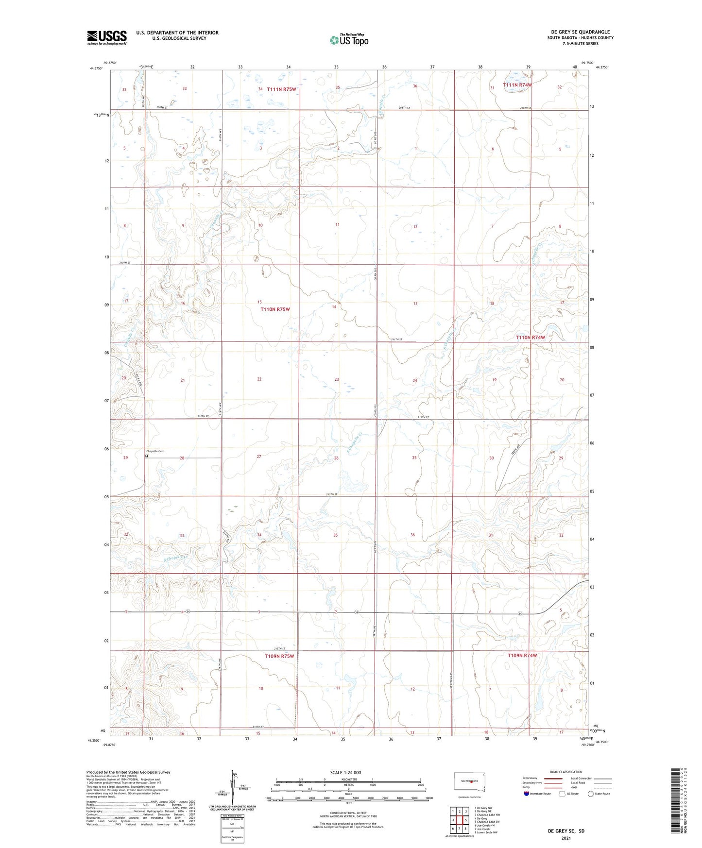
2021 topographic map quadrangle De Grey SE in the state of South Dakota. Scale: 1:24000. Based on the newly updated USGS 7.5' US Topo map series, this map is in the following counties: Hughes. The map contains contour data, water features, and other items you are used to seeing on USGS maps, but also has updated roads and other features. This is the next generation of topographic maps. Printed on high-quality waterproof paper with UV fade-resistant inks.
Quads adjacent to this one:
West: De Grey
Northwest: De Grey NW
North: De Grey NE
Northeast: Chapelle Lake NW
East: Chapelle Lake SW
Southeast: Lower Brule NW
South: Joe Creek
Southwest: Joe Creek NW
This map covers the same area as the classic USGS quad with code o44099c7.
Contains the following named places: Chapelle Cemetery, Charles Hyde Dam, Giddings Post Office, Gladys Feller Dam, Raber School, Rufus Gray Dam, Township of Raber, Wilbur Russell Dam, Winnebago Indian Reservation