MyTopo
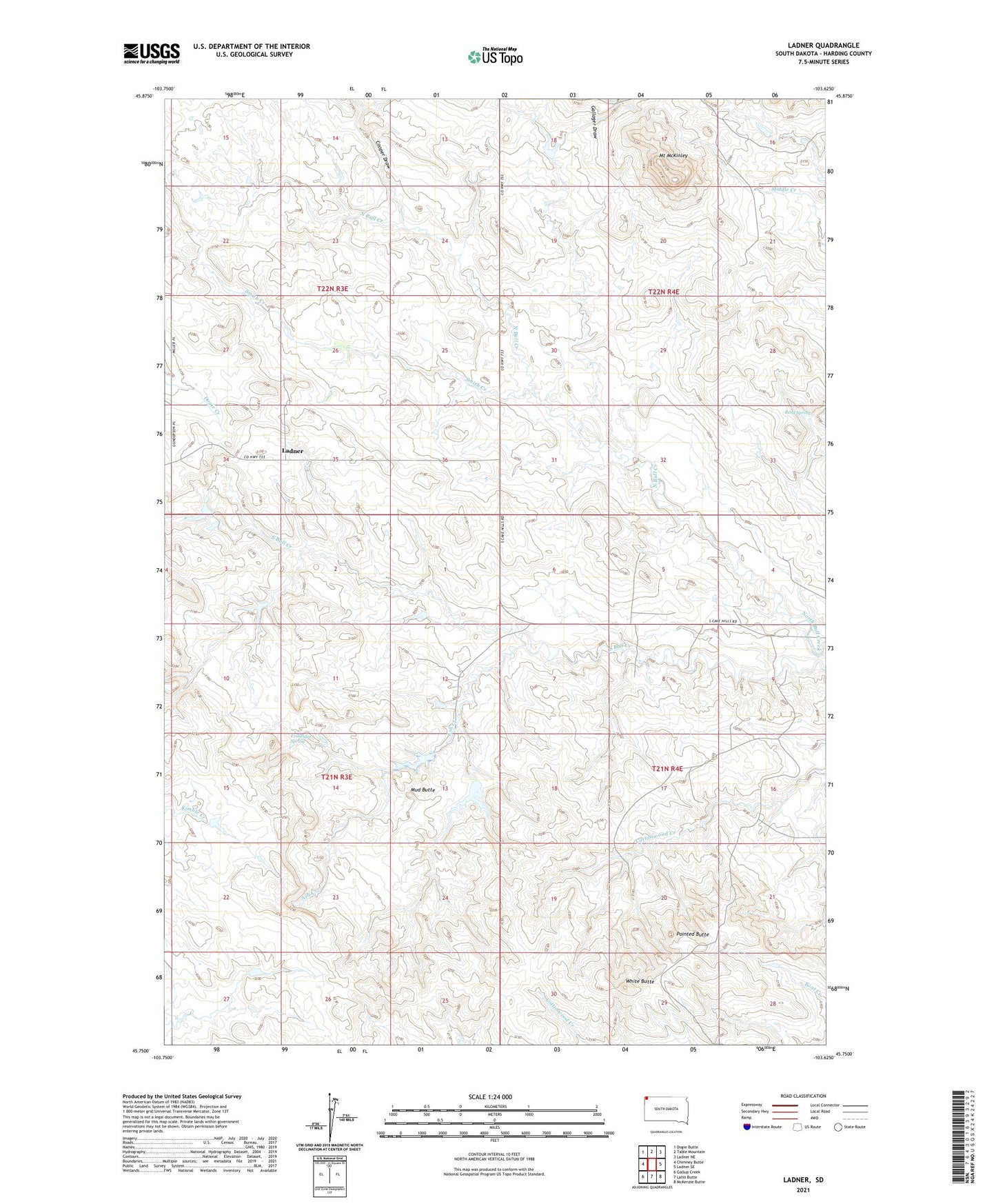
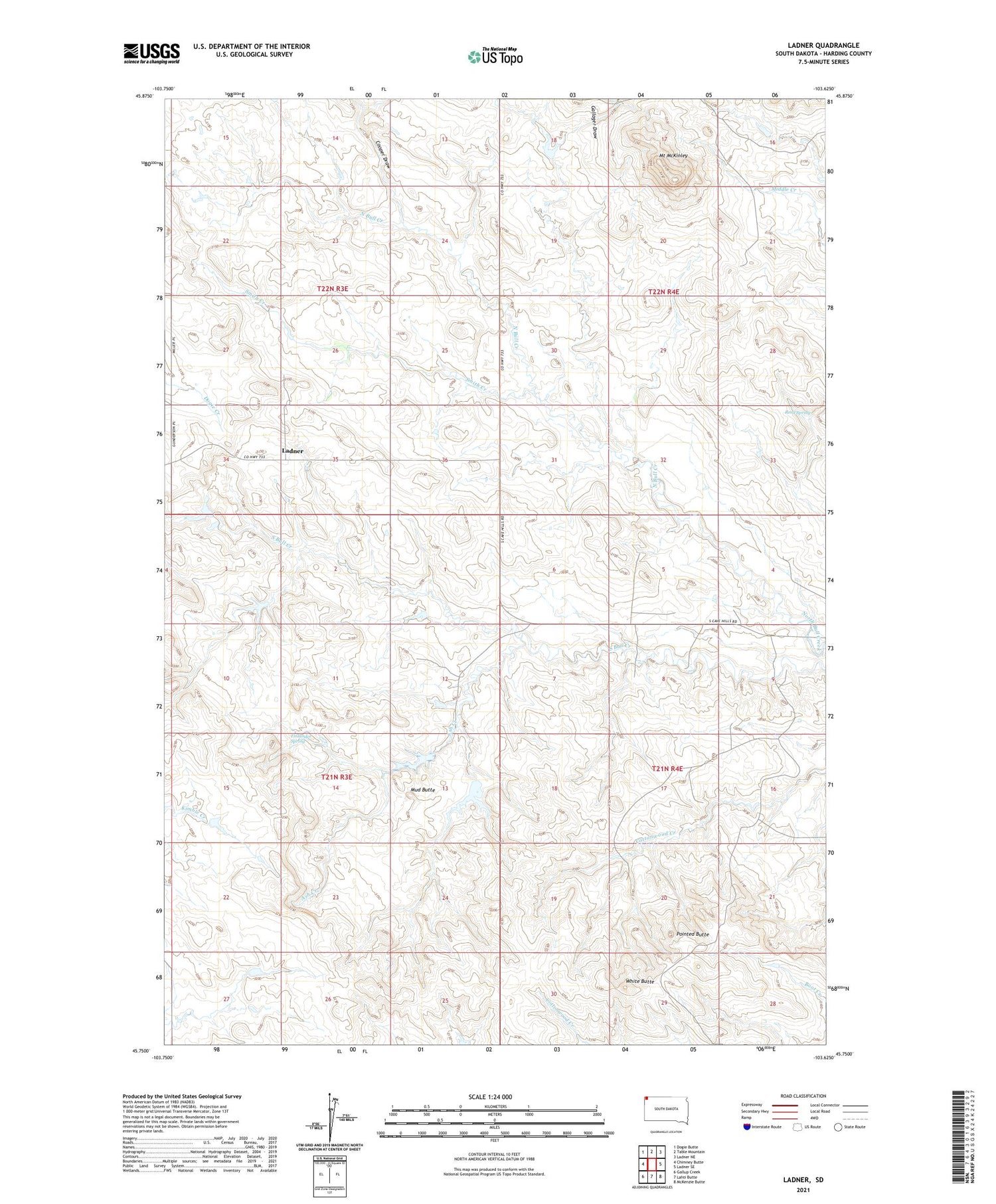
Ladner South Dakota US Topo Map
Couldn't load pickup availability
2021 topographic map quadrangle Ladner in the state of South Dakota. Scale: 1:24000. Based on the newly updated USGS 7.5' US Topo map series, this map is in the following counties: Harding. The map contains contour data, water features, and other items you are used to seeing on USGS maps, but also has updated roads and other features. This is the next generation of topographic maps. Printed on high-quality waterproof paper with UV fade-resistant inks.
Quads adjacent to this one:
West: Chimney Butte
Northwest: Dogie Butte
North: Table Mountain
Northeast: Ladner NE
East: Ladner SE
Southeast: McKenzie Butte
South: Lahti Butte
Southwest: Gallup Creek
Contains the following named places: Ash Creek, Buffalo Oil Field, Cooper Draw, Finlander Spring, Gallager Draw, Ladner, Mount McKinley, Mud Butte, Pointed Butte, Reed Spring, Smith Creek, Sterns Number 1 Dam, Sterns Number 2 Dam, Township of Pleasant Valley, White Butte