MyTopo
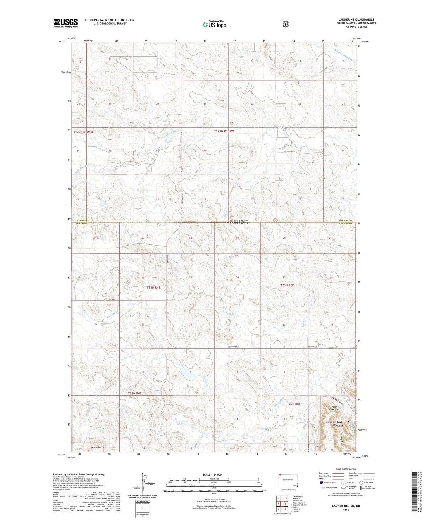
Ladner NE South Dakota US Topo Map
Couldn't load pickup availability
Also explore the Ladner NE Forest Service Topo of this same quad for updated USFS data
2021 topographic map quadrangle Ladner NE in the states of South Dakota, North Dakota. Scale: 1:24000. Based on the newly updated USGS 7.5' US Topo map series, this map is in the following counties: Harding, Bowman. The map contains contour data, water features, and other items you are used to seeing on USGS maps, but also has updated roads and other features. This is the next generation of topographic maps. Printed on high-quality waterproof paper with UV fade-resistant inks.
Quads adjacent to this one:
West: Table Mountain
Northwest: Camel Butte
North: Rhame SE
Northeast: Bowman SW
East: Eagles Nest Butte
Southeast: Ludlow
South: Ladner SE
Southwest: Ladner
This map covers the same area as the classic USGS quad with code o45103h5.
Contains the following named places: Camel Creek, Cox, Cox Church, Eagles Nest Spring, Fuller Canyon, Grand River School, Nelson Butte, Nursery Draw, Staadt Creek, Township of Grand River, Township of Table Mountain, Trunk Creek