MyTopo
Lane South Dakota US Topo Map
Couldn't load pickup availability
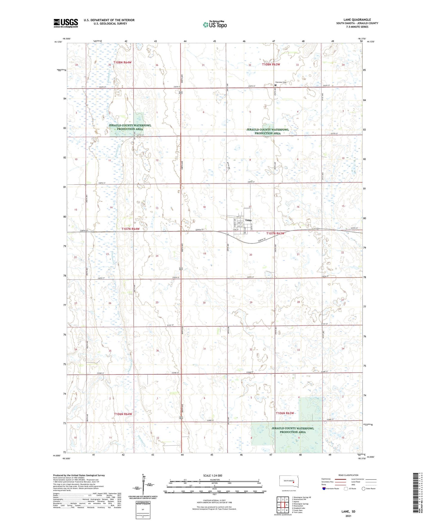
2021 topographic map quadrangle Lane in the state of South Dakota. Scale: 1:24000. Based on the newly updated USGS 7.5' US Topo map series, this map is in the following counties: Jerauld. The map contains contour data, water features, and other items you are used to seeing on USGS maps, but also has updated roads and other features. This is the next generation of topographic maps. Printed on high-quality waterproof paper with UV fade-resistant inks.
Quads adjacent to this one:
West: Wessington Springs
Northwest: Wessington Springs NE
North: Woonsocket NW
Northeast: Alpena
East: Woonsocket
Southeast: Twin Lakes
South: Fraser Dam
Southwest: Hoagland Lake
Contains the following named places: Fairview Cemetery, German Lutheran Church, Grisinger School Number 3, Jerauld County Waterfowl Production Area, Kneirem School Number 2, Knutson School Number 2, Lane, Lane Post Office, Newman School Number 4, Solberg School Number 1, Starkey, Swanson School Number 3, Town of Lane, Township of Franklin, ZIP Code: 57358