MyTopo
Fraser Dam South Dakota US Topo Map
Couldn't load pickup availability
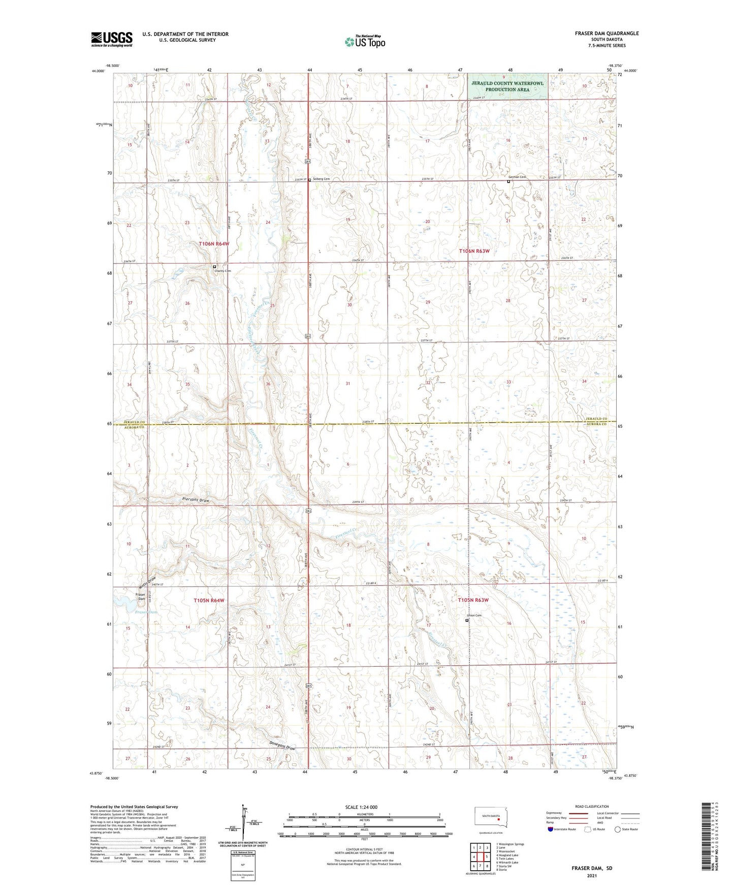
2021 topographic map quadrangle Fraser Dam in the state of South Dakota. Scale: 1:24000. Based on the newly updated USGS 7.5' US Topo map series, this map is in the following counties: Jerauld, Aurora. The map contains contour data, water features, and other items you are used to seeing on USGS maps, but also has updated roads and other features. This is the next generation of topographic maps. Printed on high-quality waterproof paper with UV fade-resistant inks.
Quads adjacent to this one:
West: Hoagland Lake
Northwest: Wessington Springs
North: Lane
Northeast: Woonsocket
East: Twin Lakes
Southeast: Storla
South: Storla SW
Southwest: Wilmarth Lake
This map covers the same area as the classic USGS quad with code o43098h4.
Contains the following named places: Bristol Townhall, Charity Cemetery, Donegans Draw, Fraser Dam, German Cemetery, Motts Draw, Piersons Draw, Protection, Solberg Cemetery, Tower Reach, Township of Belford, Township of Blaine, Union Cemetery, Viola Townhall