MyTopo
Marcus South Dakota US Topo Map
Couldn't load pickup availability
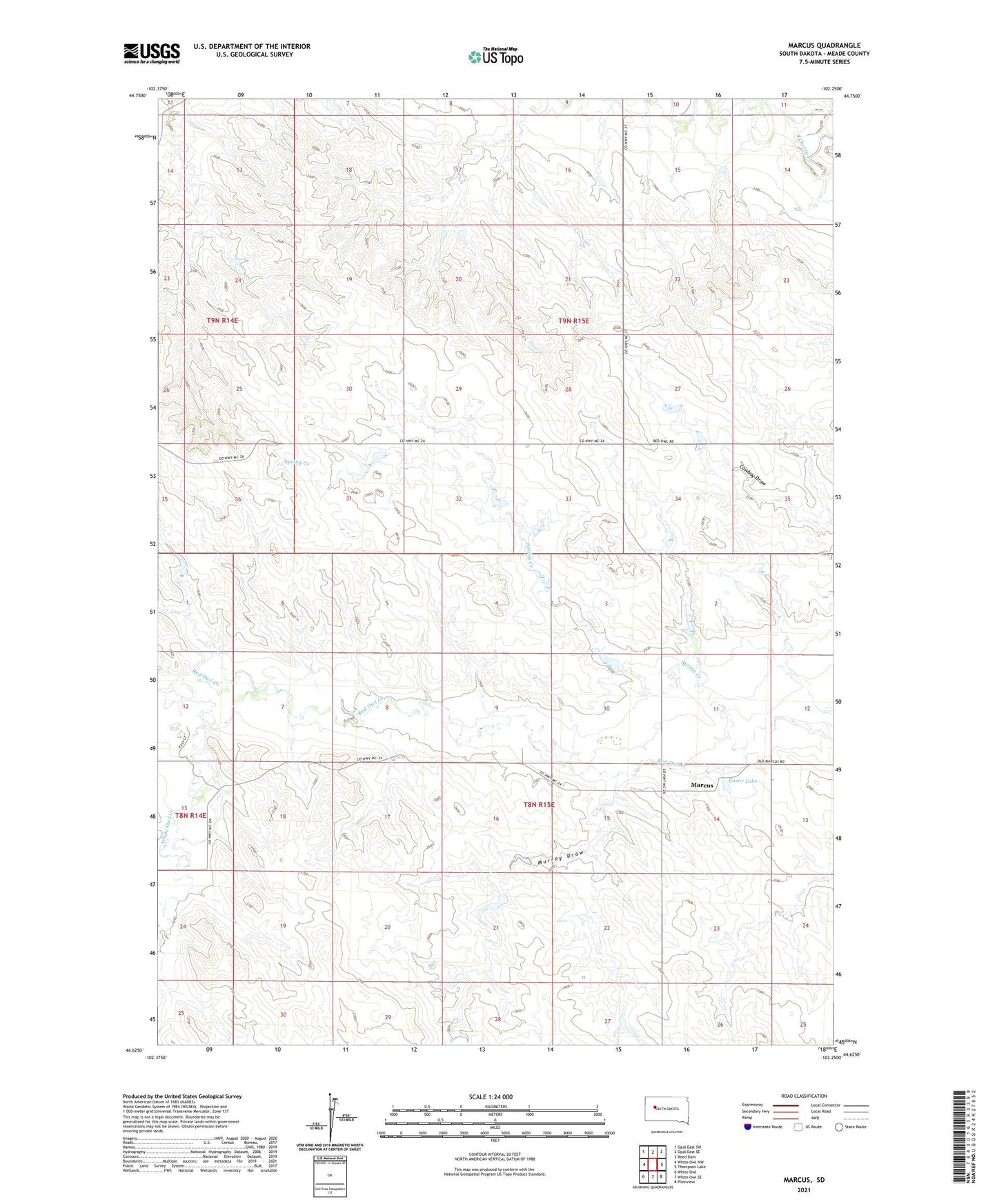
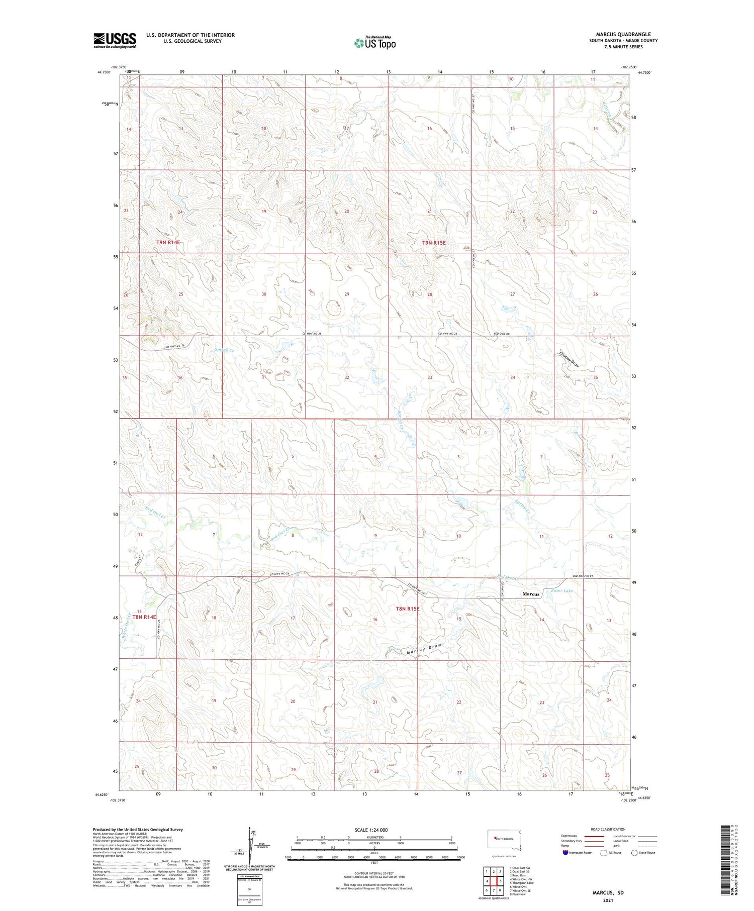
2021 topographic map quadrangle Marcus in the state of South Dakota. Scale: 1:24000. Based on the newly updated USGS 7.5' US Topo map series, this map is in the following counties: Meade. The map contains contour data, water features, and other items you are used to seeing on USGS maps, but also has updated roads and other features. This is the next generation of topographic maps. Printed on high-quality waterproof paper with UV fade-resistant inks.
Quads adjacent to this one:
West: White Owl NW
Northwest: Opal East SW
North: Opal East SE
Northeast: Reed Dam
East: Thompson Lake
Southeast: Plainview
South: White Owl SE
Southwest: White Owl
Contains the following named places: Blazek Dam, D Gifford Number 1 Dam, D Timmons Dam, Ensor Lake, J Huston Dam, Marcus, Murray Draw, R Howie Dam, Spring Creek, Township of Harding, W Mann Number 3 Dam, White Owl Creek