MyTopo
Meadow South Dakota US Topo Map
Couldn't load pickup availability
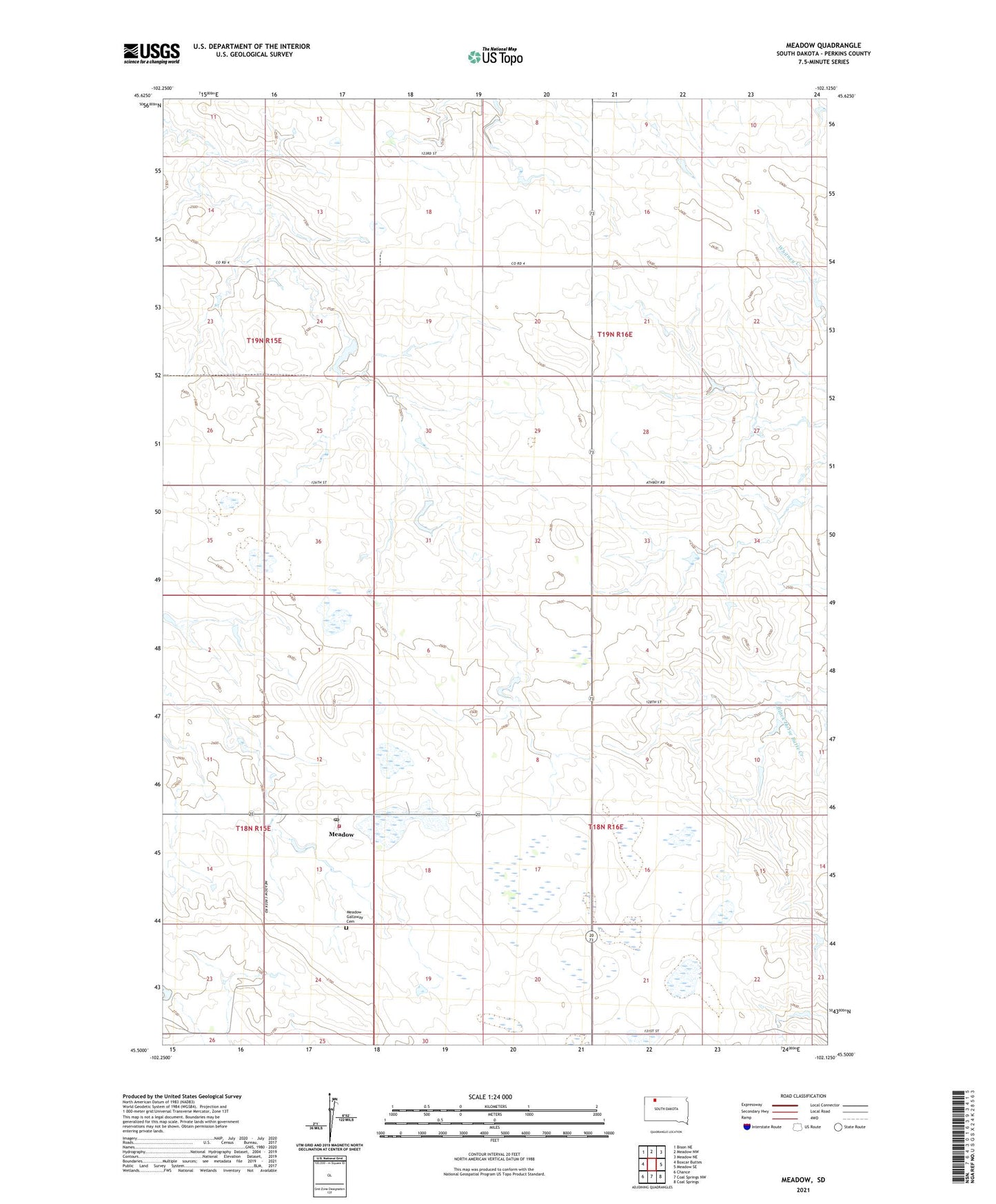
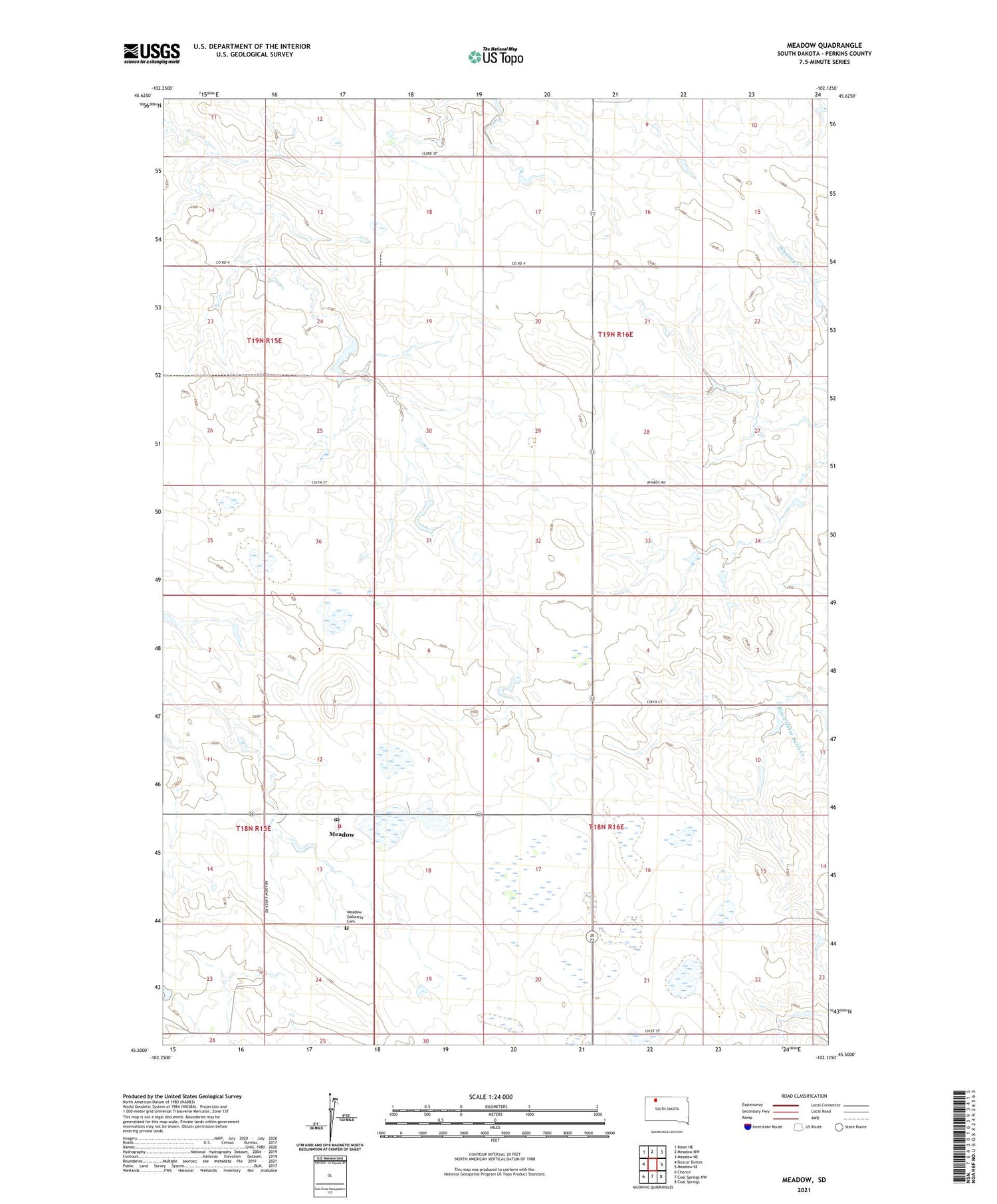
2021 topographic map quadrangle Meadow in the state of South Dakota. Scale: 1:24000. Based on the newly updated USGS 7.5' US Topo map series, this map is in the following counties: Perkins. The map contains contour data, water features, and other items you are used to seeing on USGS maps, but also has updated roads and other features. This is the next generation of topographic maps. Printed on high-quality waterproof paper with UV fade-resistant inks.
Quads adjacent to this one:
West: Boxcar Buttes
Northwest: Bison NE
North: Meadow NW
Northeast: Meadow NE
East: Meadow SE
Southeast: Coal Springs
South: Coal Springs NW
Southwest: Chance
Contains the following named places: Grand Central School, Hay Hill School Number 3, Joe Wunder Dam, Meadow, Meadow Corner, Meadow Fire Department, Meadow Gallaway Cemetery, Meadow Post Office, Richard Wolff Dam, Township of Clark, Township of Grand Central, Unorganized Territory of Grand Central