MyTopo
Milesville South Dakota US Topo Map
Couldn't load pickup availability
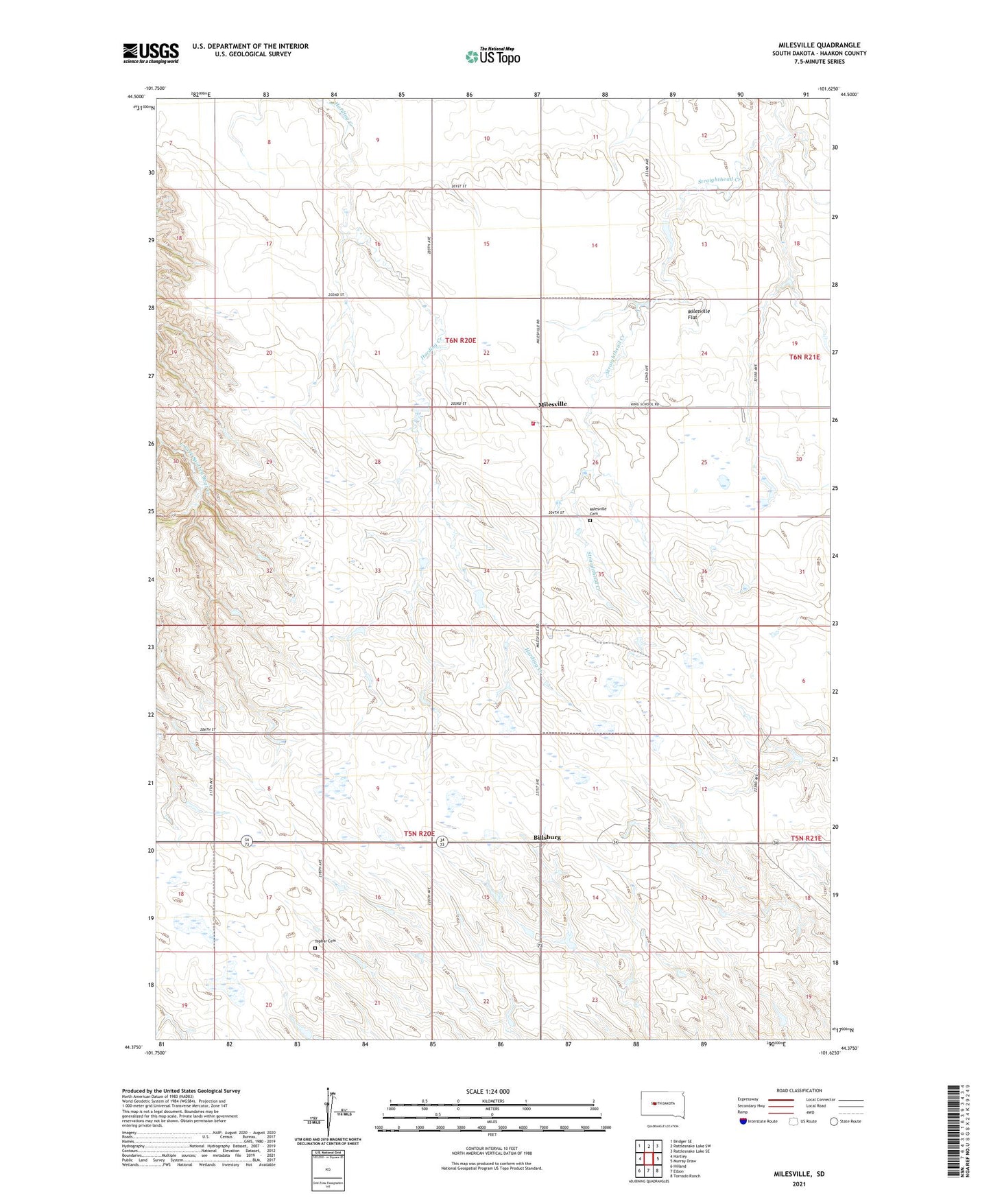
2021 topographic map quadrangle Milesville in the state of South Dakota. Scale: 1:24000. Based on the newly updated USGS 7.5' US Topo map series, this map is in the following counties: Haakon. The map contains contour data, water features, and other items you are used to seeing on USGS maps, but also has updated roads and other features. This is the next generation of topographic maps. Printed on high-quality waterproof paper with UV fade-resistant inks.
Quads adjacent to this one:
West: Hartley
Northwest: Bridger SE
North: Rattlesnake Lake SW
Northeast: Rattlesnake Lake SE
East: Murray Draw
Southeast: Tornado Ranch
South: Elbon
Southwest: Hilland
Contains the following named places: Billsburg, Falzone Ranch, First Lutheran Church, Gebes Ranch, Gittings Ranch, Hamill Ranch, Hardingrove Church, Hart School, Harty Ranch, Hopkins Ranch, Hovland Ranch, Meyers Ranch, Milesville, Milesville Cemetery, Milesville Dam, Milesville Fire Department, Milesville Flat, Milesville Post Office, Nedved Ranch, Neville Ranch, Radway Ranch, Saint Marys Church, Staben Ranch, The Ridge, Topbar Cemetery, Township of Milesville, Township of Topbar, ZIP Code: 57553