MyTopo
Elbon South Dakota US Topo Map
Couldn't load pickup availability
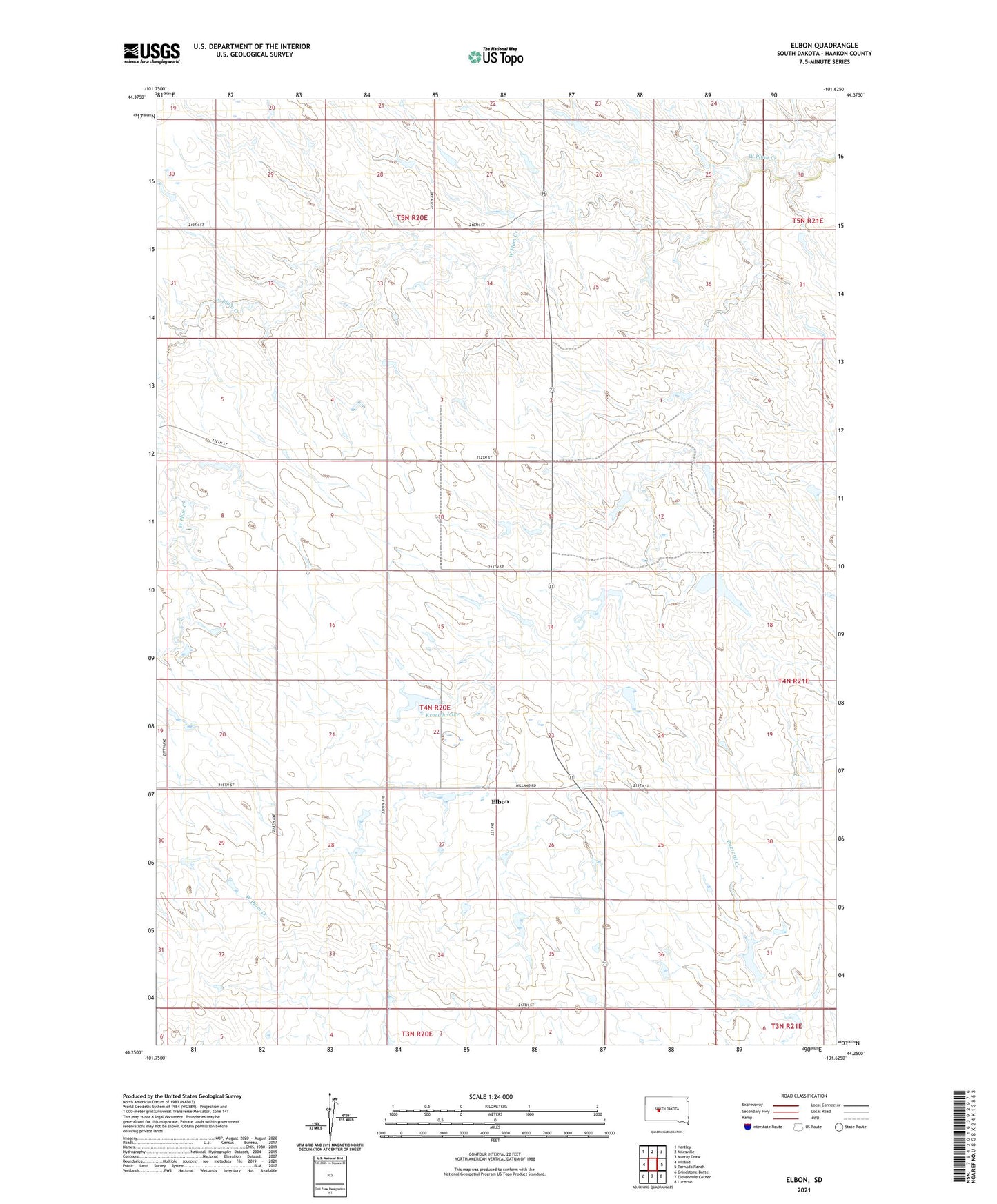
2021 topographic map quadrangle Elbon in the state of South Dakota. Scale: 1:24000. Based on the newly updated USGS 7.5' US Topo map series, this map is in the following counties: Haakon. The map contains contour data, water features, and other items you are used to seeing on USGS maps, but also has updated roads and other features. This is the next generation of topographic maps. Printed on high-quality waterproof paper with UV fade-resistant inks.
Quads adjacent to this one:
West: Hilland
Northwest: Hartley
North: Milesville
Northeast: Murray Draw
East: Tornado Ranch
Southeast: Lucerne
South: Elevenmile Corner
Southwest: Grindstone Butte
This map covers the same area as the classic USGS quad with code o44101c6.
Contains the following named places: Brooks Ranch, Donald King 1 Dam, Donald King 2 Dam, Donald King 3 Dam, Donald King 4 Dam, Donald King Dam, Donald King Ranch, Elbon, Elbon School, Kjos Ranch, Kroetch Lake, Kroetch Ranch, Morrison Ranch, Palmer Pearson Number 1 Dam, Palmer Pearson Number 2 Dam, Pearson Ranch, Pere Pearson 1 Dam, Pere Pearson Dam, Pitchfork Ranch, Rick King Ranch, Wayne Kjos Dam