
MyTopo
Mobridge NE South Dakota US Topo Map
Couldn't load pickup availability
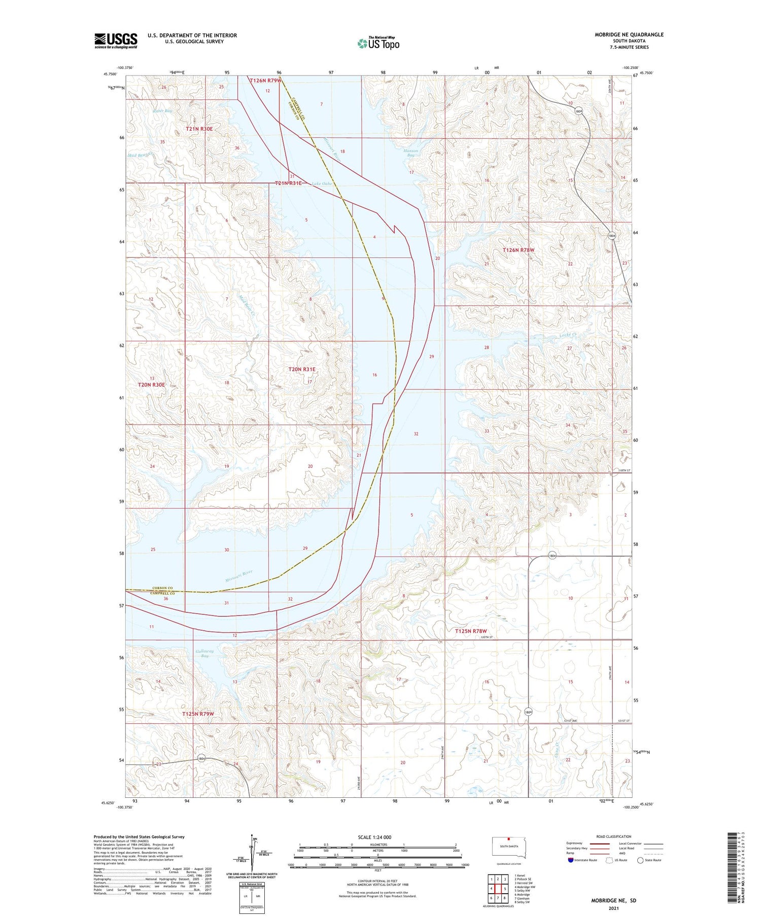
2021 topographic map quadrangle Mobridge NE in the state of South Dakota. Scale: 1:24000. Based on the newly updated USGS 7.5' US Topo map series, this map is in the following counties: Campbell, Corson. The map contains contour data, water features, and other items you are used to seeing on USGS maps, but also has updated roads and other features. This is the next generation of topographic maps. Printed on high-quality waterproof paper with UV fade-resistant inks.
Quads adjacent to this one:
West: Mobridge NW
Northwest: Kenel
North: Pollock SE
Northeast: Herreid SW
East: Selby NW
Southeast: Selby SW
South: Glenham
Southwest: Mobridge
Contains the following named places: Campbell Landing, Campbell Post Office, Eastern Grazing Association Number 1 Dam, Eastern Grazing Association Number 2 Dam, Eastern Grazing Association Number 3 Dam, Eastern Grazing Association Number 4 Dam, Eastern Grazing Association Number 5 Dam, Ellery Brockel Dam, Gallaway Bay, Hanson Bay, Larson School, Locke Creek, Mad Bear Creek, Mad Bear Mission Cemetery, Mad Bear Mission Church, Olson Creek, Ritter Bay, Rose Rabenberg Number 2 Dam, Township of Franklin, Township of Hillside


