MyTopo
Glenham South Dakota US Topo Map
Couldn't load pickup availability
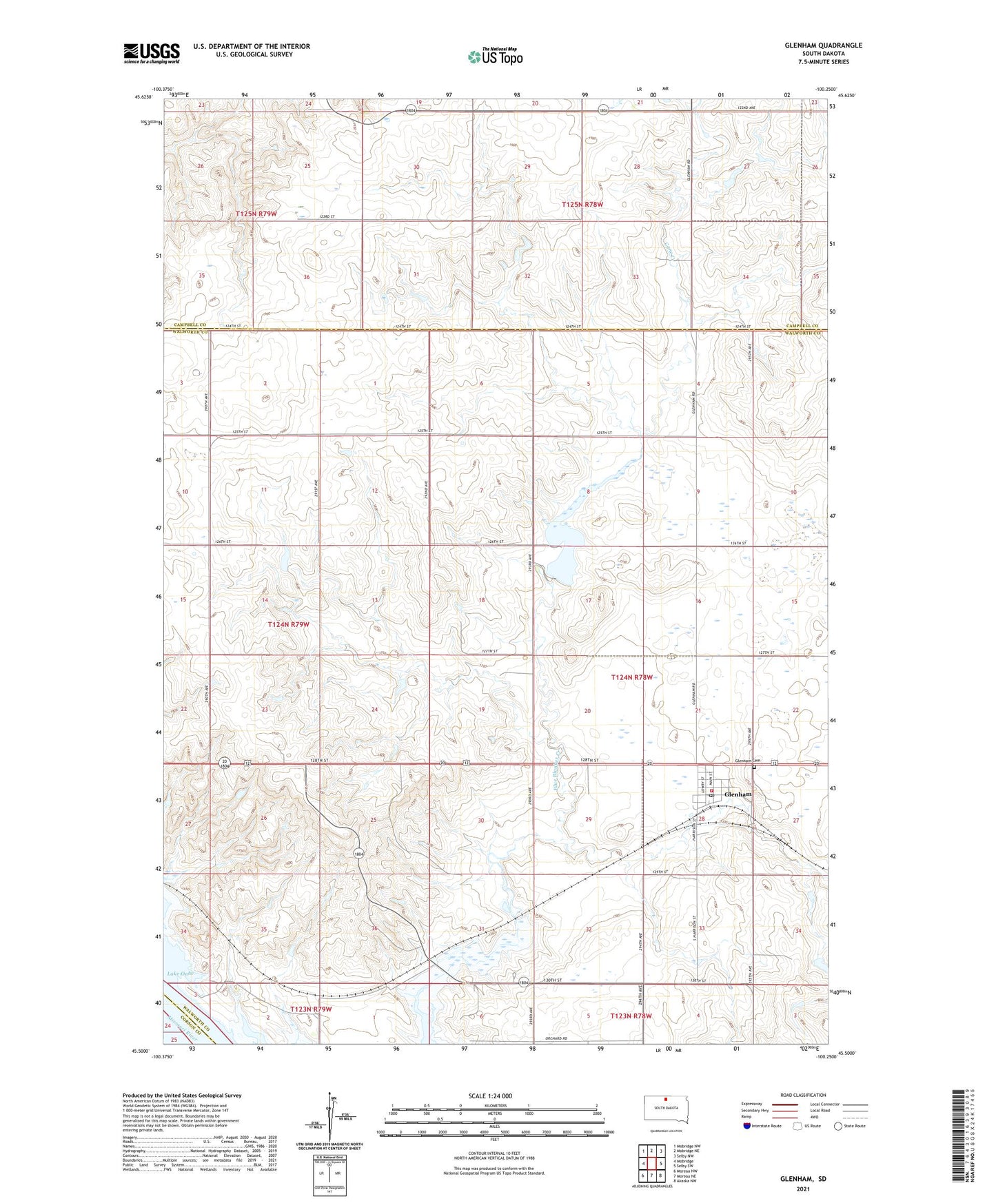
2021 topographic map quadrangle Glenham in the state of South Dakota. Scale: 1:24000. Based on the newly updated USGS 7.5' US Topo map series, this map is in the following counties: Walworth, Campbell, Corson. The map contains contour data, water features, and other items you are used to seeing on USGS maps, but also has updated roads and other features. This is the next generation of topographic maps. Printed on high-quality waterproof paper with UV fade-resistant inks.
Quads adjacent to this one:
West: Mobridge
Northwest: Mobridge NW
North: Mobridge NE
Northeast: Selby NW
East: Selby SW
Southeast: Akaska NW
South: Moreau NE
Southwest: Moreau NW
This map covers the same area as the classic USGS quad with code o45100e3.
Contains the following named places: A W Spiry Dam, Cane Creek, Glenham, Glenham Cemetery, Glenham Fire Department, Glenham Post Office, KOLY-AM (Mobridge), KOLY-FM (Mobridge), Molstad Lake, Molstad Lake Dam, Norman Schillinstad Dam, Rabenberg School, Robert Bolander Dam, Rose Rabenberg Number 1 Dam, Ted Molstad Dam, Town of Glenham, Township of Walworth, Walter Schlomer Dam, ZIP Code: 57631